Around the Château de Saint-Julien-aux-Bois

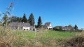
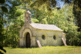
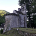
A short walk near Saint-Julien-aux-Bois along forest tracks and quiet roads. Easy, even with children. A chance to explore the agricultural landscape (meadows, woods, herds) of this beautiful region.

Details

n°40099839
Creation:
Last update:
Last review:
  • Walking
    Activity: Walking
  • ↔
    Distance: 3.24 mi
  • ◔
    Average duration: 1h 40 
  • ▲
    Difficulty: Easy

  • ⚐
    Back to start: Yes
  • ↗
    Ascent: + 187 ft
  • ↘
    Descent: - 200 ft

  • ▲
    Highest point: 1,965 ft
  • ▼
    Lowest point: 1,808 ft

Description of the walk

The start/finish point is located at the water tower on the D111 coming from Saint-Julien-aux-Bois, just before the Château du Bois (guesthouse). Parking is available at the foot of the water tower.

(S/E) Take the path that leads into the forest for about 700 m to the Croix de Sagiran (a small cross on the edge of the path but not very visible).

(1) Turn left onto a dirt track which takes you slightly back the way you came. Continue through the forest, then along a meadow until you reach the junction with a stony track; turn left to reach the Haras du Sagiran.

(2) At the stud farm (which has been beautifully restored), turn left towards the hamlet of La Bessette along a small tarmac road to reach the D111. Turn left again towards Saint-Julien.

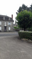
(3) Opposite the entrance gate to the Château du Bois, follow a small path on the right which takes you across a series of meadows to a road below the hamlet of Le Jaladis. Turn left towards the hamlet.

(4) When you reach the first houses, turn left onto a stony track which takes you back to the starting point (S/E)

Waypoints

  1. S/E : mi 0 - alt. 1,932 ft - At the foot of the water tower
  2. 1 : mi 0.49 - alt. 1,965 ft - Sagiran Cross
  3. 2 : mi 1.27 - alt. 1,886 ft - Sagiran Stud Farm
  4. 3 : mi 2.16 - alt. 1,909 ft - Château du Bois
  5. 4 : mi 2.74 - alt. 1,847 ft - Le Jaladis
  6. S/E : mi 3.24 - alt. 1,932 ft - Water tower

Notes

Walk described on a leaflet from the Corrèze General Council, marked with yellow signposts, but these are barely visible.
No shelters or water points.
The paths are very well maintained; no special footwear is required, apart from perhaps for a very wet section between (1) and (2).

Reviews and comments

4.7 / 5
Based on 1 review

Reliability of the description
5 / 5
Ease of following the route
5 / 5
Route interest
4 / 5
Geraud
Geraud

Overall rating : 4.7 / 5

Date of your route : Apr 18, 2025
Reliability of the description : ★★★★★ Very good
Ease of following the route : ★★★★★ Very good
Route interest : ★★★★☆ Good
Very busy route : No

A route with very gentle and pleasant scenery and terrain, ideal for families (aged 5 to 88…).

Machine-translated

Other walks in the area

For more walks, use our search engine .

The GPS track and description are the property of this route's author. Please do not copy them without permission.