In the woods of Saint-Rouffy

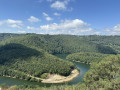
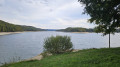
A pleasant walk featuring sections through woodland, stream crossings and ridge walks with stunning views of the Monts du Cantal.

Details

40936242
Creation:
Last update:
Last review:
  • Walking
    Activity: Walking
  • ↔
    Distance: 7.27 mi
  • ◔
    Average duration: 4h 15 
  • ▲
    Difficulty: Moderate

  • ⚐
    Back to start: Yes
  • ↗
    Ascent: + 1,001 ft
  • ↘
    Descent: - 1,001 ft

  • ▲
    Highest point: 2,116 ft
  • ▼
    Lowest point: 1,532 ft

Description of the walk

Park in the hamlet of Saint-Rouffy.

(S/E) Take the path on the left at the end of the hamlet, heading south-west.

(1) Ford the Ruisseau de Saint-Rouffy and walk up the hill.

(2) Once at the top, take the path on the left and continue along this path until you reach the access road to Creste. Carry on in the same direction until you reach a junction near a water tower: there’s a beautiful panoramic view of the Cantal Mountains

(3) Turn left towards the hamlet of Trémouille.

(4) Leave the road and take the wide path on the left, walking along the edge of the woodland.

(5) Take the path that descends to the left, blocked by a gate preventing access to vehicles.

(6) Ford the Ruisseau de Mansergues.

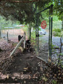
(7) Shortly after passing under the high-voltage power line, take the path that branches off at a right angle to the right: this section of the path is poorly maintained.

(8) At the end of this section, continue along the path to the left until you reach the junction with a well-marked gravel track.

(9) Take this by turning left; the path continuing straight ahead at the junction is also very poorly maintained. Follow the gravel track as it winds through the woods, then emerges into open country and joins the road leading to Saint-Rouffy.

(10) Turn left.

(11) Keep to the right at the three-way junction; ignore the access road to Brousse on the right and carry on to the Selves junction.

(12) Carry on straight ahead and follow the road to Saint-Rouffy (S/E).

Waypoints

  1. S/E : mi 0 - alt. 1,877 ft - Saint-Rouffy
  2. 1 : mi 0.5 - alt. 1,532 ft - Saint-Rouffy stream, ford
  3. 2 : mi 1 - alt. 1,903 ft - Path on the left
  4. 3 : mi 2.12 - alt. 2,064 ft - Crossroads, panoramic view
  5. 4 : mi 2.71 - alt. 1,998 ft - Trémouille
  6. 5 : mi 3.05 - alt. 1,929 ft - Path on the left
  7. 6 : mi 3.27 - alt. 1,768 ft - Mansergues stream, ford
  8. 7 : mi 3.68 - alt. 2,005 ft - Poorly maintained section
  9. 8 : mi 4.02 - alt. 2,008 ft - End of the tall grass
  10. 9 : mi 4.17 - alt. 2,051 ft - Road suitable for vehicles
  11. 10 : mi 5 - alt. 2,116 ft - Saint-Rouffy Road
  12. 11 : mi 5.55 - alt. 2,031 ft - Three-way junction
  13. 12 : mi 5.87 - alt. 1,969 ft - Crossroads, go straight on
  14. S/E : mi 7.27 - alt. 1,880 ft - Saint-Rouffy

Notes

Another possible starting point is at (10), where it is easier to park. Follow the road to Saint-Rouffy then continue along the route described.

Worth a visit

Sections through woodland.
Views of the Monts du Cantal.

Reviews and comments

4.1 / 5
Based on 3 reviews

Reliability of the description
4.7 / 5
Ease of following the route
4.7 / 5
Route interest
3 / 5
christel R
christel R

Overall rating : 4.3 / 5

Date of your route : Jul 24, 2024
Reliability of the description : ★★★★★ Very good
Ease of following the route : ★★★★★ Very good
Route interest : ★★★☆☆ Average
Very busy route : No

Watch out for trees or bushes along the way…

Machine-translated

letsim
letsim

Overall rating : 3 / 5

Date of your route : May 19, 2024
Reliability of the description : ★★★★☆ Good
Ease of following the route : ★★★★☆ Good
Route interest : ★☆☆☆☆ Very disappointing
Very busy route : No

Best avoided, especially given all the other magnificent walks to be had in the area.
You go from areas of clear-cut woodland to trails that are completely unmaintained and uninteresting gravel paths
A big disappointment

Machine-translated

Les fouineuses
Les fouineuses

Overall rating : 5 / 5

Date of your route : Nov 14, 2023
Reliability of the description : ★★★★★ Very good
Ease of following the route : ★★★★★ Very good
Route interest : ★★★★★ Very good
Very busy route : No

A very pleasant walk. With beautiful scenery, valleys, rock paintings, lovely woodland and stunning views.

Machine-translated

Other walks in the area

For more walks, use our search engine .

The GPS track and description are the property of this route's author. Please do not copy them without permission.