The Incon stream at Pleaux

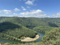
A lovely walk, partly sheltered from the bright sunshine.
Well-maintained paths.

Details

3609439
Creation:
Last update:
Last review:
  • Walking
    Activity: Walking
  • ↔
    Distance: 6.30 mi
  • ◔
    Average duration: 3h 40 
  • ▲
    Difficulty: Moderate

  • ⚐
    Back to start: Yes
  • ↗
    Ascent: + 912 ft
  • ↘
    Descent: - 902 ft

  • ▲
    Highest point: 2,093 ft
  • ▼
    Lowest point: 1,614 ft

Photos

Description of the walk

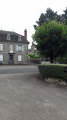
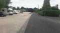
(S/E) Park at Place du Foirail near the motorhome site and head towards the recycling bins, then walk straight across Place d’Empeyssine to go up Rue du Séminaire behind Pleaux secondary school.
Turn left onto Rue Soubeyre towards the housing estate.

(1) Turn right and make your way through the housing estate along a winding downhill path until you reach a small road; turn left onto this road, which leads down towards Pont Blanchard.

(2) At a left-hand bend, leave the road and take a track on the right under the trees, signposted ‘VTT 35 km’ and marked with a yellow arrow. This downhill track is a short cut.
Join the road on the right and follow it down to the junction. Turn left and cross the Pont Blanchard.

(3) Just after the bridge, turn right between two houses onto a path that climbs up into the woods.
Follow this path uphill until you reach a road again; follow the yellow arrows, turn right and you’ll arrive at the hamlet of Vielh.

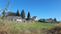
(4) After passing thefirst house on the right, turn right onto the path that crosses a farmyard; continue to the right along this wide path for 100 m. Turn left onto a narrower, downhill path. After 300 m, cross a cattle gate and then follow the path to the left, which climbs through the undergrowth. Cross asecond cattle grid, then turn left and climb a small embankment which leads onto a grassy track. Walk uphill alongside the meadows until you reach the road.

(5) Take the road to the right, passing a shed on your left and, further on, the hamlet of Maniac; then continue along the road to the right, passing the hamlet of Lherm on your left.
Continue along this road for 400 m.

(6) Leave the road and turn left onto a wide forest track which winds down to the Incon stream.

(7) After the ruins of an old mill, cross the stream via a lovely footbridge. Begin the final climb towards Pleaux, still on a wide, well-maintained stony track.

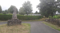
(8) After thefirst houses in Pleaux, at the stone cross, take the path opposite which runs behind the CCAS holiday centre. Pass the U’Express shopping centre on your left.

(9) Admire the water lily wash house on your left and take the road on the right to reach Pleaux’s main square.
Follow Rue d’Empeyssine to Place d’Empeyssine, cross the square and return to your starting point, Place du Foirail (S/E).

Waypoints

  1. S/E : mi 0 - alt. 2,051 ft - Foirail car park
  2. 1 : mi 0.44 - alt. 2,093 ft - Soubeyre housing estate
  3. 2 : mi 0.9 - alt. 1,988 ft - Junction on the path
  4. 3 : mi 1.49 - alt. 1,742 ft - Pont Blanchard
  5. 4 : mi 1.94 - alt. 1,991 ft - The hamlet of Vielh
  6. 5 : mi 2.54 - alt. 1,982 ft - Road junction
  7. 6 : mi 3.64 - alt. 1,785 ft - Path junction. Leave the road
  8. 7 : mi 4.11 - alt. 1,631 ft - The Incon stream. Start of the final climb
  9. 8 : mi 5.15 - alt. 2,037 ft - Stone crosses
  10. 9 : mi 5.88 - alt. 2,044 ft - Water lily wash house
  11. S/E : mi 6.3 - alt. 2,051 ft - Foirail car park

Notes

A pleasant walk, often shaded by trees, which is very welcome in summer. The paths are in good condition; trainers are sufficient. This route follows several stretches of very quiet roads. Be sure to bring plenty of water to stay hydrated (even though you’re in Auvergne at an altitude of 650 metres).

Worth a visit

In autumn and spring, go mushroom picking.
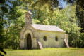
During the open season: trout fishing in the Incon stream. Take a detailed tour of the pretty town of Pleaux with its rich historical past. Take a look at the stone crosses that dot many of the trails in this region.

Reviews and comments

3.7 / 5
Based on 5 reviews

Reliability of the description
4 / 5
Ease of following the route
4 / 5
Route interest
3.2 / 5
rando4444
rando4444

Overall rating : 2.7 / 5

Date of your route : Apr 06, 2026
Reliability of the description : ★★★☆☆ Average
Ease of following the route : ★★☆☆☆ Disappointing
Route interest : ★★★☆☆ Average
Very busy route : No

The route is a bit vague, there’s too much road, and there aren’t any points of interest, but it’s an easy, quiet walk. Second choice.

Machine-translated

Myrarice
Myrarice

Overall rating : 3.3 / 5

Date of your route : Nov 09, 2024
Reliability of the description : ★★★☆☆ Average
Ease of following the route : ★★★★☆ Good
Route interest : ★★★☆☆ Average
Very busy route : No

Hello, a pleasant and easy walking route that can be completed quickly.
There aren’t many scenic views or points of historical interest, but the section through the forest is relaxing.

Machine-translated

Ninja 36
Ninja 36

Overall rating : 3.3 / 5

Date of your route : Aug 09, 2023
Reliability of the description : ★★★★☆ Good
Ease of following the route : ★★★★☆ Good
Route interest : ★★☆☆☆ Disappointing
Very busy route : No

An easy walk, but not particularly interesting: a lot of road walking (about a third of the route) and not much of interest (in terms of heritage) to see. We were disappointed

Machine-translated

randonnée pascal
randonnée pascal

Overall rating : 4.7 / 5

Date of your route : Sep 12, 2021
Reliability of the description : ★★★★★ Very good
Ease of following the route : ★★★★★ Very good
Route interest : ★★★★☆ Good
Very busy route : No

This walk was combined with the “Ruisseau des Moulergues to Pleaux” route; the two walks join at the Blanhard bridge between 3 and 4.
Not too much road walking, with some lovely views.
Well worth a visit: the village of Pleaux is very interesting.
Thanks, Kartman.

Machine-translated

randonnée pascal
randonnée pascal

Overall rating : 4.7 / 5

Date of your route : Sep 12, 2021
Reliability of the description : ★★★★★ Very good
Ease of following the route : ★★★★★ Very good
Route interest : ★★★★☆ Good
Very busy route : No

This walk was combined with the “Ruisseau des Moulergues to Pleaux” route; the two walks join at the Blanhard bridge between 3 and 4.
Not too much road walking, with some lovely views.
Well worth a visit: the village of Pleaux is very interesting.

Machine-translated

Other walks in the area

For more walks, use our search engine .

The GPS track and description are the property of this route's author. Please do not copy them without permission.