Country:
 City:


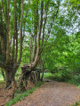
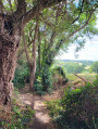
Park in the stadium car park.
(S/E) Take the path at the far end of the car park and walk alongside the tennis complex. Leave the path on your left before the pump track. At the end of the path, take the path on the left until you reach Route de la Vove.
(1) Turn right onto the road and, a few metres further on, take the path on the right towards Le Cormier.
(2) Take the path on the left, running parallel to the road, to the Parc de Jublanc, situated on Boulevard Nature.
(3) Turn left into Parc de Jublanc and follow the Boulevard Nature path, which leads past the retention basins, until you reach Route du Champ de la Vigne. Turn right and follow this road for 300 metres.
(4) Take the path on the right, follow it until you reach the wooden bridge. Carry on straight ahead after the bridge; at the end of the path, turn left and continue along the road.
(5) When you reach the Ferme de l’Epine, take the path on the right at the fork, follow the track running alongside the field and then take the Chemin de l’Épine.
(6) Cross the road with great care (it is a busy road with poor visibility). Take the path opposite for 300 metres. Turn left. After 100 metres, turn right and follow the Chemin des Petites Rigaudières (view of the rolling countryside). After the houses, leave the path on your left. Continue straight on along the Chemin de la Chouanas and, at the end of this path, turn right. Note the view of the city of Le Mans.
(7) After 250 metres, take the Chemin des Gouachères on the right. At the hamlet known as “Les Vignes”, head into the meadow on the right, pass the chicane and go down the sunken path. At the bottom, turn right.
(8) Walk along the Boulevard Nature, pass the two chicanes and follow the private footpath running alongside the meadows (view of the Chaumard valley). The route winds halfway up the hillside then climbs back up along a section of the Boulevard Nature.
(9)⚠️ Warning: from this point onwards, pedestrians must use a dangerous road. For the time being, the return to the starting point requires you to use a section of the Route de Jublanc. There is no pavement to protect pedestrians; the road, with a speed limit of 70 km/h, has very limited visibility and is subject to frequent vehicle traffic.
(3) At Jublanc Park, take the path running parallel to the road again, in the opposite direction to the outward journey.
(2) At the first roundabout, carry on straight ahead. When you reach the second roundabout, turn right and follow the pavement until you return to the stadium car park (S/E).
 Visorando Member
 Easy

 Tourism professional