Country:
 City:
City:


Park in the car park at the sports complex.
(S/E) From the sports complex car park, take the path on the left, which runs alongside the tennis courts, then go round the football pitch, keeping to the right. At the end of the path, turn left onto the Chemin de la Pointe, which leads you to the Route de la Vove.
Turn right onto the Route de la Vove and, a few dozen metres further on, turn right onto the Chemin de la Hallonnière, which takes you back to the entrance to the village of Rouillon.
(1) Turn left onto the path running parallel to the road, which descends to Boulevard Nature at the place known as “Jublanc”.
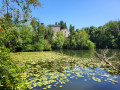
(2) Turn left onto Boulevard Nature, which runs alongside the ponds to the Route de la Vove.
Turn right and follow this road for about 500 metres.
(3) Take the path on your right and head down into the meadow. At the junction on the edge of the woods, turn right to enter the woods and walk round them. Follow the deep ditch and head up to the left until you reach a fork in the path.
(4) Take the path on the right after you’ve noticed the Carmelite nuns’ house of penance on your left. Just before reaching the Épine farm, turn left. After crossing the drive leading to the farm, go round the back of the tree-lined artificial mound to bypass the buildings and continue along the Chemin de l’Épine, which leads you to the Route des Ardriers.
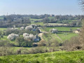
(5) Cross the road with great care (busy road with poor visibility). Take the path opposite for 300 metres. Turn left. At a place called Le Clos Marteau, turn left then right. Continue along the Chemin des Petites Rigaudières (viewpoint over the rolling countryside). After passing the houses, carry straight on along the Chemin de la Chouanas and, at the end of this track, turn right. Note the view over the town of Le Mans.
(6) After 250 m, turn right onto the Chemin des Gouachères. At a place called Les Vignes, head into the meadow on the right, pass the chicane and go down the sunken path. At the bottom, turn right.
(7) Pass the two chicanes and follow the private footpath along the edge of the meadows (view of the Chaumard valley). The route winds its way halfway up the hillside before descending towards a stream. Cross it via the footbridge and turn right to rejoin the road.
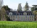
(8) Turn right and follow this road for 300 metres. Pass the Chemin des Furêteries on your right and immediately turn right onto the Route de Loulay for about 150 metres. On your left, you will then be able to see Rouillon Castle.
(9) Climb the steps on the left and take the private footpath at the edge of the woods, which leads out near the Vaugeonnières farm.
Walk past the hemp kiln on your left and continue to the road.
At the roundabout, keep left and follow the pavement to the next roundabout.
Cross the road at the children’s playground and take Rue des Charmes. Walk past the tennis hall and then past the sports hall.
(E) You will arrive directly at your car park on the right.



 Visorando Member
 Tourism professional
 Moderate