Around the Ballon Saint-Antoine

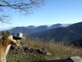
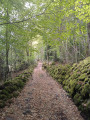
A circular route starting from the car park at La Planche des Belles Filles. The route runs along the north-western side of the Ballon Saint-Antoine, overlooking the Plancher-les-Mines valley, and returns via the eastern side, passing by the Étang des Belles Filles.

Details

73023374
Creation:
Last update:
Last review:
  • Walking
    Activity: Walking
  • ↔
    Distance: 3.07 mi
  • ◔
    Average duration: 1h 55 
  • ▲
    Difficulty: Easy

  • ⚐
    Back to start: Yes
  • ↗
    Ascent: + 538 ft
  • ↘
    Descent: - 509 ft

  • ▲
    Highest point: 3,504 ft
  • ▼
    Lowest point: 3,015 ft

Description of the walk

Park at the free car park at La Planche des Belles Filles. 

(S/E) Head north-east until you reach a small crossroads (altitude 996). 

(1) Continue straight ahead along the GR®533, marked with a Green Rectangle, and follow the north-western flank of the Ballon Saint-Antoine to reach an unnamed pass at the foot of the Tête de Demesy.

(2) Turn right and follow the path marked with a Green Triangle leading to the Étang des Belles Filles. 

(3) Walk along the left bank of the lake and take a path marked with a Red Disc, heading towards the Planche des Belles Filles ski resort. This hillside path leads back to the junction where you started.

(1) Turn left to return to the car park (S/E).

Waypoints

  1. S/E : mi 0 - alt. 3,255 ft - Car park - Planche des Belles Filles
  2. 1 : mi 0.15 - alt. 3,281 ft - Junction of the circular loop
  3. 2 : mi 1.56 - alt. 3,392 ft - Unnamed pass
  4. 3 : mi 2.34 - alt. 3,015 ft - Étang des Belles Filles
  5. S/E : mi 3.07 - alt. 3,255 ft - Car park - Planche des Belles Filles

Notes

Picnic spot at the Étang des Belles Filles.

This route passes through a protected area, which may be subject to special regulations:

Worth a visit

The Étang des Belles Filles was previously known as “des Belfahy”, after the village of the same name situated north of Plancher-les-Mines.

The ‘fahy’ or ‘fayard’ is a species of tree: the old name for the common beech (Fagus sylvatica).

The name ‘des Belles Filles’ came to be used because of a legendary tale said to have involved young girls throwing themselves into the pond to escape the Swedish invaders.

Always be cautious and plan ahead when you're outdoors. Visorando and the author of this route cannot be held responsible for any accidents occurring on this route.

The GR® and PR® markings are the intellectual property of the Fédération Française de Randonnée Pédestre.

Reviews and comments

4.8 / 5
Based on 2 reviews

Reliability of the description
5 / 5
Ease of following the route
5 / 5
Route interest
4.5 / 5
bouledjouidja rabah
bouledjouidja rabah

Hello
Glad you were able to enjoy this walk
All the best with your future walks

Machine-translated

gras stephane
gras stephane

Overall rating : 4.7 / 5

Date of your route : May 13, 2025
Reliability of the description : ★★★★★ Very good
Ease of following the route : ★★★★★ Very good
Route interest : ★★★★☆ Good
Very busy route : Yes

a pleasant outing, the aim being to enjoy the view of the ‘Pond of the Beautiful Girls’.

Machine-translated

bouledjouidja rabah
bouledjouidja rabah
• Edited:

Hello
Glad you enjoyed this walk
All the best with your future walks

Machine-translated

le saut de bonneille

Overall rating : 5 / 5

Date of your route : May 08, 2025
Reliability of the description : ★★★★★ Very good
Ease of following the route : ★★★★★ Very good
Route interest : ★★★★★ Very good
Very busy route : Yes

A lovely little route
We were able to stop off by the pond
A lovely spot with a table
However, the final path leading back to the starting crossroads is quite steep

Machine-translated

Other walks in the area

For more walks, use our search engine .

The GPS track and description are the property of this route's author. Please do not copy them without permission.