Le Buc in Bellengrevillette

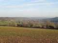
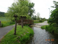
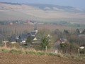
A short walk in the Envermeu area, taking us to Le Buc, a charming hamlet near Bellengrevillette. Normandy with its plains, woods, cows, horses and ponies.

Details

632875
Creation:
Last update:
Last review:
  • Walking
    Activity: Walking
  • ↔
    Distance: 5.28 mi
  • ◔
    Average duration: 2h 40 
  • ▲
    Difficulty: Easy

  • ⚐
    Back to start: Yes
  • ↗
    Ascent: + 302 ft
  • ↘
    Descent: - 302 ft

  • ▲
    Highest point: 453 ft
  • ▼
    Lowest point: 138 ft

Photos

Description of the walk

To reach the starting point, take the D920 north-west of Envermeu. At Bellengrevillette, turn right onto Chemin du Bucq. The car park (2 spaces) is located before the level crossing.

(S/E) From the car park, follow the chalky path uphill, which curves first to the left then to the right. Walk through the Bois de Saint-Sulpice along this same path. About 300m after leaving the woods, turn left, then right to walk past the EDF transformer.

(1) At the junction, veer right and continue for 200m. At the crossroads, turn left into Rue du Bucq. At the recycling bins, do not take the path on the right.

(2) At the junction with Rue du Chenot, head left and ignore the path leading to the water tower. Continue straight ahead across the plain along this road.

(3) At the junction, turn left onto the D256. Ignore the path on the left as you round the bend and carry on, turning right towards a line of trees. Pass through Breuilly via Rue du 31 août 1944.

(4) At the junction, carry on to the left, passing just below the ‘Bellengreville – Breuilly’ bus stop; ignore the path on the right, as well as the Chemin des Oiseaux opposite. Go down the bends, one of which is a hairpin bend and another with a war memorial on the right.

(5) At the bottom of the descent, after the cemetery, turn onto the path on the left before the level crossing. Carry on, ignoring the path on the left, along a quiet track until you reach, straight ahead, the chalky path which leads off to the right towards the car park (S/E).


Waypoints

  1. S/E : mi 0 - alt. 151 ft - Car park before the level crossing. Near the - Eaulne (rivière) - Affluent de l'Arques
  2. 1 : mi 1.59 - alt. 423 ft - After the EDF transformer, turn right
  3. 2 : mi 2.41 - alt. 449 ft - T-junction before the water tower, turn left
  4. 3 : mi 2.98 - alt. 436 ft - Junction with the D256, turn left
  5. 4 : mi 4.03 - alt. 381 ft - Pass two paths on the right in Breuilly
  6. 5 : mi 4.97 - alt. 154 ft - Path on the left before the level crossing
  7. S/E : mi 5.28 - alt. 151 ft - Car park at the start

Notes

Walking shoes, especially in wet weather.

Worth a visit

The Alabaster Coast, with its cliffs and beaches: 15 km
Dieppe: marina, shops, fishing and cross-Channel ferries: 15 km, fully automated dry dock.
Eu: Royal town and its Château Louis-Philippe: 26 km
The state-owned forest: 9,300 ha
Le Tréport: marina, shops, fishing: 30 km
Neuchâtel-en-Bray and its heart-shaped cheese: 30 km

Reviews and comments

4.2 / 5
Based on 3 reviews

Reliability of the description
4.7 / 5
Ease of following the route
4.7 / 5
Route interest
3.3 / 5
Auffay.Randonnée
Auffay.Randonnée

Overall rating : 4 / 5

Date of your route : May 11, 2026
Reliability of the description : ★★★★☆ Good
Ease of following the route : ★★★★★ Very good
Route interest : ★★★☆☆ Average
Very busy route : No

If you are travelling in several cars, it is best to start at waypoint 5 (the cemetery car park)
After waypoint 4, you can avoid the hairpin bends by cutting right at the first bend. You’ll arrive next to the memorial to the five people who died on 31 August 1944, which is less dangerous

Machine-translated

Cindidi
Cindidi

Overall rating : 4.3 / 5

Date of your route : Jan 13, 2025
Reliability of the description : ★★★★★ Very good
Ease of following the route : ★★★★☆ Good
Route interest : ★★★★☆ Good
Very busy route : No

Apart from a bit of a scare at the start of the walk caused by a dog running loose as we passed the first farm, the route is excellent. Suitable for families with children (aged 8 and 12).

Machine-translated

Christine Rando
Christine Rando

Overall rating : 4.3 / 5

Date of your route : Sep 09, 2024
Reliability of the description : ★★★★★ Very good
Ease of following the route : ★★★★★ Very good
Route interest : ★★★☆☆ Average
Very busy route : No

There’s still a long way to go. What a shame.

Machine-translated

Other walks in the area

For more walks, use our search engine .

The GPS track and description are the property of this route's author. Please do not copy them without permission.