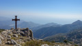
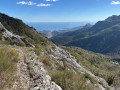
Around the ruins of the Ongrand de Peille chapel

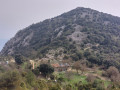
A route that takes in the rocky areas near Castel d’Ongrand, before offering views of the wooded Mont Méras massif. The magnificent paved slanting street that leads back offers beautiful views of Mont Ours and the nearby Cime de Baudon.

Details

18788998
Creation:
Last update:
Last review:
  • Walking
    Activity: Walking
  • ↔
    Distance: 7.73 mi
  • ◔
    Average duration: 5h 45 
  • ▲
    Difficulty: Moderate

  • ⚐
    Back to start: Yes
  • ↗
    Ascent: + 2,562 ft
  • ↘
    Descent: - 2,566 ft

  • ▲
    Highest point: 3,678 ft
  • ▼
    Lowest point: 1,345 ft

Photos

Description of the walk

Drive to the end of Chemin de Virounous (this is a tarmac dead end) in the village of Peille. Turn round and park on the hard shoulder about a hundred metres further on, so as not to block this small turning area.

(S/E) Return to the cul-de-sac where you turned round with your car, and take the path that starts on the right. Marker 593 is missing; an old yellow marker is in place. Cross the Ruisseau de Gazouil and continue to the tarmac road at Ongrand.

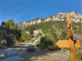
(1) Cross the road. Take a quick first turn right then left, pass marker 124 and head towards Ségra. Climb along this path, which winds its way uphill and reaches a pass (elevation 831) marked by a wooden post that once supported a sign which has now disappeared.

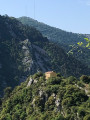
(2) Head left and climb up to the nearby ridge to see the beautiful ruins of the Castel d’Ongrand, dating from the 12th century. This fortified settlement is known as “Ongrand supérieur”. From the castle, continue along the same ridge line, heading west, to discover the ruins of the chapel, some 200 metres away. The ascending path is barely visible: keep to the left of the ridge, following the numerous cairns that guide the way. As you approach the ruins, the vegetation is somewhat dense, but easily passable.

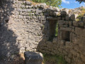
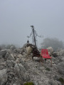
(3) The ruins of the Ongrand chapel are situated on the upper part of the ridge, where it widens into a plateau. It fell into ruin at the end of the 15th century. The apse – the rounded stone section of the chapel – is well preserved. Then retrace your steps.

(2) From the pass, continue along the wooded path heading north then north-east. Keep heading in this direction.

(4) At the crossroads (marker 123), turn right towards Ségra and head for the nearby junction. At this junction, turn left onto the track heading north (marker 122 is missing). Continue along this track, passing marker 121, and carry on along this track, which becomes a path through the forest and climbs gradually towards the Col du Farguet, skirting around Mont Méras. Walk past the water tower on the right and continue to marker 116, which is signposted “Col du Farguet 1083 m”.

(5) Turn left towards the valley, crossing the two tracks at right angles. The start of the valley is a field with no marked path, beginning at marker 116 (same number). Head towards “Chapelle Saint-Siméon”. Walk down the field for about thirty metres: the grassy path begins on your left, then becomes rocky.

(6) End of the rocky path: turn right onto this concrete track leading downhill.

(7) At the junction of the track and the Route de l’Escarène, cross over and head straight on along the concrete road which descends steeply. Follow the concrete road (marker 138 is missing). Walk for about 200 m: the Chapel of Saint-Siméon is on the left. You’ll reach the edge of a grassy field with stone slabs.

(8) Head straight ahead along a barely visible path towards the nearby chapel.

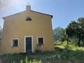
(9) This restored chapel stands on a rocky, barren plateau. Bordered by a precipice to the south, the Chapel of Saint-Siméon d’Ongrand, dating from 1229, was built by the monks of Saint-Pons. It stands at an altitude of 635 m. Then retrace your steps.

(8) Turn left onto the concrete track leading downhill.

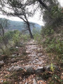
(10) When the track turns right towards the houses, leave it and head straight on along a path that is barely marked at first. After a few metres, it becomes a very beautiful paved slanting street, parts of which are in good condition. Head down towards the Pas d’Ongrand valley.

(11) Pas d’Ongrand marks the end of our trail. In this hamlet, continue along the path to the right towards the nearby bridge over the Erbossièra stream and follow the tarmac road uphill. This is the least interesting part of our route. Follow this road, which leads back to the Chemin de Virounours.

(12) At this junction of tarmac roads, turn left to rejoin the Chemin de Virounours (signpost 594 is missing). Continue to your car (S/E).


Waypoints

  1. S/E : mi 0 - alt. 1,578 ft - Virounours Trail.
  2. 1 : mi 0.64 - alt. 1,955 ft - Marker 124. Junction of the path and the road.
  3. 2 : mi 1.27 - alt. 2,720 ft - Pass (elevation 831)
  4. 3 : mi 1.49 - alt. 2,828 ft - Ruins of the Ongrand chapel.
  5. 4 : mi 2.75 - alt. 3,110 ft - Marker 123, junction of tarmac roads.
  6. 5 : mi 4.52 - alt. 3,537 ft - Marker 116, Col du Farguet.
  7. 6 : mi 5.8 - alt. 2,369 ft - Junction between the footpath and a track suitable for vehicles.
  8. 7 : mi 6.1 - alt. 2,165 ft - Junction of the footpath and Route de l’Escarène.
  9. 8 : mi 6.19 - alt. 2,080 ft - Start of the path towards the chapel
  10. 9 : mi 6.27 - alt. 2,149 ft - Saint-Siméon Chapel.
  11. 10 : mi 6.46 - alt. 2,005 ft - Turn right.
  12. 11 : mi 7 - alt. 1,352 ft - The hamlet of Pas d’Ongrand.
  13. 12 : mi 7.3 - alt. 1,496 ft - Junction of tarmac roads.
  14. S/E : mi 7.73 - alt. 1,585 ft - Virounours Trail.

Notes

A little-used route.
A moderate hike requiring a minimum level of fitness.

There is no drinking water on the route.
There are several streams where you can cool off during the walk.
Make sure you have good walking shoes.

Worth a visit

At the end of the walk, visit Peille, a superb medieval village where charm, ancient buildings and history abound.
Peille

Reviews and comments

4.6 / 5
Based on 3 reviews

Reliability of the description
5 / 5
Ease of following the route
4.3 / 5
Route interest
4.3 / 5
bernard bb
bernard bb
• Edited:

Thanks, Eric, for this information
Best wishes, B.

Machine-translated

ERICRANDO06
ERICRANDO06
• Edited:

Overall rating : 4.7 / 5

Date of your route : Feb 17, 2024
Reliability of the description : ★★★★★ Very good
Ease of following the route : ★★★★☆ Good
Route interest : ★★★★★ Very good
Very busy route : No

A lovely walk in the Peille hinterland.
The ascent and descent are very rocky and technical in places.
On the St Siméon section (between points 8 and 9), we came across aggressive, off-leash dogs prowling around the chapel and the neighbouring houses. Their owners eventually came out of the house after a while, following constant barking.
A lovely route with ever-changing scenery.
I recommend it

Machine-translated

bernard bb
bernard bb

Thank you, Perseepj, for your review of this walk, which, as you say, is lovely
Best wishes, rando b.

Machine-translated

Perseepj
Perseepj

Overall rating : 4.7 / 5

Date of your route : Mar 28, 2022
Reliability of the description : ★★★★★ Very good
Ease of following the route : ★★★★★ Very good
Route interest : ★★★★☆ Good
Very busy route : No

Hello,
A lovely route.
Thanks to the detailed description for finding the starting point. The area beyond is very remote, with no signs indicating the start of the walk. The description and the GPX track are also invaluable, as the yellow markers are sometimes badly faded.
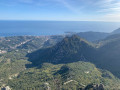
The detour to Ongrand Chapel is worth it for the view over the valley. Along with point 5, these are the two spots with really unobstructed views.
Like Tidgy, I’d like to point out that from point 5 to 11, the path is a continuous descent which can be quite steep...

Machine-translated

bernard bb
bernard bb

Thank you, Tidgy, for your constructive feedback
Best wishes from Rando. b .

Machine-translated

Tidgy
Tidgy

Overall rating : 4.3 / 5

Date of your route : Feb 19, 2022
Reliability of the description : ★★★★★ Very good
Ease of following the route : ★★★★☆ Good
Route interest : ★★★★☆ Good
Very busy route : No

A lovely, quiet walk
In my opinion, the section leading to the second ruin (between points 2 and 3) doesn’t add much. The path to get there isn’t easy, and it doesn’t offer anything extra.
The sections through the woodland are very pleasant and lovely.
Be careful on the descent, which is quite steep and uneven

Machine-translated

Other walks in the area

For more walks, use our search engine .

The GPS track and description are the property of this route's author. Please do not copy them without permission.