Country:

 City:
City:


Parking at the top of Rue Marie, in the car park next to the cemetery.
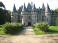
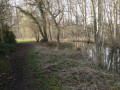
(S/E) Take the grassy path that winds down alongside the cemetery wall and then leads into a wood. When you reach the small gardens, turn right. The path comes out onto a street; follow it to the right as far as the church (you may be able to see the castle as you cross the car park).
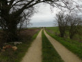
(1) At the church, turn left onto Rue de la Comtée, pass the Vigny washhouse and, at the next junction on the outskirts of the village, turn left onto a wide, straight path for 1 km.
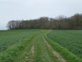
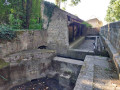
(2) Just before reaching the first houses in Longuesse, turn right at the picnic tables onto a path that follows the river and follow it to the entrance to the Vigny quarries. At the entrance gate to the quarries, turn left, passing through a barrier and over a small bridge.
(3) Turn left onto the road and, immediately, right onto a path that climbs through the fields. Ten metres before reaching a road and a wayside cross, take the path on the right and follow it to the end.
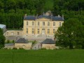
(4) Turn right and follow the path as it descends gently. Take the second path on the right until you reach the corner of the castle grounds’ wall.
(5) Turn left, cross over the Aubette and join a road at the fire station. Turn right and, immediately afterwards, left into Rue du Lieutenant Henri Savalle. At a 30 km/h speed limit sign, the street changes its name to Rue Charles de Gaulle and then curves slightly to the right.
(6) Immediately afterwards, in front of a detached house, turn right onto a path that joins the Chemin du Bourbier. Turn right and then immediately left onto a grassy path and follow it to the end.
(7) Turn left onto Ruelle des Moines and, straight away, right onto Ruelle Tortue. At the end, turn left onto Rue Vaillant. At the end, cross the D169 with care and continue along Sente du Clos Forget, which branches off to the right.
(8) At the end, turn left onto Allée du Bois Ribot, go through the gate and head straight up the path. At the top of the hill, after another gate, the path leads to a crossroads. Take the road furthest to the right (Rue de la Vieille Côte), which leads down towards the village.
(9) At the first footpath on the left (gate), just round the corner from a house (No. 22 on the street), turn into the second footpath on the left (there’s a bench at the junction of the footpaths). Climb a few steps and cross a road. Carry on straight ahead, then take the first footpath on the right. At the end, you’ll come out onto a road.
(10) Cross the road, carry on to the Stop sign and turn right onto a small road that leads downhill and back to the car park (S/E).

 Visorando Member

 Association / Club / Walk leader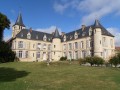
 Difficult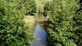
 Easy
Easy