Country:

 City:


The route starts from the war memorial square in the village of Haute-Rivoire.
(S/E) From the war memorial square, facing the bar-tobacconist’s, take the street on the right and continue down Rue du Pavé. Pass the sports hall, Salva-Terra and Labyland until you reach a junction.
(1) Leave the path leading to the Pierre de Saint-Gorgolu on your left (you can take a detour to see this unmissable part of Taravouer folklore, whose story children will love) and carry on straight ahead along the path. Turn left 50 metres before the road, just before the ‘Give Way’ sign. The path (marked for mountain bikes) runs alongside the river and then crosses it to reach a hamlet.
After the first house, turn left towards the highest house, then turn right just before entering its grounds. Head up to Le Bancel, where a yellow signpost indicates several directions.
(2) Follow the signs for “La Bonnetière” along the Chemin du Bois de Duerne. The path winds through the fields, crosses a river and heads up into the woods. You’ll reach the road known as the Chemin de la Bonnetière just before the château. Turn left towards the château. You’ll come to a T-junction.
(3) Admire La Bonnetière Castle on your right. Continue straight on along the road for about 1.5 km until you reach the village of Les Halles at a multi-way junction.
(4) Turn left onto the Grande Rue (D489). Use the pavements, as there is heavy traffic on this stretch. Pass a square and the sports ground (on the right) and take the Chemin des Rapaces, which descends to the left, just after the chicane. It is a pleasant path that winds down through fields and copses before climbing back up towards Les Pierres Blanches, where it joins a road.
(5) Turn right onto it, then, after the bend, at the junction, turn left onto Chemin des Mayères. At the cross, turn right onto Chemin des Caillets. At the next junction, carry on straight ahead along a stretch of path until you reach a road.
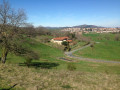
(6) Lovely view of the village of Haute-Rivoire. Carry on straight ahead along this route, alternating between tarmac roads and footpaths. Head down to the River La Toranche.
(7) Follow the river until you reach a road. Turn right and cross the river onto the Chemin de la Marcière, which climbs back up towards Haute-Rivoire. You’ll come to the war memorial square (S/E).

 Visorando Member
 Moderate

 Difficult