Around Saint-Bonnet-de-Rochefort

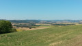
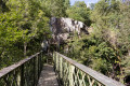
A pleasant walk around Saint-Bonnet-de-Rochefort.

Details

1516708
Creation:
Last update:
Last review:
  • Walking
    Activity: Walking
  • ↔
    Distance: 4.83 mi
  • ◔
    Average duration: 2h 30 
  • ▲
    Difficulty: Easy

  • ⚐
    Back to start: Yes
  • ↗
    Ascent: + 364 ft
  • ↘
    Descent: - 351 ft

  • ▲
    Highest point: 1,355 ft
  • ▼
    Lowest point: 997 ft

Description of the walk

Car park near the church.

(S/E) Starting from the church in Saint-Bonnet-de-Rochefort, take Rue des Tisserands to the level crossing, cross the railway line and turn immediately right. You are now on theGR®300for about 400 metres.

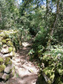
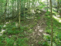
(1) Enter the woods, leaving theGR® on your left, and follow the track to the junction. Turn right and follow the track, which bends left further on.

(2) At the top, turn left. Walk straight down until you reach a road.

(3) Turn left, follow the road for about 100 metres, then take the path on the right. Walk alongside the copse, turn left at the end of the track and continue for about 200 metres to return to the tarmac road (GR® 300).

(4). Follow the road to the right, pass Linard and carry on to Les Rivards.

(5) Turn right, then immediately left, walking alongside the farmhouse; you are still on the GR®. Follow the path to the right until you reach the next junction.

(6) Turn left, follow the track to the first path on the left, opposite an iron gate.

(7) Continue along the track heading south-west, cross a road and join the D35.

(8) Follow it to the left, cross the railway line again and return to the starting point (S/E).

Waypoints

  1. S/E : mi 0 - alt. 1,102 ft - Car park near the church
  2. 1 : mi 0.57 - alt. 1,168 ft - Entrance to the woods
  3. 2 : mi 1.3 - alt. 1,355 ft - Summit
  4. 3 : mi 1.63 - alt. 1,276 ft - Turn left onto the road
  5. 4 : mi 2.1 - alt. 1,243 ft - Turn right onto the road
  6. 5 : mi 2.74 - alt. 1,175 ft - Les Rivards
  7. 6 : mi 3.32 - alt. 1,004 ft - Path on the left
  8. 7 : mi 3.66 - alt. 1,007 ft - Maziére
  9. 8 : mi 4.54 - alt. 1,109 ft - Turn left onto the D35
  10. S/E : mi 4.83 - alt. 1,102 ft - Car park near the church

Always be cautious and plan ahead when you're outdoors. Visorando and the author of this route cannot be held responsible for any accidents occurring on this route.

The GR® and PR® markings are the intellectual property of the Fédération Française de Randonnée Pédestre.

Reviews and comments

4.7 / 5
Based on 2 reviews

Reliability of the description
5 / 5
Ease of following the route
4.5 / 5
Route interest
4.5 / 5
Paulette et copines
Paulette et copines

Overall rating : 4.7 / 5

Date of your route : Dec 09, 2020
Reliability of the description : ★★★★★ Very good
Ease of following the route : ★★★★★ Very good
Route interest : ★★★★☆ Good
Very busy route : No

A very pleasant route – one to do again in the spring

Machine-translated

chomel**
chomel**

Overall rating : 4.7 / 5

Date of your route : Jun 15, 2020
Reliability of the description : ★★★★★ Very good
Ease of following the route : ★★★★☆ Good
Route interest : ★★★★★ Very good
Very busy route : No

A lovely, enjoyable walk through the countryside and woodland
an easy route

Machine-translated

Other walks in the area

For more walks, use our search engine .

The GPS track and description are the property of this route's author. Please do not copy them without permission.