Giverzat Forest

A walk through the Giverzat Forest suitable for families and even mountain bikers, except around the point (8), where it is advisable to walk alongside your bike.

Details

3224715
Creation:
Last update:
Last review:
  • Walking
    Activity: Walking
  • ↔
    Distance: 5.27 mi
  • ◔
    Average duration: 2h 35 
  • ▲
    Difficulty: Easy

  • ⚐
    Back to start: Yes
  • ↗
    Ascent: + 184 ft
  • ↘
    Descent: - 190 ft

  • ▲
    Highest point: 1,220 ft
  • ▼
    Lowest point: 997 ft
  • ⚐ Country: France
  • ⚐ City: Fleuriel (03140)
  • ⚑
    Start/End: N 46.266177° / E 3.141788°
  • ❏
    IGN map(s): Ref. 2529SB
  • Hour-by-hour weather

Photos

Description of the walk

You can park at the forest roundabout in the heart of the Giverzat Forest.

(S/E) Head west along the tarmac road.

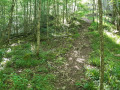
(1) Turn left onto a small grassy path and continue straight on until you reach the southern edge of the woodland.

(2) As you leave the forest, turn left to walk alongside a field. Follow the yellow markings forthe PR®22“Giverzat”. Continue along the grassy path to the left, following the markings. Be careful: tall grass can sometimes hide ruts, which are a hazard to your ankles.

About a hundred metres further on, carry straight on, leaving thePR® 24 “Au fil de la Bouble” on your right. Enter the forest again.

(3) At the junction, turn right and cross the village road with care. Continue straight on for about 1 km, heading deeper into the forest whilst following thePR®22“Giverzat”.

(4) Take the path on the left, then turn right at a 90° angle.

(5) Leave the track and take the path through the forest on the left.

(6) Walk alongside the village road on the left, still following thePR®22“Giverzat”: avoid thePR®21“La Veauvre”, which branches off to the right. Walk for about 150 m, then take the path on the right between the meadows.

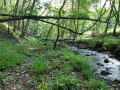
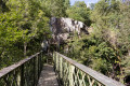
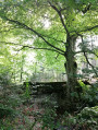
(7) An alternative route is possible by crossing the small bridge, but for now simply follow the stream on the left.

(8) At the junction, turn right. After descending the fairly steep slope, you’ll need to climb back up it. You’ll come to a fork in the path.

(9) Here again, you can continue to follow the yellow markings ofthe PR®22“Giverzat” route, but this time, cut left along the logging track. At the forest lodge, turn left onto the local road to reach your car at the next roundabout (S/E).

Waypoints

  1. S/E : mi 0 - alt. 1,171 ft - Forest circular walk in the heart of the Giverzat Forest
  2. 1 : mi 0.55 - alt. 1,178 ft - Turn left at the fork
  3. 2 : mi 1.59 - alt. 1,152 ft - Forest edge
  4. 3 : mi 2.2 - alt. 1,198 ft - Crossroads
  5. 4 : mi 2.92 - alt. 1,089 ft - Crossing a public road
  6. 5 : mi 3.29 - alt. 1,083 ft - Turn left at the fork
  7. 6 : mi 3.52 - alt. 1,043 ft - Change of direction; several PR routes available
  8. 7 : mi 3.92 - alt. 997 ft - Entrance to the forest
  9. 8 : mi 4.37 - alt. 1,053 ft - Difficult section: crossing a stream
  10. 9 : mi 4.73 - alt. 1,207 ft - Logging track
  11. S/E : mi 5.27 - alt. 1,171 ft - Forest circular walk in the heart of the Giverzat Forest

Notes

Please be aware of the hunting season; check with the town hall in Deneuille-lès-Chantelle for opening dates and hunting days.

(7) In spring, along this stream between this point and the next, you can forage for wild garlic. Please take care not to trample the area too much and stay on the narrow path so that everyone can enjoy it.

Worth a visit

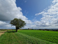
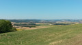
(2) A remarkable view of the Monts de la Madeleine opposite (the Bourbonnais mountains) and the Puy-de-Dôme to the south, clearly visible on a clear day.

Always be cautious and plan ahead when you're outdoors. Visorando and the author of this route cannot be held responsible for any accidents occurring on this route.

The GR® and PR® markings are the intellectual property of the Fédération Française de Randonnée Pédestre.

Reviews and comments

4.4 / 5
Based on 3 reviews

Reliability of the description
4.7 / 5
Ease of following the route
5 / 5
Route interest
3.7 / 5
delfyne03500
delfyne03500

Overall rating : 4.7 / 5

Date of your route : Apr 12, 2021
Reliability of the description : ★★★★★ Very good
Ease of following the route : ★★★★★ Very good
Route interest : ★★★★☆ Good
Very busy route : No

A nice little walk that alternates between narrow paths and wider tracks. The forest is very quiet. Ideal for walking with dogs. The stream is shallow, so it’s likely to be dry in summer.

Machine-translated

les trois sœurs +
les trois sœurs +

Overall rating : 4.7 / 5

Date of your route : Feb 01, 2021
Reliability of the description : ★★★★★ Very good
Ease of following the route : ★★★★★ Very good
Route interest : ★★★★☆ Good
Very busy route : No

a lovely walk

Machine-translated

S2FMG
S2FMG

Overall rating : 4 / 5

Date of your route : May 26, 2020
Reliability of the description : ★★★★☆ Good
Ease of following the route : ★★★★★ Very good
Route interest : ★★★☆☆ Average
Very busy route : Yes

We cycled the first part of the walk, and when we got back near the starting point, we put on our walking shoes. It wouldn’t have been possible to cycle the second part with the child bike seat attached at the back. The route was uphill in places, narrow, steep and slippery when we did it.
Be careful at the start – make sure you turn left before the first kilometre, otherwise you’ll come out of the forest and the route will be a bit longer, though on bikes we didn’t really notice the difference! A really lovely walk, and the short stop at point 7 in the river was a real treat in the hot weather.
It’s also brilliant if you’ve got dogs with you.

Machine-translated

Other walks in the area

For more walks, use our search engine .

The GPS track and description are the property of this route's author. Please do not copy them without permission.