Around Ploubalay

A circular route of around twelve kilometres around Ploubalay.
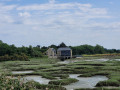
Explore the Beaussais marshes and polders; a short loop around Ploubalay to reach the Floubalay valley, a river which flows into the Anse de Beaussais.

Details

n°29382282
Creation:
Last update:
Last review:
  • Walking
    Activity: Walking
  • ↔
    Distance: 7.30 mi
  • ◔
    Average duration: 3h 30 
  • ▲
    Difficulty: Moderate

  • ⚐
    Back to start: Yes
  • ↗
    Ascent: + 174 ft
  • ↘
    Descent: - 177 ft

  • ▲
    Highest point: 125 ft
  • ▼
    Lowest point: 16 ft
  • ⚐ Country: France
  • ⚐ City: Lancieux (22770)
  • ⚑
    Start/End: N 48.596412° / W 2.165769°
  • ❏
    IGN map(s): Ref. 1016ET
  • Hour-by-hour weather

Description of the walk

The walk starts at the Tertre de Corlieu car park, accessible via Rue des Bénédictins, which is itself accessible from Lancieux.

(S/E) You reach the water’s edge near the Tertre de Corlieu via Rue des Bénédictins.

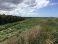
(1) Follow the well-signpostedGR®34to the left. You’ll then walk along the shore of Lancieux Bay, sometimes on dykes marking the boundaries of the polders, sometimes along the edge of the marshes.

(2) Whilst theGR®34branches off to the right to go round Beaussais Bay, carry on straight ahead to cross the Route de Plancouet – take care, as this is a very busy road. You will then go round the small town of Ploubalay, via the hamlet of La Giquelais and the neighbourhoods of La Patenais and La Noë. We then follow the signposts for the ‘Route du Floubalay’ and reach Rue de Dinan.

(3) Cross the road, turning left, then immediately turn right onto a small road running alongside the grounds of a manor house. At the far end of the grounds, take a path on the left which leads uphill through the woods. You’ll cross the Floubalay stream for the first time.

(4) On emerging from the woods, take the path branching off to the left and continue along the Floubalay Route until you reach a small road; follow this to the left for about 200 metres, then take a path on the left that runs alongside a sloping field. You’ll arrive at the edge of the road coming from Dinard, Rue du Général de Gaulle.

.(5) Cross under a bridge spanning the Floubalay. You then walk alongside the Floubalay before heading up above it. This brings you to a small road (Rue du Sabre).

(6) Turn right onto this road and follow it for about 300 metres, then turn left onto Rue des Noes, which you follow for quite some time, going straight on at every junction. You’ll come to Rue Bodard.

(7) Turn left onto it. Then cross the Lancieux–Ploubalay road and follow Rue de la Digue aux Moines on the opposite side, then continue along the path that extends from it.

(8) Just before you reach the seafront, take the path branching off to the right to reach the car park (S/E).

Waypoints

  1. S/E : mi 0 - alt. 23 ft - Tertre de Corlieu car park
  2. 1 : mi 0.24 - alt. 26 ft - Seaside
  3. 2 : mi 1.95 - alt. 20 ft - Route de Plancouët
  4. 3 : mi 3.53 - alt. 72 ft - Route de Dinan
  5. 4 : mi 3.98 - alt. 82 ft - Exit from the woods
  6. 5 : mi 4.68 - alt. 49 ft - Route de Dinard - Floubalay (Ruisseau)
  7. 6 : mi 5.63 - alt. 72 ft - Rue du Sabre
  8. 7 : mi 6.26 - alt. 95 ft - Rue de Bodard
  9. 8 : mi 7.13 - alt. 23 ft - Before reaching the sea
  10. S/E : mi 7.3 - alt. 23 ft - Tertre de Corlieu car park

Always be cautious and plan ahead when you're outdoors. Visorando and the author of this route cannot be held responsible for any accidents occurring on this route.

The GR® and PR® markings are the intellectual property of the Fédération Française de Randonnée Pédestre.

Reviews and comments

4 / 5
Based on 2 reviews

Reliability of the description
4 / 5
Ease of following the route
4.5 / 5
Route interest
3.5 / 5
MaudG33
MaudG33

Overall rating : 3.7 / 5

Date of your route : May 09, 2026
Reliability of the description : ★★★★☆ Good
Ease of following the route : ★★★★☆ Good
Route interest : ★★★☆☆ Average
Very busy route : No

A walk through the beautiful countryside of rural Brittany

Machine-translated

yannvallard
yannvallard

Overall rating : 4.3 / 5

Date of your route : Mar 06, 2023
Reliability of the description : ★★★★☆ Good
Ease of following the route : ★★★★★ Very good
Route interest : ★★★★☆ Good
Very busy route : No

You say on the journey
11.75 km in 3 hours 25 minutes
At a normal walking pace of 4.5 km per hour, it took us 2 hours 25 minutes
Thanks, the route is relatively flat. Thanks
Yann, the hiker

Machine-translated

Other walks in the area

For more walks, use our search engine .

The GPS track and description are the property of this route's author. Please do not copy them without permission.