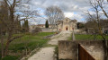
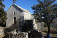
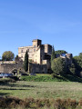
Silvacane Abbey and the Côtes mountain range

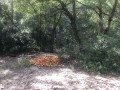
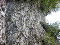
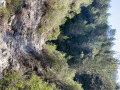
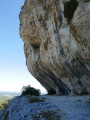
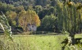
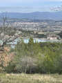
Hike from Silvacane Abbey (worth visiting) and climb up to the ridges for beautiful views of the Luberon, Mont Ventoux and the Alps. The descent through the Castellas valley, which follows the bed of a torrent, is tricky in places but possible in dry weather.

Details

2939056
Creation:
Last update:
Last review:
  • Walking
    Activity: Walking
  • ↔
    Distance: 7.93 mi
  • ◔
    Average duration: 4h 30 
  • ▲
    Difficulty: Moderate

  • ⚐
    Back to start: Yes
  • ↗
    Ascent: + 948 ft
  • ↘
    Descent: - 942 ft

  • ▲
    Highest point: 1,430 ft
  • ▼
    Lowest point: 528 ft

Photos

Description of the walk

(S/E) Park in the car park in front of the abbey. Head east and take the path that runs alongside the D561a. Cross the D23 with caution and continue along the D561a for about 40 metres.

(1) Cross this road with extreme caution as there is no pedestrian crossing. Take the forest track (DFCI 221) on the right, which crosses the Marseille canal further on and climbs gently towards the ridges. The noise of traffic in the valley gradually fades away.

(2) Pass cistern 322 and reach the junction with cistern 186 just after leaving a track on the left.

(3) Ignore the Vallon des Pierres Rouges path on the right and continue straight on to cistern 162.

(4) Take the path furthest to the right, which descends gently into the forest until it crosses the Vallon de la Baume path.

(5) Turn completely left and continue along the hillside until you reach the EDF THT pylon located about a hundred metres before another cistern.

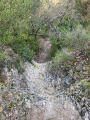
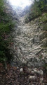
(6) Take the small path on the right that passes under the pylon and descends into the valley. The path quickly follows the course of a (dry) stream at the bottom of the valley. Be careful, as the stones can be slippery. A small 5-metre-high stone waterfall requires particular attention but is easily passable using the few roughly hewn steps. You will then reach a pleasant path through pine, boxwood and oak trees.

(7) At the end of the valley, after passing a wide path on your right that leads back into the mountains, walk along the sports fields and then cross the Marseille canal

(8) After the canal, immediately turn left onto Rue du Castellas, cross Boulevard de la Paix, keeping to the left to use the pedestrian crossing. Continue for about 20 metres, then turn left onto Rue Albert Camus. Walk past the old town hall, then continue straight on Rue Georges Clémenceau.

(9) Turn right onto the small Rue de Vaudois, which ends in an alleyway. Turn left onto Rue du Temple, take a look at the Protestant temple and the information panel on the history of the Waldensians in the valley. Continue along this street, then turn left onto Rue de la Calade, which will take you to the castle

(10) Follow Avenue de Silvacane to the right. This is the least pleasant part of the route, with poorly maintained verges.

(11) Keep to the right at the three-way junction and continue straight ahead.

(12) Just before the T-junction, at the pedestrian crossing, turn left onto the path that runs alongside the road to reach the car park (S/E).

Waypoints

  1. S/E : mi 0 - alt. 548 ft - Silvacane Abbey car park
  2. 1 : mi 0.61 - alt. 535 ft - Crossing the D561a - Towards - Canal de Marseille
  3. 2 : mi 1.68 - alt. 942 ft - Cistern 322
  4. 3 : mi 2.43 - alt. 1,056 ft - Cistern 186
  5. 4 : mi 3.48 - alt. 1,398 ft - Cistern 162
  6. 5 : mi 3.95 - alt. 1,240 ft - Baume Valley
  7. 6 : mi 4.73 - alt. 1,253 ft - EDF pylon - Castellas valley
  8. 7 : mi 6.33 - alt. 623 ft - Exit from the valley
  9. 8 : mi 6.51 - alt. 604 ft - Rue de Castellas
  10. 9 : mi 6.83 - alt. 554 ft - Rue de Vaudois
  11. 10 : mi 6.94 - alt. 541 ft - Castle - Office de Tourisme La Roque d'Anthéron
  12. 11 : mi 7.04 - alt. 528 ft - Fork, cross
  13. 12 : mi 7.71 - alt. 541 ft - Path leading to the car park
  14. S/E : mi 7.93 - alt. 548 ft - Silvacane Abbey car park

Notes

Wear sturdy shoes and bring walking sticks, especially for the descent into the valley. In summer, don't forget to check the fire alert status (telephone number posted at the start of the hiking trails).

Worth a visit

Reviews and comments

4.5 / 5
Based on 12 reviews

Reliability of the description
4.6 / 5
Ease of following the route
4.7 / 5
Route interest
4.2 / 5
piat colette
piat colette

Overall rating : 3.7 / 5

Date of your route : Jun 03, 2025
Reliability of the description : ★★★★☆ Good
Ease of following the route : ★★★★☆ Good
Route interest : ★★★☆☆ Average
Very busy route : No

The first part wasn't very interesting, but the return trip through the valley was very nice. It's a shame that the tour doesn't include the chapel.
I wouldn't do it again, disappointed.

Machine-translated

Confucius2
Confucius2

Overall rating : 4.3 / 5

Date of your route : Mar 27, 2025
Reliability of the description : ★★★★☆ Good
Ease of following the route : ★★★★☆ Good
Route interest : ★★★★★ Very good
Very busy route : No

This hike was very interesting, with beautiful views of the Luberon, beyond the Durance, on the Vaucluse side. The route was clear enough to follow without any problems. The only downside was the end of the route, which took us to the village of La Roque d'Anthéron: not interesting at all. If I were to do it again, I would try to find a way to reach the abbey while staying in the forest, before turning off towards the village.

Machine-translated

Rosa13400
Rosa13400
• Edited:

Overall rating : 4.3 / 5

Date of your route : Sep 30, 2024
Reliability of the description : ★★★★★ Very good
Ease of following the route : ★★★★★ Very good
Route interest : ★★★☆☆ Average
Very busy route : No

Beautiful hike, first part goes uphill, uphill, uphill 🤪 with a very pretty view, the second part is superb, you go downhill on small paths.
Don't miss a visit to the abbey.

Machine-translated

Rando Leo
Rando Leo

Overall rating : 5 / 5

Date of your route : Apr 11, 2024
Reliability of the description : ★★★★★ Very good
Ease of following the route : ★★★★★ Very good
Route interest : ★★★★★ Very good
Very busy route : No

A beautiful, very varied hike with lovely views, particularly of Mont Ventoux. There are indeed a lot of tracks on the first part of the route, but the descent into the very shady Castellas valley is very pleasant.
There is no particular difficulty in descending the 5-metre slope of the Castellas "waterfall". With a little care, it's easy to get down (in dry weather, like today!). If you have time, it might be worth visiting the Saint-Anne chapel. Finally, if you have at least two cars, you can leave one in the village of La Roque d'Anthéron, which will allow the drivers to return to the Silvacane Abbey car park to collect the other vehicles. This avoids the whole group of hikers having to walk the last part of the hike along the road.

Machine-translated

phildaix
phildaix

Overall rating : 5 / 5

Date of your route : Nov 02, 2022
Reliability of the description : ★★★★★ Very good
Ease of following the route : ★★★★★ Very good
Route interest : ★★★★★ Very good
Very busy route : No

A very beautiful hike: a pleasant climb; the descent through the Castelet valley is stunning, especially today with the sun shining through the foliage and the magnificent autumn colours. A real treat.
What's more, this descent isn't that difficult: even after yesterday's heavy rain, the rocks were a little damp but not really slippery; the rock cascade is easy to navigate, even if you've never been rock climbing before.

Machine-translated

godillot1
godillot1

Overall rating : 5 / 5

Date of your route : Oct 18, 2022
Reliability of the description : ★★★★★ Very good
Ease of following the route : ★★★★★ Very good
Route interest : ★★★★★ Very good
Very busy route : No

A route enjoyed by all the hikers I accompanied that day.

Machine-translated

franck_preaud
franck_preaud

Overall rating : 4.7 / 5

Date of your route : Oct 24, 2021
Reliability of the description : ★★★★★ Very good
Ease of following the route : ★★★★★ Very good
Route interest : ★★★★☆ Good
Very busy route : No

Very nice hike. Moderate elevation gain. Some slippery sections in the riverbed (Vallon du Castelas) due to overnight moisture, but really fun. Beautiful views. Only the end on the road isn't great, but hey, it doesn't last very long. A beautiful hike with glorious sunshine, no difficulty.

Machine-translated

vitisflora
vitisflora

Overall rating : 4.7 / 5

Date of your route : Jan 24, 2021
Reliability of the description : ★★★★☆ Good
Ease of following the route : ★★★★★ Very good
Route interest : ★★★★★ Very good
Very busy route : No

A very pleasant route with beautiful views along the way.
No difficulties, very good paths
Vallon du Castelas: impassable section of the stream (water in the stream)
Return to the trail at point 4 to reach La Roque via the northbound trail (stele).

Machine-translated

fredchopin
fredchopin

Overall rating : 4.3 / 5

Date of your route : May 25, 2020
Reliability of the description : ★★★★★ Very good
Ease of following the route : ★★★★★ Very good
Route interest : ★★★☆☆ Average
Very busy route : No

We made a mistake and ended up following the path to the Baume valley. The reliability of the route is not in question; it was due to our distraction and, to some extent, the monotony of the route, with too many tracks... Despite all that, it was a pleasant outing.

Machine-translated

dmike
dmike
• Edited:

Overall rating : 4.7 / 5

Date of your route : Feb 12, 2020
Reliability of the description : ★★★★★ Very good
Ease of following the route : ★★★★★ Very good
Route interest : ★★★★☆ Good

Hike tested in February 2020 in beautiful sunshine, very pleasant, with lovely views. The dry stream section requires you to use your hands to climb down about twenty metres on two or three occasions. Not suitable for young children. Dry weather is essential to avoid slipping.

Machine-translated

brissonnet claudine
brissonnet claudine

Overall rating : 4.7 / 5

Date of your route : Feb 10, 2020
Reliability of the description : ★★★★★ Very good
Ease of following the route : ★★★★★ Very good
Route interest : ★★★★☆ Good

There is just a small error in step 2; you should not cross the D23 but the road you arrive on by car. The distance between the abbey car park and the first path is more than 40 metres (several hundred metres).
I modified the route slightly to extend it along the ridge and go to the chapel, but it's a very beautiful walk...
In general, I use your information sheets a lot; they are very well done and the walks are always enjoyable...
Thank you again.
Claudine Brissonnet

Machine-translated

Other walks in the area

For more walks, use our search engine .

The GPS track and description are the property of this route's author. Please do not copy them without permission.