Country:
 City:
City:


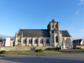
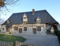
Park on Rue des Monts.
(S/E) With your back to the Vatteville-la-Rue sign, turn right heading north-west. Take the first left onto Chemin du Roy and follow the wide bend, ignoring Rue de la Mare on your right. Then turn right onto Rue de la Hette; at the end, take a slight right-left turn and head down to the T-junction.
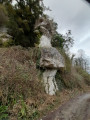
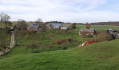
(1) Turn right onto Route d’Aizier and immediately turn left onto Venelle du Vieux Château. At the next crossroads (X-junction), turn left onto Rue, ignoring the bend to the right and continuing straight ahead along the grassy path. Pass the old castle or oppidum on your left.
(2) At the T-junction, turn right. Continue along this path and take the second turning on the right to rejoin the tarmac road, the Rue.
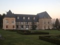
(3) Turn left onto the Rue, walk past the house known as ‘FrançoisI’s House’ and head towards the church, following the road to the left. At the T-junction opposite the church, turn right and, at the end, turn right again to reach the Les Cateliers roundabout.
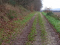
(4) Turn left onto the pavement; cross at the first pedestrian crossing, then make the first turn left then right to join Chemin de la Brèche. Continue straight ahead along the track once you’ve left the tarmac behind.
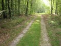
(5) At the X-junction of paths, on the edge of the forest, veer left. Ignore Chemin du Rouage, which runs along on your left, and carry on until the next left-hand turn.
(6) Turn left to rejoin the tarmac road, Rue d’Arelaune. At the T-junction ahead, turn right and then immediately left onto Rue du Gros Chêne. Continue to the triangular junction.
(7) Cross the road and carry on straight ahead along Rue de l’Angle. Follow this street to the end and take the grassy path opposite to reach the River Seine.
(8) Turn right and head towards the old ferry crossing. Turn right onto Rue du Bac, walk for about 700 metres and, after the ‘give way’ sign, turn left onto Chemin du Roy. Continue along this path and turn right at the first junction.
(9) At the T-junction, turn right onto Route de Frévaux. At the Fork in the road, turn left immediately onto Rue de la Mare. Continue to the crossroads (X-junction) with Grande Rue (D65).
(10) Cross carefully and carry on straight ahead onto Route de la Forêt or Route de la Plaine. Ignore the first turn-off on the right, then turn right onto the first track, in the middle of the plain, to rejoin the road at the T-junction.
(11) Turn left onto Route du Fayel (D40). At the next crossroads, turn left onto Rue de l’Orée du Bois. Turn right onto the first path just before the water tower, go round the back of it and follow the path which veers to the right, opposite a house. At the first X-junction of paths, take the first path on the left. Continue straight on, ignoring the paths to the right and left, until you reach the T-junction, then turn left until you reach the forest gate.
(12) Turn right, then immediately left onto Chemin des Pilotes. At the end of the path, veer left and immediately take the path on the right. After a few metres, you’ll see mounds of earth forming a hill.
(13) Carry on straight ahead, with the hill on your left. To avoid the difficult stretch a few metres further on – a pool of water and mud caused by forestry machinery – go round the area on the right and rejoin the track. With the earthen hill on your right, take the first path on the left. Continue to the star-shaped junction with an upright sandstone boulder. Take the first path on the left and keep turning left until you reach the road.
(14) Opposite the Arelaune Nurseries, turn right onto Rue des Landes and, at the Y-junction, continue along the right-hand branch. Ignore a turn-off to the right.
(15) Then turn right onto Chemin de la Fieffé; at the end, the route continues along a footpath. At the end of the footpath, follow the tarmac road, Ruelle Moussard, to the T-junction.
(16) Turn right onto Rue Moussard and continue to the next junction at a place called Le Wuy. Carry on to the right along Rue du Wuy and, at the T-junction, veer to the right. Follow the road to the next crossroads.
(17) Carry on straight ahead, then turn onto the first track on the right, leaving the road behind. At the T-junction, turn left onto Chemin aux Lapins. At the X-junction, carry on straight ahead and continue to the next X-junction.
(18) Turn left onto Route forestière aux Amis and, after the forest gate, at the T-junction, turn right onto Rue des Monts and continue straight on to the car park on Rue des Monts (S/E).

 Visorando Member
 Easy
Easy 
 Moderate