Country:
 City:
City:


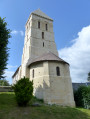
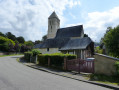
Parking is available in the car park opposite the church in Vatteville-la-Rue.
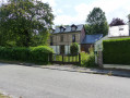
(S/E) Facing the church, head left and turn left immediately onto La Rue. Pass the town hall on your right, ignore the road branching off to your left, pass the Maison François1er and continue to the next turn-off on the right.
(1) Turn right and then immediately left. At the end, continue along the path to the castle ruins – Oppidum. Turn left onto the path between the house and the ruins. Take the first right, Venelle du Vieux Château, until you reach the T-junction.
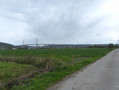
(2) Turn right onto Route d’Aizier, continue for about 400 m and turn right. Carry on straight ahead, taking the grassy path to reach the banks of the Seine. Turn left, continue to the sand quarry and turn into the first path on the left to rejoin Route d’Aizier at the T-junction on the outskirts of the hamlet of La Neuville.
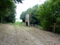
(3) Turn right, pass the old Neuville lighthouse on your right and turn into the next path on the right. This path runs alongside Route d’Aizier and joins it after about 1,570 m. Ignore the road and continue along the path opposite, which continues to run alongside the road and rejoins Route d’Aizier at La Vaquerie.
(4) Turn right, pass through the hamlet of La Vaquerie and the hamlet of Le Flacq, then continue along the road to the village of Aizier.
(5) Take the first right onto Impasse du Quai de Seine. “Down below is a large mown area with picnic tables, and on the way down there are several small signs recounting the history of the village in days gone by.”
(6) Then retrace your steps back to the crossroads.
(5) Carry on straight ahead along Route du Fond des Vaux (with some lovely thatched cottages, one of which is a listed building).
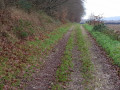
(7) Turn left onto the Route des Bois de Fécamp. Walk for about 260 m and take the first path branching off to the left. On the climb, at the Y-junction, turn left onto the small path to emerge at the top, in the hamlet of La Coudrette.
(8) Turn left onto Chemin de la Coudrette. Ignore Chemin du Nouveau Monde, which joins from the right, and carry on straight ahead to the forest gate. Go through the gate, follow the electric fence straight ahead for about ten metres, then turn right at the end. Follow the path alongside the electric fence to the next junction.
(9) Turn right and carry on straight ahead, ignoring the path branching off to the right which continues to run alongside the fence. Keep going straight on until you reach the Route du Val du Long Brun. Cross the road and carry on straight ahead to the forest gate at the star-shaped junction.
(10) Ignore the first forest road, the Route forestière de la Mare à la Chèvre, on the left, and take the second left-hand turn, which leads diagonally off, the Cheminage de Vatteville. Continue for 1,840 metres, ignoring the first X-junction.
(11) At the second X-junction, ignore the path leading off to the left and turn right onto the Ligne de la Vaquerie. Go straight on until you reach the D131, the Route de Pont Audemer. Cross the road and continue straight ahead, up a fairly steep slope for a few metres. Continue along this path until you reach the star-shaped junction at the Rond de Nagu.
(12) Head straight ahead, go through the forest gate, follow the Route Forestière de la Charmante and take the first left: Ligne au Blaireau. Carry on straight ahead until you reach the star-shaped junction at Rond de Mortemart.
(13) Cross the Route de Pont Audemer (D131) and take the forest track – Ligne au Blaireau – which starts opposite. Walk for 1,580 metres, ignoring an X-junction.
(14) Turn left towards the Chapelle Saint-Maur and Les Arbres à Nœuds. Continue straight on until you reach the Maison Forestière des Landes. After the forest gate, carry on straight ahead and then turn right for 30 m onto Rue des Landes.
(15) Turn right, walk 2 m and take the path branching off to the left, marked in blue. At the end, at the T-junction, turn left and, when you reach the road (Rue des Landes), turn right until you reach the star-shaped junction at the Ancien Moulin de la Vallée.
(16) Turn right and carry on to the end, to the ruins of the Moulin de la Vallée.
(17) Retrace your steps.
(16) Turn right again and then immediately right once more onto Rue du Moulin (picnic tables on the right 100 m ahead).
At junction X, continue straight ahead towards the Maison Forestière de la Haie du Maur, until you reach the forest gate.
(18) Go through the forest gate and follow the Chemin de la Brèche de l’Église to reach the edge of the forest. Continue along the path straight ahead, across the fields, to reach the houses.
(19) Carry on straight ahead to the T-junction, Route de Caudebec. Turn left; at the roundabout, veer right, go down 60 metres and take the small path, after the gate, which leads towards the houses and joins the church car park (S/E).

 Visorando Member
 Easy
Easy 
 Moderate