Circular route along the Seine opposite Caudebec-en-Caux

Close to the Pont de Brotonne, which is free to cross, this walk takes you through unspoilt and rich natural surroundings. Mint, tansy, oregano, chervil: the variety of plants is incredible! Mostly in the shade, which is a real bonus on hot days. You’ll first explore the banks of the Seine as you follow its course, then head deeper into the countryside and the forest before descending via charming little roads back to the starting point.

Details

59058461
Creation:
Last update:
Last review:
  • Walking
    Activity: Walking
  • ↔
    Distance: 7.55 mi
  • ◔
    Average duration: 3h 40 
  • ▲
    Difficulty: Moderate

  • ⚐
    Back to start: Yes
  • ↗
    Ascent: + 262 ft
  • ↘
    Descent: - 269 ft

  • ▲
    Highest point: 295 ft
  • ▼
    Lowest point: 56 ft

Description of the walk

There’s a small car park at the end of the D40 in Saint-Nicolas-de-Bliquetuit, next to the landing slipway of the old Caudebec ferry, which was scuttled in 1940 as the Germans advanced. The Seine is right there – you can almost touch it!

(S/E) From the car park at the old Caudebec ferry landing stage, follow the old towpath to the left, heading west for about 250 metres.

(1) Leave the return path on your left and continue along the Seine downstream on the left bank.

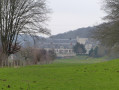
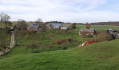
(2) When you reach an old barn, opposite Villequier, leave the banks of the Seine and turn left onto the Chemin de Villequier heading south-east. In the large meadows on the right in the Angle marshes, we saw around forty storks flying and feeding.

(3) At the junction just past the first houses, carry on straight ahead. Cross the Route des Chaumières, then the Route de Caudebec. Walk past the farm buildings of Ferme Féron and continue to the edge of the forest, leaving Vatteville-la-Rue on your right.

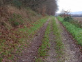
(4) Turn left and follow the path along the edge of the woodland, which smells of hazelnuts.

(5) After about 600 m, turn left onto the path leading towards some houses; further on, it becomes tarmac-surfaced and is absolutely charming.

(6) At the crossroads, turn 90° to the right and carry on straight on until you reach the D40.

(7) Turn left onto the D40 and follow it carefullyfor about sixty metres, then turn left onto the Route des Maraîchers. Keep left at the first junction, then head due north. Cross the D65 carefully to the left of the first houses in Saint-Nicoles-de-Bliquetuit, and continue to the first three-way junction. 

(8) Turn slightly to the right and continue north for a good kilometre to reach the towpath along the banks of the Seine.

(1) Turn right to reach the car park very close to where you started (S/E). 

Waypoints

  1. S/E : mi 0 - alt. 171 ft - (Small) car park on the banks of the Seine - Pont de Brotonne
  2. 1 : mi 0.18 - alt. 171 ft - Junction of the circular loop - Seine [la]
  3. 2 : mi 2.55 - alt. 167 ft - Barn, fork to the left
  4. 3 : mi 3.44 - alt. 174 ft - Crossroads, go straight on
  5. 4 : mi 4.28 - alt. 223 ft - Edge of the woods, on the left
  6. 5 : mi 4.76 - alt. 292 ft - Path on the left
  7. 6 : mi 5.33 - alt. 66 ft - At the crossroads, turn sharp right
  8. 7 : mi 5.92 - alt. 230 ft - Turn left onto the D40
  9. 8 : mi 6.7 - alt. 190 ft - Three-way junction, turn right
  10. S/E : mi 7.55 - alt. 171 ft - Return to the small car park

Notes

There are no drinking fountains along this very rural route. You’ll see houses and signs of life, but no shops!

Please respect the surroundings at (S/E), a lovely car park on the banks of the Seine. 

Worth a visit

Until the end of summer 2024, there is an extraordinary exhibition in Caudebec-en-Caux on the banks of the Seine: the exodus of 1940 and the town’s ordeal, as a ferry crossing point that was overwhelmed and overrun.
At point (2), you’ll find yourself opposite Villequier, close to the spot where Léopoldine, Victor Hugo’s daughter, and her husband Charles Vaquerie drowned in the Seine. ‘The grass must grow and children must die…’. The Maison Vaquerie is, incidentally, a moving Victor Hugo Museum well worth a visit.

Reviews and comments

4.7 / 5
Based on 2 reviews

Reliability of the description
4.5 / 5
Ease of following the route
5 / 5
Route interest
4.5 / 5
MARTDomi
MARTDomi

Overall rating : 4.3 / 5

Date of your route : Jun 08, 2025
Reliability of the description : ★★★★☆ Good
Ease of following the route : ★★★★★ Very good
Route interest : ★★★★☆ Good
Very busy route : No

Nice loop with no difficulties

Machine-translated

Claude41
Claude41

Overall rating : 5 / 5

Date of your route : May 25, 2025
Reliability of the description : ★★★★★ Very good
Ease of following the route : ★★★★★ Very good
Route interest : ★★★★★ Very good
Very busy route : No

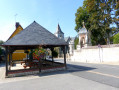
A lovely walk. The first 4 kilometres along the towpath offer panoramic views of this circular bend in the Seine from Caudebec to Villequiers. You don’t realise how much you’re climbing to reach the forest because the slope is so gentle. Despite the pleasant weather – lovely sunshine (though quite windy) – we didn’t come across any other walkers. Given the type of paths and sections of road (narrow and quiet), there won’t be any problems in wet weather. At the start/finish point, there are tables and benches where you can have a bite to eat at the end of the walk. A varied and very easy walk.

Machine-translated

Other walks in the area

For more walks, use our search engine .

The GPS track and description are the property of this route's author. Please do not copy them without permission.