Saint-Calais and Vieux Conches

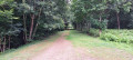
An easy route, mainly along forest paths and small country lanes.

=> Report dated 28 March 2025 from the Evreux Conches signposting manager.
Please note that the GRP® (red and yellow markings) has been removed andno longer exists on the ground, but is still shown on the map.

Details

n°66361733
Creation:
Last update:
Last review:
  • Walking
    Activity: Walking
  • ↔
    Distance: 5.35 mi
  • ◔
    Average duration: 2h 35 
  • ▲
    Difficulty: Easy

  • ⚐
    Back to start: Yes
  • ↗
    Ascent: + 167 ft
  • ↘
    Descent: - 174 ft

  • ▲
    Highest point: 492 ft
  • ▼
    Lowest point: 371 ft

Photos

Description of the walk

Start from the market car park, Rue de Wareham, in the centre of Conches-en-Ouche.

(S/E) Head to the Wareham Dorset roundabout and turn left towards the SNCF station.

(1) Cross the car park, walk alongside the railway line, pass under the motorway bridge and take the dirt track on the right. Follow this track for about 800 m until you reach a T-junction.

(2) Turn left and continue straight on for over a kilometre.

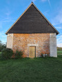
(3) Turn left and leave the woodland. You’ll reach the Saint-Calais Chapel.

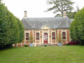
(4) Turn slightly left and walk past the Manoir de Saint-Calais.

(5) At the T-junction, turn left and immediately ignore a road on the right. Further on, pass under a railway bridge and reach the hamlet of Vieux Conches.

(6) At the junction, turn left, walk through the hamlet and reach the end of Rue des Pierrots.

(7) Cross the D140 with care and follow the road opposite, the Chemin de la Balivière, passing a restaurant on your right.

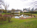
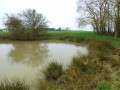
(8) At the end (pond on the right), turn left onto the Chemin du Marteau.

(9) Return to the D140 and follow it to the right. Enter Conches, then turn left onto Rue de la Forge. Turn right onto this road and pass under a road bridge. Go past the entrance to Parc de la Forge and, a few metres further on, you’ll come to a path starting on the left.

(10) Take this path and follow it to a road (steep section at the end of the path).

(11) Follow the road to the left (Rue Orly Roederer). At the junction, go straight on and you’ll immediately reach the market car park (S/E).


Waypoints

  1. S/E : mi 0 - alt. 459 ft - Market car park - Église Sainte-Foy (Conches-en-Ouche)
  2. 1 : mi 0.19 - alt. 404 ft - Gare de Conches
  3. 2 : mi 1.19 - alt. 469 ft - T-junction
  4. 3 : mi 2.29 - alt. 486 ft - Turn left
  5. 4 : mi 2.62 - alt. 489 ft - Chapel - Chapelle Saint-Calais (Louversey)
  6. 5 : mi 2.72 - alt. 476 ft - T-junction - Manoir de Saint-Calais
  7. 6 : mi 3.63 - alt. 479 ft - Vieux Conches
  8. 7 : mi 3.91 - alt. 472 ft - Crossing the D140
  9. 8 : mi 4.14 - alt. 417 ft - Chemin du Marteau - Étangs du Vieux Conches
  10. 9 : mi 4.27 - alt. 407 ft - D140 road - Rouloir (cours d'eau) - Affluent de l'Itton
  11. 10 : mi 4.89 - alt. 387 ft - Start of the trail
  12. 11 : mi 5.21 - alt. 463 ft - Rue Orly Roederer
  13. S/E : mi 5.35 - alt. 459 ft - Market car park

Notes

(1) On Thursdays, market day, it is best to start from the SNCF station car park.

(10) You can continue along the road to return to the starting point.

Worth a visit

Reviews and comments

4 / 5
Based on 2 reviews

Reliability of the description
4 / 5
Ease of following the route
4 / 5
Route interest
4 / 5
thomblanc
thomblanc

Overall rating : 4.7 / 5

Date of your route : Mar 22, 2026
Reliability of the description : ★★★★★ Very good
Ease of following the route : ★★★★★ Very good
Route interest : ★★★★☆ Good
Very busy route : No

A lovely, pleasant and easy walk.

Machine-translated

jploust
jploust

PLEASE NOTE: This route was not created by JEAN-PAUL LOUSTAU!!!

Machine-translated

isafo
isafo
• Edited:

Overall rating : 3.3 / 5

Date of your route : Oct 24, 2025
Reliability of the description : ★★★☆☆ Average
Ease of following the route : ★★★☆☆ Average
Route interest : ★★★★☆ Good
Very busy route : No

Lack of signposting in the forest.
Upon arrival, the description mentions that the path is steep... AND IT IS (difficult to traverse) unless you missed a small trail to avoid it, in which case it would need to be marked or indicated in the description.
Otherwise, a very pleasant and varied walk.

Machine-translated

jeanpaul Loustau
jeanpaul Loustau

I am Armelle Loustau, the person in charge of signposting for the Evreux–Conches route
Please note that the GRP® (red and yellow markings) has been removed and no longer exists on the ground, although it is still shown on the map.

Machine-translated

Other walks in the area

For more walks, use our search engine .

The GPS track and description are the property of this route's author. Please do not copy them without permission.