Country:
 City:
City:


Start from the market car park on Rue de Wareham in the centre of Conches-en-Ouche.
(S/E) With your back to the War Memorial, head to the Wareham Dorset roundabout and turn left, following Rue Mendes France towards the SNCF station. Signposted along the GRP® ‘Tour du pays d’Ouche’ route.
(1) Cross the car park and walk alongside the railway line until you reach the underpass beneath the expressway.
(2) A few dozen metres further on, at the Fork in the road, leave the return route on your left and take the dirt track on the right. This heads north-east and leads to a T-junction.
(3) Turn left, heading north-west. Ignore the paths branching off to the right or left; maintain your direction and continue through the forest, straight ahead for over 1.5 km. You’ll reach the Bois de la Couaille at a 90° bend to the right of the GRP®.
(4) Turn left and leave the woodland. You’ll reach Saint-Calais at a junction. The path turns right and leads to another junction at the Chapelle Saint-Calais.
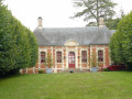
(5) Turn left; at the crossroads just after, turn left again and walk past the entrance to the Manoir de Saint-Calais. Continue due south and enter the forest. Further on, pass under a railway bridge and reach the hamlet of Vieux Conches. Continue to the junction with the D140.
(6) Turn left, then take thefirst path on the left, cross a railway bridge, enter the forest and reach a junction a few dozen metres further on.
(7) Turn right, walk past the gate, then cross the footbridge over the stream. You’ll come to a T-junction.
(8) Turn right, then head back to the junction you passed on the way there.
(2) Follow the route back in the opposite direction to reach the car park where you started (S/E).
 Visorando Member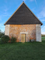

 Difficult
  Moderate