Around La Ferté-Saint-Aubin

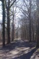
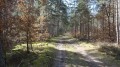
A lovely circular route between the Loiret and Loir-et-Cher departments. Most of this circular route takes you through pretty forests and along wide tracks in good condition. Suitable for cycling with children.

Details

1024001
Creation:
Last update:
Last review:
  • Walking
    Activity: Walking
  • ↔
    Distance: 8.35 mi
  • ◔
    Average duration: 3h 55 
  • ▲
    Difficulty: Moderate

  • ⚐
    Back to start: Yes
  • ↗
    Ascent: + 79 ft
  • ↘
    Descent: - 79 ft

  • ▲
    Highest point: 453 ft
  • ▼
    Lowest point: 344 ft

Photos

Description of the walk

Park at the side of the track near the boundary marker between the Loiret and Loir-et-Cher departments.

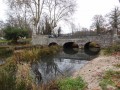
(S/E) Leave the car park heading north-north-east and follow the long path marked in white and red. Pass the Couapellière junction (known locally as La Grille en Fer), ignoring all the paths to the right and left, which are all private. Reach a small bridge and cross it. From this point, the path turns into a lovely little road.

(1) Pass the Cannefoucher house, follow the road ignoring all side paths, pass the Chemin du Moinard and reach a junction with several paths.

(2) Take the path at a right angle to the right signposted “Canne Villiers, Chambouy, RD108”, ignoring several paths to the right and left. Continue to the next junction.

(3) Turn right, following the yellow-and-red “Vouzon” markings, ignoring all side paths.

(4) Cross the Chambouy bridge (wooden deck) via the long, ascending path, then enter Chambouy. Ignore the numerous paths to the right and left and head for a junction just before La Couapellière.

(5) Ignore theGR® de Sologne branching off to the left; continue straight on (CR markings, D153). Pass the paths leading to the properties known as La Couapellière, Le Chêne Rond, Les Sapins Bleus and Les Boulats.
The path becomes a road; follow this small road until you reach a Y-junction at La Chesnière.

(6) Follow the grassy path on the right until you reach the Route de Vouzon (D153). Follow the road to the right and join the D2020, then cross it.
Carry on straight ahead along the road signposted “Yvoy le Marron”, cross the railway bridge and pass a house on the right, until you reach a Y-junction formed by the road and a wide track.

(7) Turn right and continue along this wide track, ignoring all side tracks, until you reach an inverted Y-junction. Follow the track on the right signposted CR, leaving La Ronce and its pretty dovecote on your left. At the next junction, turn left towards R, leaving a grassy track straight ahead. Continue to a Y-junction at a place called La Bruyère.

(8) Follow the path on the right, ignoring all side paths, until you reach an inverted Y-junction.

(9) Take the path on the right marked ‘CR’, ‘Ménestreau en V’, and walk alongside Les Clasys and then Les Arcis.
Pass under the railway bridge, continue along the track, ignoring all side paths, until you reach the D 2020. Cross the road and head for the car park (S/E).

Waypoints

  1. S/E : mi 0 - alt. 374 ft - Parking at the departmental boundary marker
  2. 1 : mi 1.53 - alt. 364 ft - Maison La Canne Foucher
  3. 2 : mi 2.3 - alt. 377 ft - Turn right at the junction where several paths meet
  4. 3 : mi 2.67 - alt. 384 ft - Path on the right
  5. 4 : mi 3.31 - alt. 354 ft - Chambouy Bridge
  6. 5 : mi 4.33 - alt. 381 ft - Go straight on before La Couapellière
  7. 6 : mi 5.47 - alt. 446 ft - La Chesnière
  8. 7 : mi 6.4 - alt. 446 ft - Turn right at the Y-junction
  9. 8 : mi 7.13 - alt. 407 ft - At La Bruyère, take the path on the right
  10. 9 : mi 7.59 - alt. 390 ft - Path on the right
  11. S/E : mi 8.35 - alt. 374 ft - Parking at the departmental boundary marker

Notes

To reach the starting point of this circular route, leave the town centre of La Ferté-Saint-Aubin via the D 2020 towards Lamotte-Beuvron, and drive for about 7 km to reach the boundary between the two departments (Loiret and Loir-et-Cher). This boundary is marked at the entrance to a path on the left-hand side of the road by a tall white boundary post. This circular walk starts at the foot of this post.

Always be cautious and plan ahead when you're outdoors. Visorando and the author of this route cannot be held responsible for any accidents occurring on this route.

The GR® and PR® markings are the intellectual property of the Fédération Française de Randonnée Pédestre.

Reviews and comments

4.3 / 5
Based on 2 reviews

Reliability of the description
5 / 5
Ease of following the route
4.5 / 5
Route interest
3.5 / 5
D Raulin
D Raulin

Overall rating : 4.3 / 5

Date of your route : Jun 20, 2024
Reliability of the description : ★★★★★ Very good
Ease of following the route : ★★★★☆ Good
Route interest : ★★★★☆ Good
Very busy route : No

It would be helpful to clarify in point 5: “Let the Sologne GR trail branch off to the left (leaving the yellow and red markers behind)…”

Whilst the path through the woods is very pleasant, the incessant noise from a clay pigeon shooting range around point 6, stretching for several kilometres, detracts from the enjoyment of the walk; the same is true a little further on with the noise of trains between points 7, 8, 9 and the finish.

Machine-translated

AnneBihan
AnneBihan

Overall rating : 4.3 / 5

Date of your route : Jul 08, 2018
Reliability of the description : ★★★★★ Very good
Ease of following the route : ★★★★★ Very good
Route interest : ★★★☆☆ Average

A bit too many wide paths and roads for our liking. A route to avoid in hot weather!

Machine-translated

Other walks in the area

For more walks, use our search engine .

The GPS track and description are the property of this route's author. Please do not copy them without permission.