Country:

 City:


The route starts at the car park on the corner of Route de la Ferté and Chemin de la Perdrière, in Ménestreau-en-Villette.
Yellow-red markings, with ‘Le Ciran’ clearly signposted
(S/E) Join the Route de la Ferté (D17) via the Chemin de la Perdrière and turn onto the first path you come to as you head away from the village centre. This path,the GR® de Pays de Sologne, is signposted ‘Étang Communal’, ‘Chemin communal autorisé’ and ‘le Ciran 4km’.
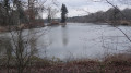
(1) Pass the first pond on your right, the Étang de Ménestreau, and ignore the forest track which leads to the Bois de la Cachotte by turning left. The route heads north-west, running alongside the Étang du Masnil on your right. Ignore the side paths, which are private.
(2) At the crossroads, turn right and continue to the next junction.
(3) Turn right, following the sign for ‘Le Ciran 3km’. Pass the former Mazuray hunting lodge on your left.
No signposting
(4) The track becomes tarmac as it joins the Route de Vanne, which comes in on the left. At the next junction, ‘les Quatre Routes’, cross the Route de Marcilly, the D108 (take care), and carry on straight ahead.
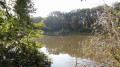
(5) At the crossroads, continue along the Route de Vanne, passing the Morneau pond on your right.
White-and-red markings, with signs for Menestreau clearly indicated
(6) At the crossroads, turn right. You’ll see a sign reading ‘Chemin communal autorisé’ (authorised local path),GR®3C‘Menestreau 6km’.
(7) At the next junction, turn right. The path, initially heading west, runs alongside a pond on your left as it veers north-west. It will then head west again, then south-west, bypassing the Petit Chavenay on your right.
(8) Continue along the tarmac Route de Sennely, which joins on your left. Ignore the various side roads. In the village, take the Route de Vouzon on the right and take the opportunity to admire the Church of Notre-Dame.
(9) Ignore the Route de Saint-Martin on the right, walk past the cemetery, and leave the Route de Marcilly on your right. The main street becomes the Route de la Ferté, which leads back to the starting point on the outskirts of the village (S/E)


 Visorando Member
 Easy