Country:

 City:
City:


(S/E) Start this circular route at the Book Box on Place de la Halle. Cross the square heading north-east, then follow Rue Général Leclerc (D2020) due north for 50m.
Turn left onto Rue des Jardins, going round the Tourist Office on the left.
Cross the car park diagonally towards the north-west and reach Rue des Poulies via a small flight of steps, turn right, reach Rue Massena and follow it to the left for 250m.
(1) Turn right onto Rue des Temples and leave Rue du Canal on your right.
Pass Rue du Coulevrain on your left, then take the first path on your right, which runs along the back of the campsite.
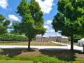
Just before Le Pianiste, turn left, cross the esplanade diagonally north-east, cross Avenue Lowendal and pass to the left of No. 4, reach the Cosson and follow it to the right until you reach the D2020.
Cross it carefully and turn right.
(2) At the end of the castle moat, follow the small street on the left leading to Saint-Michel Church, leave the church on your left, then join Rue Saint-Michel and turn left.
Opposite No. 30, take Venelle du Poirier on the right, then Rue de Sully to the left and left again onto Rue du Four Banal.
Cross the square diagonally in front of the cemetery, turn left onto Rue des 29 Fusillées and continue to the end of the cemetery.
(3) Cross the street and follow Chemin de Vinauger diagonally to the left. Pass a chicane and continue straight ahead. Opposite the entrance to the Vinauger Equestrian Centre, turn right, passing the junction with the path (Rue de Beauvais).
(4) At the western corner of Rue de Beauvais and Chemin des Cheneries, enter the woods, join the fitness trail, and follow it to the right to reach a wider path. Continue towards the sports hall, ignoring all turnings to the right and left; go round the sports hall on the right and continue towards the main entrance to the stadium; do not go through the barrier.
(5) Turn left, pass between the hedge and the concrete fence to walk alongside the football pitch until you reach its halfway line, take a narrow lane on the right and join Rue du Moulin, which you should follow to the left. Pass Rue Pierre et Marie Curie on your left, then follow Rue Pasteur.
At Rue des Cheneries, turn right and continue until you reach the D2020, ignoring the adjacent streets.
(6) Turn left for 50 metres and take Rue du Plant d’Arbres on the left. At the next junction, continue straight on along Rue des Perronnières until you reach the D2020, then turn left. Cross the D2020 opposite Saint-Aubin Church. Continue along Rue Haute, join Rue Basse, then take a slight left/right to follow Chemin Latéral.
(7) Take a small lane just after No. 812; this leads to an underpass (watch your head!) that takes you under the railway line and onto Chemin de la Croix d’Alvault. Turn right and join Route des Trays.
Turn right onto Route de Ligny-le-Ribault, then turn right again and go under the railway bridge. Continue along Rue Massena, ignoring all side streets on both sides, until you reach Rue Boch.
(8) Turn right onto Boulevard du Maréchal Foch, follow the boulevard leftwards due east, ignoring all side streets, until you reach Rue des Poulies.
(9) Turn left, follow Rue des Poulies until you reach Place de la Halle (S/E)

 Visorando Member
 Moderate