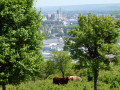
In search of the ‘Sabot de Vénus’ via the Croix de Fer

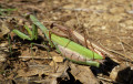
On the lookout for the wild orchid ‘Venus’s Slipper’ (a rare and protected species). As you walk through the woods, you are sure to come across Neottia nidus-avis (Bird’s-nest Orchid) and Epipactis purpurata (Purple Helleborine). On the grassy areas, at the edge of the woods and in the open woodland, you’re more likely to find Ophrys scolopax (Woodcock Orchid), Orchis purpurea (Purple Orchid) or Orchis ustulata (Burnt Orchid). Flowering takes place in May–June, when the plants reveal their delicate flowers, which you must neither pick nor uproot. (The protection of rare species is governed by the Ministerial Order of 20 January 1982).

Details

n°33413342
Creation:
Last update:
Last review:
  • Walking
    Activity: Walking
  • ↔
    Distance: 9.25 mi
  • ◔
    Average duration: 4h 35 
  • ▲
    Difficulty: Moderate

  • ⚐
    Back to start: Yes
  • ↗
    Ascent: + 381 ft
  • ↘
    Descent: - 394 ft

  • ▲
    Highest point: 499 ft
  • ▼
    Lowest point: 299 ft

Photos

Description of the walk

From Pont-sur-Yonne, take the D976 towards Bray-sur-Seine, then turn right onto the D29 towards Sergines. The starting point is the town hall car park on Rue de l’Hôtel de Ville.

(S/E) On leaving the car park, turn left, then immediately left again onto Rue du Foyer Rural (behind the town hall). Then take the second right to join Rue Geoffroy de Sargines. At the Fork in the road, turn left and cross the D470 to reach Rue du Cimetière. After the cemetery, follow the path due north until you reach a crossroads.

(1) Carry straight on, passing the next two turn-offs on the right, and continue through the left-hand and right-hand bends. Head towards the small wood, passing the turn-off on the left and the one on the right, until you reach another T-junction.

(2) Turn left. Follow the edge of the woods, keeping them on your right. Stay on the same track until you reach the road.

(3) Carefully cross the road from Pont-sur-Yonne to Bray-sur-Seine (D976) and follow the small road to Courlon-sur-Yonne for 600 metres until you reach the first cross-track at the end of the wooded strip.

(4) Take the path leading down towards a farm. You’ll come out onto a road at the Ferme du Bas.

(5) Turn left and take the first right at the last building. Continue straight on along the edge of the woodland, keeping it on your left. Pass a turning on the right and, 50 metres further on, you’ll reach a crossroads (GR®113).

(6) Turn left at the edge of the woodland and join the D470.

(7) Cross this road carefully, making a quick first turn left then right to head down into the Bois du Fay, following the main path (ignore the side paths). You’ll come to a three-way junction.

(8) Turn left onto the Croix de Fer route. Follow the main path and cross the woods. At the last junction before leaving the woods, turn left. On leaving the woods, turn right to reach the D976.

(9) Cross this road with care, then turn left and take the first path on the right. Follow it towards Sergines. At the next junction, turn right towards the woods. At the edge of the woods, turn left. You’ll come to another junction.

(10) Set off along the path leading downhill, then after 200 m, turn left. The return route to Sergines is via Rue Fernand Maître. Ignore two paths on the left to reach the end of the street at a school complex.

(11) Head straight on into Rue Serré, then turn left onto Chemin des Fossés. Turn right when you reach Rue du Marché aux Chevaux. Turn left when you reach Place de l’Église, then left again onto Rue de l’Hôtel de Ville to return to the starting point (S/E).

Waypoints

  1. S/E : mi 0 - alt. 384 ft - Sergines Town Hall car park
  2. 1 : mi 0.39 - alt. 492 ft - Crossroads
  3. 2 : mi 1.97 - alt. 446 ft - Crossroads
  4. 3 : mi 3.01 - alt. 397 ft - D976 road
  5. 4 : mi 3.39 - alt. 410 ft - Bifurcation
  6. 5 : mi 3.84 - alt. 341 ft - La Ferme du Bas
  7. 6 : mi 4.86 - alt. 308 ft - Junction with the GR113
  8. 7 : mi 5.32 - alt. 420 ft - D470 road
  9. 8 : mi 5.58 - alt. 351 ft - Three-way junction
  10. 9 : mi 6.85 - alt. 449 ft - D976 road
  11. 10 : mi 8.2 - alt. 446 ft - Crossroads
  12. 11 : mi 8.78 - alt. 384 ft - Fernand Maître School Complex
  13. S/E : mi 9.25 - alt. 384 ft - Sergines Town Hall car park

Notes

(S/E) Nearby.
Shops & services: grocery shop, bakery, café, restaurant, pizzerias, library, post office, Yonne Nord School of Music and Theatre, Maison France Services, police station, fire station, GP, chemist’s, nurses.
Leisure & sports facilities: village hall and multi-purpose hall, football pitch, pétanque court (International Pétanque Centre: a voluntary organisation providing high-level training), multi-sports halls (gymnasium, dojo). Campsite.

Worth a visit

(2) Viewpoint over the Seine Valley
(9) Viewpoint over the Yonne Valley
(S/E) Nearby: Saint-Tiburce Church and its organ. The statue of Blaise Rigault and, at the Town Hall, the halberd confiscated from the leader of his opponents.

Always be cautious and plan ahead when you're outdoors. Visorando and the author of this route cannot be held responsible for any accidents occurring on this route.

The GR® and PR® markings are the intellectual property of the Fédération Française de Randonnée Pédestre.

Reviews and comments

4.7 / 5
Based on 1 review

Reliability of the description
5 / 5
Ease of following the route
5 / 5
Route interest
4 / 5
Bernard D2.
Bernard D2.

Overall rating : 4.7 / 5

Date of your route : Jun 10, 2024
Reliability of the description : ★★★★★ Very good
Ease of following the route : ★★★★★ Very good
Route interest : ★★★★☆ Good
Very busy route : No

A lovely walk in this area, which makes excellent use of the ridge separating the Seine from the Yonne. Stunning views.
Plenty of wildlife (hares, roe deer). Some goat’s-beard orchids, but relatively few flowers at the start of June (perhaps due to the dreadful weather in May?)
An absolutely peaceful walk, along good paths generally maintained by local farmers.

Machine-translated

Other walks in the area

For more walks, use our search engine .

The GPS track and description are the property of this route's author. Please do not copy them without permission.