Around the Saint-Auban aerodrome

An easy route suitable for a variety of activities: walking, mountain biking and running.

Details

n°44786442
Creation:
Last update:
Last review:
  • Walking
    Activity: Walking
  • ↔
    Distance: 2.87 mi
  • ◔
    Average duration: 1h 25 
  • ▲
    Difficulty: Easy

  • ⚐
    Back to start: Yes
  • ↗
    Ascent: + 82 ft
  • ↘
    Descent: - 82 ft

  • ▲
    Highest point: 1,512 ft
  • ▼
    Lowest point: 1,427 ft

Photos

Description of the walk

On the main D4096 road, follow the signs to Château-Arnoux Saint-Auban aerodrome.
Coming from Sisteron, as you leave Saint-Auban, turn left and head down the road opposite the main entrance to the aerodrome. Park in one of the many car parks before this entrance (reserved for users).

(S/E) Take the path on the right-hand side, next to the undulating mountain-bike trail.
Continue along the well-marked dirt track through a forest of holm oaks or holly oaks (so called because of the resemblance of their leaves).

(1) Follow the MTB signposts marked ‘No. 8’ in orange along the paths; there are several changes of direction. Please note that the MTB route number changes depending on the paths you take. Also follow the ‘MTB Link’ sign, which will appear below the MTB No. 8 signposts. You will reach a crossroads with a view of the hilltop village of Montfort.

(2) Ride alongside the airfield for a few metres, then turn right onto the path that goes round the airfield. Please note that unauthorised members of the public are prohibited from entering the airfield grounds. You will reach a junction where three paths meet.

(3) Take care here: make sure you spot mountain bike trail no. 8, which heads downhill, as the sign is positioned on a tree slightly below (look carefully).
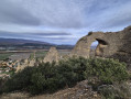
Note: on the right-hand side of this track, you will come across an imposing cairn, built on a large rock. Continue on to reach a hairpin bend.

(4) Turn almost 180° to the left onto MTB trail no. 8 and the MTB link trail, skirting the airfield at a distance before reaching it.

(5) Carry on along the dirt track, skirting the aerodrome. At the far end of the aerodrome, you’ll reach a crossroads.

(6) Keep to the right to follow the edge of a woodland, then the town’s sports and tennis courts. Return to the dirt track and follow the MTB No. 8 signs to the left once more to quickly reach the car park (S/E).

Waypoints

  1. S/E : mi 0 - alt. 1,509 ft - Car parks at the sports grounds
  2. 1 : mi 0.07 - alt. 1,506 ft - Cycle route no. 8
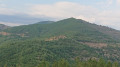
  3. 2 : mi 0.67 - alt. 1,483 ft - View of Montfort
  4. 3 : mi 0.85 - alt. 1,473 ft - Crossroads of three paths
  5. 4 : mi 1.33 - alt. 1,440 ft - Hairpin bend
  6. 5 : mi 1.68 - alt. 1,444 ft - Airfield. Near the - La Durance
  7. 6 : mi 2.6 - alt. 1,512 ft - Wood crossroads
  8. S/E : mi 2.87 - alt. 1,509 ft - Car parks at the sports grounds

Worth a visit

::2: View of Montfort, a rural village with a population of 349 situated in the Alpes-de-Haute-Provence department; it is a hilltop village at an altitude of 500 metres, with its steep, stepped streets. This village lies between Sisteron and Forcalquier on the right bank of the middle Durance. It offers beautiful views, particularly of the Pénitents des Mées.
Between (5) and (6), the Arkema and Kem One chemical plant in Château-Arnoux and Saint-Auban stands on the site of the former Pechiney factory, which was once the driving force behind the industrial town in this valley. This plant, which produces heavy chemicals, is classified as a Seveso II chemical risk, high threshold.

Reviews and comments

4.7 / 5
Based on 1 review

Reliability of the description
5 / 5
Ease of following the route
5 / 5
Route interest
4 / 5
joc772
joc772

Overall rating : 4.7 / 5

Date of your route : Feb 29, 2024
Reliability of the description : ★★★★★ Very good
Ease of following the route : ★★★★★ Very good
Route interest : ★★★★☆ Good
Very busy route : No

It’s surprising – even though it’s close to the airfield, you really are in the middle of the forest.

Machine-translated

Other walks in the area

For more walks, use our search engine .

The GPS track and description are the property of this route's author. Please do not copy them without permission.