Jorigny – Château de Cercigny – Le Recloux Bas circular route

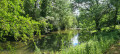
A pleasant circular walk through the countryside south of Vivonne, with views of Jorigny Manor, Cercigny Chapel and Cercigny Castle.

Details

192623
Creation:
Last update:
Last review:
  • Walking
    Activity: Walking
  • ↔
    Distance: 6.67 mi
  • ◔
    Average duration: 3h 15 
  • ▲
    Difficulty: Moderate

  • ⚐
    Back to start: Yes
  • ↗
    Ascent: + 184 ft
  • ↘
    Descent: - 171 ft

  • ▲
    Highest point: 377 ft
  • ▼
    Lowest point: 285 ft
  • ⚐ Country: France
  • ⚐ City: Vivonne (86370)
  • ⚑
    Start/End: N 46.425214° / E 0.257783°
  • ❏
    IGN map(s): Ref. 1727SB, 1728SB
  • Hour-by-hour weather

Description of the walk

Starting point: Vounant Park in Vivonne

(S/E) Walk between the rear of the château and the Salle de Vounant, then head towards the Clain via the kayaking centre. Cross the playground and, in front of the kayaking centre, turn right towards the swimming pool.

(1) Behind the swimming pool, take the small bridge on the left spanning the river. Cross the small meadow towards the steps alongside the bridge. Cross the road at the pedestrian crossing (take care).

Turn right and cross the bridge. When you reach the junction, turn left, cross the pedestrian crossing and continue to the left. Continue along the pavement on the right-hand side of the road (take care). Just before a left-hand bend, leave the road and take the small street branching off to the right. When you reach the small square in the hamlet of Jorigny, continue to the right.

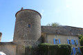
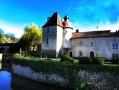
(2) As you pass, take a moment to admire the magnificent 17th-century manor house on your right. Keep going straight on. At the end of the street, continue along the path. Ignore the first path on the right and carry on straight ahead until the next fork.

(3) At the junction, turn right (blue signposting). Keep following this path straight on (passing several forest tracks). Pass close to a mobile phone mast on your left, continue to the next junction and carry on straight ahead. At the next junction, turn right, then left at the following one. At the next junction, turn right and cross the railway bridge. Walk downhill to the chapel.

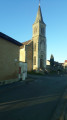
(4) As you pass by, take a moment to admire this little chapel in Cercigny. Follow the road to the left (taking care).

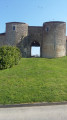
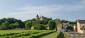
(5) After about 200 metres, you’ll reach Cercigny Castle. Continue along the road until you come to a footbridge on the right.

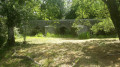
(6) Cross the footbridge over the Clain. Stay on the white track, ignore a path branching off to the left and head uphill until you reach a crossroads.

(7) Take the first road on the right (D27) and head uphill to the village of Le Peu de Thay. Take the first right at the entrance to the village, then the first left in the village and the second right past the farm sheds to rejoin the D27.

(8) At the end of a grove of holm oaks and cork oaks (with a truffle field on the left), take the path on the right called Rue du Recloux Haut. Take the next right, towards Bas Recloux. At the junction, turn left onto the road. Pass the beautiful Peuchault mansion on your right. At the next junction, turn right and pass through the village of Bois Coutant. On leaving the village, rejoin the road towards Vivonne.

(9) At the roundabout, continue straight ahead. Opposite the fire station, turn into the small street on the right. After passing a path on your right, take the small street on the right. Walk down to the village hall and go round it on the right. Passing between the village hall and the castle, you’ll reach the car park (S/E).

Waypoints

  1. S/E : mi 0 - alt. 292 ft - Vounant Park
  2. 1 : mi 0.25 - alt. 285 ft - Take the small bridge on the left spanning the > - Clain (rivière)
  3. 2 : mi 0.7 - alt. 354 ft - Vounant Castle
  4. 3 : mi 1.29 - alt. 364 ft - Jorigny Castle
  5. 4 : mi 2.35 - alt. 312 ft - Cercigny Chapel
  6. 5 : mi 2.48 - alt. 312 ft - Cercigny Castle
  7. 6 : mi 2.72 - alt. 302 ft - Gué de l’Isle footbridge
  8. 7 : mi 3.51 - alt. 338 ft - Change of direction
  9. 8 : mi 4.28 - alt. 361 ft - Change of direction
  10. 9 : mi 6.17 - alt. 361 ft - Roundabout
  11. S/E : mi 6.67 - alt. 292 ft - Vounant Park

Worth a visit

Cercigny Chapel: dating from the early 17th century, it is built of Chauvigny stone with a Carène-style nave and a pendentive that is unique in France (1626). Stone altarpiece.
Cercigny Castle: admire this magnificent castle (dating from the 14th century, rebuilt in the 17th century and restored in the 19th century); opposite is a rather remarkable dovecote.
At the car park: If you have a few minutes to spare, cross the bridge over the Clain and take a look at the town hall and the post office (there are a few information boards explaining the history of these buildings).

Reviews and comments

4.1 / 5
Based on 4 reviews

Reliability of the description
4.3 / 5
Ease of following the route
4 / 5
Route interest
4 / 5
Marc Moissat
Marc Moissat

Machine-translated

Mardelet
Mardelet

Overall rating : 4 / 5

Date of your route : Mar 16, 2022
Reliability of the description : ★★★★☆ Good
Ease of following the route : ★★★★☆ Good
Route interest : ★★★★☆ Good
Very busy route : No

The N10 is noisy along this route, and there’s too much walking along Route Recloux, where cars travel at high speed.

Machine-translated

grandin
grandin ★

Thank you! I’ve added the street name (Rue du RECLOUX Haut) to the description, at (7)

Machine-translated

AYRAULT DANIELLE
AYRAULT DANIELLE

Overall rating : 4.7 / 5

Date of your route : Jun 27, 2018
Reliability of the description : ★★★★★ Very good
Ease of following the route : ★★★★☆ Good
Route interest : ★★★★★ Very good

Hello everyone, what a brilliant walk!!!
We had a bit of trouble finding the path after the truffle oaks. It’s not a path, it’s a small road called Rue du Recloux Haut. Apart from that minor detail, everything was perfect.

Machine-translated

hikerin
hikerin

Overall rating : 4.3 / 5

Date of your route : Oct 22, 2016
Reliability of the description : ★★★★☆ Good
Ease of following the route : ★★★★★ Very good
Route interest : ★★★★☆ Good

At the field of truffle-bearing holm oaks, it’s impossible to find the path on the right (see description).

Machine-translated

gazok54
gazok54 ★

Thank you, rousseaupolo, for your comment, but please bear in mind that, in this case, your comment only concerns the appeal of the walk, not the reliability of the route.

Machine-translated

rousseaupolo
rousseaupolo

Overall rating : 3.3 / 5

Date of your route : Feb 02, 2016
Reliability of the description : ★★★★☆ Good
Ease of following the route : ★★★☆☆ Average
Route interest : ★★★☆☆ Average

It’s a shame the return journey isn’t the same as the outward one, particularly the stretch that runs alongside the RN10

Machine-translated

Other walks in the area

For more walks, use our search engine .

The GPS track and description are the property of this route's author. Please do not copy them without permission.