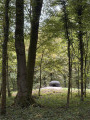
Around Charleville-sous-Bois

A short walk through woods and countryside around Charleville-sous-Bois, passing through Épange.

Details

29781987
Creation:
Last update:
Last review:
  • Walking
    Activity: Walking
  • ↔
    Distance: 5.77 mi
  • ◔
    Average duration: 3h 00 
  • ▲
    Difficulty: Easy

  • ⚐
    Back to start: Yes
  • ↗
    Ascent: + 433 ft
  • ↘
    Descent: - 446 ft

  • ▲
    Highest point: 1,096 ft
  • ▼
    Lowest point: 722 ft

Description of the walk

The car park (meeting point) is the visitors’ car park at the Charleville-sous-Bois healthcare centre on the D72A. (Second car park when coming from Charleville-sous-Bois).

(S/E) From the car park, head towards the D72A and follow it north-west for about 80 metres, then turn right onto the 500-metre-long dirt track that leads into the forest heading north-east.

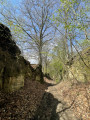
(1) At the junction, take the path on the left heading north-west. Follow it until you reach the junction on the left with a forest track. Continue along this track, passing the Nidange hunting lodge, until you reach a wayside cross.

(2) Leave the forest track and turn right onto the path heading south-east. Follow it along the edge of the forest until you reach the road leading to the hamlet of Épange.

(3) Turn right onto this road, heading south-east without entering the hamlet, and, after passing the sewage treatment plant on your right, join the D72.

(4) Follow it to the right towards Charleville-sous-Bois.

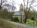
(5) At the entrance to the village, turn right into Rue de l’Église, then follow it to the left. Enter the cemetery to see this building and the view, then cross through it and go down the steps to the wash house. Head right along Rue de la Grotte onto the D72A heading west.

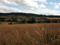
(6) On leaving the village, after a right-hand bend, leave the D72A and turn left onto a field path marked in yellow, heading west towards the woods. Follow this path until you reach a forest track. Turn right onto it and rejoin the D72A.

(7) Continue straight ahead along this road to reach the USLD car park (S/E).

Waypoints

  1. S/E : mi 0 - alt. 1,017 ft - USLD car park
  2. 1 : mi 0.39 - alt. 942 ft - Junction
  3. 2 : mi 1.46 - alt. 827 ft - Calvary
  4. 3 : mi 2.8 - alt. 774 ft - Épange
  5. 4 : mi 3.7 - alt. 725 ft - D72
  6. 5 : mi 4.34 - alt. 791 ft - Rue de l’Église
  7. 6 : mi 4.72 - alt. 863 ft - Path marked in yellow
  8. 7 : mi 5.48 - alt. 988 ft - D72a
  9. S/E : mi 5.77 - alt. 1,014 ft - USLD car park

Reviews and comments

3.5 / 5
Based on 4 reviews

Reliability of the description
3.3 / 5
Ease of following the route
3.5 / 5
Route interest
3.8 / 5
lucraucy
lucraucy

Overall rating : 5 / 5

Date of your route : Oct 10, 2025
Reliability of the description : Not used / Not applicable
Ease of following the route : ★★★★★ Very good
Route interest : ★★★★★ Very good
Very busy route : No

A very beautiful route. A few muddy sections, as is common after heavy rain.

Machine-translated

tofangel
tofangel

Overall rating : 4.7 / 5

Date of your route : May 26, 2025
Reliability of the description : ★★★★★ Very good
Ease of following the route : ★★★★☆ Good
Route interest : ★★★★★ Very good
Very busy route : No

I don’t understand why some people find this route disappointing
It’s absolutely lovely, a pleasure to cycle along, and the scenery is magnificent
Don’t listen to those naysayers
Perfect!

Machine-translated

valeriede M
valeriede M

Overall rating : 4 / 5

Date of your route : Feb 03, 2024
Reliability of the description : ★★★★☆ Good
Ease of following the route : ★★★★☆ Good
Route interest : ★★★★☆ Good
Very busy route : No

Hello
Thanks for sharing. A gentle walk to take the dog out, tracked using GPS.
One star is a bit harsh, I think.
I found the walk pleasant with some lovely panoramic views. It’s certainly not the walk of the century, but there are some lovely stretches through the forest, even if at this time of year the paths are muddy and walking sticks come in handy to stop you slipping. There’s a stretch of road between points 3 and 4 with little traffic, and a bit more between points 4 and 5.

Machine-translated

Vallya2641
Vallya2641

Overall rating : 1 / 5

Date of your route : Aug 20, 2023
Reliability of the description : ★☆☆☆☆ Very disappointing
Ease of following the route : ★☆☆☆☆ Very disappointing
Route interest : ★☆☆☆☆ Very disappointing
Very busy route : No

HELLO, the “AROUND CHARLEVILLE SOUS BOIS” walk: no signposting, the path is not maintained – best avoided

Machine-translated

Other walks in the area

For more walks, use our search engine .

The GPS track and description are the property of this route's author. Please do not copy them without permission.