The schoolchildren’s path in Charleville-sous-Bois

A short walk featuring information boards on local flora, fauna and history, set in a stunning woodland setting.

Details

3002638
Creation:
Last update:
Last review:
  • Walking
    Activity: Walking
  • ↔
    Distance: 1.76 mi
  • ◔
    Average duration: 1h 05 
  • ▲
    Difficulty: Easy

  • ⚐
    Back to start: Yes
  • ↗
    Ascent: + 322 ft
  • ↘
    Descent: - 318 ft

  • ▲
    Highest point: 1,096 ft
  • ▼
    Lowest point: 801 ft

Description of the walk

Park in the small car park on Rue Principale. The start sign for the route is located on this street.
Yellow markings and signposts, route no. 7. See practical information.

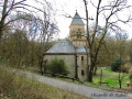
(S/E) Start from the car park, heading towards the château, then turn left onto the D72A and walk for about 250 m.

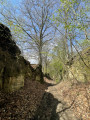
(1) Leave the D72A and turn left onto the dirt track leading into the woods. Continue straight on, keeping the same direction, until you reach the junction with a forest road.

(2) Turn left towards Charleville-sous-Bois to join the D72 at a bend. This allows you to continue onto Circular Loop No. 2, ‘La source de Charlemagne’, via a 3.8 km link.

(3) Turn left onto the road and descend towards the village with care. At the entrance to the village, turn left onto the main street and head for the car park (S/E).

Waypoints

  1. S/E : mi 0 - alt. 801 ft - Car park in the centre of Charleville-sous-Bois
  2. 1 : mi 0.18 - alt. 863 ft - Turn left
  3. 2 : mi 0.63 - alt. 1,096 ft - Forest track, on the left
  4. 3 : mi 1.32 - alt. 938 ft - D72 junction / lane
  5. S/E : mi 1.76 - alt. 801 ft - Car park in the centre of Charleville-sous-Bois

Notes

From point 2, you can continue on to Circular Loop No. 2: Charlemagne’s Spring https://www.visorando.com/randonnee-la-s...

At the junction of Rue de Hayes and the main street at the entrance to the village, there is a signpost for “Charleville-sous-Bois”. By turning right, you can link up with the “Pays Boulageois” walking routes via a connecting route, a distance of 1.7 km (towards Condé-Northen).

Worth a visit

The route features information boards on the local flora, fauna and history, set within a stunning woodland setting.

Reviews and comments

4.8 / 5
Based on 2 reviews

Reliability of the description
5 / 5
Ease of following the route
5 / 5
Route interest
4.5 / 5
henri57
henri57 ★
• Edited:

Hello,

We are currently in lockdown

Pursuant to Decree No. 2020-1310 of 29 October 2020 prescribing the general measures necessary to tackle the Covid-19 epidemic within the framework of the public health emergency.

Short trips, limited to one hour per day and within a maximum radius of one kilometre from the home, relating either to individuals’ physical activity – excluding all group sports and any close contact with other people – or to going for a walk solely with people living in the same household, or to the needs of pets.

See you soon

Machine-translated

5corinne
5corinne

Overall rating : 4.7 / 5

Date of your route : Nov 11, 2020
Reliability of the description : ★★★★★ Very good
Ease of following the route : ★★★★★ Very good
Route interest : ★★★★☆ Good
Very busy route : No

A LOVELY LITTLE WALK IN THE WOODS!

Machine-translated

Chantaletienne
Chantaletienne

Overall rating : 5 / 5

Date of your route : Mar 09, 2020
Reliability of the description : ★★★★★ Very good
Ease of following the route : ★★★★★ Very good
Route interest : ★★★★★ Very good

A lovely little route, very well signposted. Extremely interesting information boards on wildlife, flora and geology.
Well worth doing again.

Machine-translated

Other walks in the area

For more walks, use our search engine .

The GPS track and description are the property of this route's author. Please do not copy them without permission.