Around Chancay

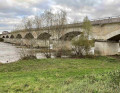
A pleasant walk near Chancay, exploring a lovely green setting. The climb up the hillside offers views of the Rouères Bourdon valley. The section along the top of the hillsides provides beautiful views over the Brenne valley and Chancay. The greenway allows you to follow the Brenne river at the start and end of the route. A pleasant nature walk on the outskirts of the village.

Details

n°44097711
Creation:
Last update:
Last review:
  • Walking
    Activity: Walking
  • ↔
    Distance: 2.76 mi
  • ◔
    Average duration: 1h 25 
  • ▲
    Difficulty: Easy

  • ⚐
    Back to start: Yes
  • ↗
    Ascent: + 164 ft
  • ↘
    Descent: - 164 ft

  • ▲
    Highest point: 361 ft
  • ▼
    Lowest point: 190 ft
  • ⚐ Country: France
  • ⚐ City: Chançay (37210)
  • ⚑
    Start/End: N 47.450982° / E 0.873983°
  • ❏
    IGN map(s): Ref. 1922SB
  • Hour-by-hour weather

Photos

Description of the walk

The car park is located on Rue de la Voie Verte.

(S/E) Leave the car park by taking Rue de la Voie Verte heading north-east. Cross Rue des Anciens d’Afrique du Nord (the D78) with care and continue opposite along the Voie Verte, which is the GR®655 West. Further on, pass by a water tower and continue to the road leading from La Massoterie to Moulin Foulon. There is a lovely view of Valmer Castle to the east on the right-hand side a short distance away.

(1) Turn left onto the small road towards La Massoterie, leaving the GR®655 West. Fifty metres further on, cross the Route de Château Renault (D46) with care and continue straight ahead along Rue de la White Cross. At the next junction, about seventy metres on, turn left into Rue de la Roche Fleurie. Follow this road to the centre of La Massoterie. At the junction with Rue de la Massoterie, continue to the right along Rue de la Roche Fleurie.

(2) At the next junction with Rue des Acacias, turn right onto this road, which climbs slightly. About a hundred metres further on, turn left onto the path known as Avenue Marie Louise, which climbs the hillside, initially through a small wood and then past vineyard plots. On reaching the plateau, at a crossroads in front of a small copse of trees, take the left-hand path between the vineyards. At the next crossroads, turn right onto the flat path, which soon passes an isolated farm shed. Continue to a small road at a T-junction.

(3) Turn left and follow this small road for about a hundred metres south-east before turning left onto a flat farm track that runs alongside the buildings at La Fosse Mignot. The route rejoins the GR®655 West. Further on, turn right onto the Chemin de la Garenne, which descends past a small housing estate. The track soon becomes Rue de la Garenne and continues to the junction with Rue Saint-Vincent. Turn right and follow it downhill to Rue de la Mairie.

(4) Turn left and proceed with caution along this street for about thirty metres before turning right onto Rue de l’Aube. This street turns into a farm track as soon as you pass the last buildings. Follow it to the junction with the Voie Verte, near the Brenne.

(5) Turn left to follow the Voie Verte north-eastwards. It soon winds its way between two branches of the Brenne and leads back to the car park (S/E).

Waypoints

  1. S/E : mi 0 - alt. 197 ft - Car park on Rue de la Voie Verte
  2. 1 : mi 0.79 - alt. 203 ft - Junction of the Voie Verte and the Route du Moulin Foulon
  3. 2 : mi 1.18 - alt. 220 ft - Junction of Rue de la Roche Fleurie and Rue des Acacia
  4. 3 : mi 1.88 - alt. 361 ft - Junction of Avenue Marie Louise and a minor road
  5. 4 : mi 2.37 - alt. 203 ft - Junction of Rue Saint Vincent and Rue de la Mairie
  6. 5 : mi 2.51 - alt. 190 ft - Junction of the Rue de l’Aube path and the Voie Verte
  7. S/E : mi 2.76 - alt. 197 ft - Car park on Rue de la Voie Verte

Notes

This walk across varied terrain requires suitable footwear.

This route is only partially marked in yellow but does not present any real difficulties. Consequently, it is advisable to follow the directions in this description and on the map provided by Visorando, whilst also paying attention to the surrounding landscape. Distance markers from the starting point, or even the GPS coordinates of waypoints (including the start), can also help hikers find their way.

Hike completed by the author on 11 June 2024.

Worth a visit

Always be cautious and plan ahead when you're outdoors. Visorando and the author of this route cannot be held responsible for any accidents occurring on this route.

The GR® and PR® markings are the intellectual property of the Fédération Française de Randonnée Pédestre.

Reviews and comments

4.7 / 5
Based on 1 review

Reliability of the description
5 / 5
Ease of following the route
5 / 5
Route interest
4 / 5
User 24934361

Overall rating : 4.7 / 5

Date of your route : Jul 20, 2026
Reliability of the description : ★★★★★ Very good
Ease of following the route : ★★★★★ Very good
Route interest : ★★★★☆ Good
Very busy route : No

.

Machine-translated

Other walks in the area

For more walks, use our search engine .

The GPS track and description are the property of this route's author. Please do not copy them without permission.