Country:
 City:


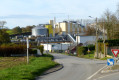
Start at Place du Général de Gaulle, where Bacqueville-en-Caux Town Hall is located; there are three car parks here.
(S/E) From the Place de la Mairie, take Rue du Président René Coty, pass the newsagent’s, continue to the bar and tobacconist’s, then go down the steps to reach Rue des Douze Apôtres.
(1) Turn left onto Rue des Douze Apôtres and continue to the T-junction. Turn right, then immediately right again onto Rue aux Juifs to reach the church.
(2) Opposite the church, turn left into Rue des Martels and walk past Bacqueville Castle. Continue straight on along this street, which merges into Rue des Charmettes, for about 1 km.
(3) When you reach the hamlet of Beautot, just after the first farm shed, at the right-angled bend, turn left onto the tarmac track leading into the Plaine de Beautot. Follow the grassy, stony track, first turning right then left, then right, left to reach a T-junction. Here you’ll find the signpost for routes 17, 18 and 24. Turn right onto the Chemin des Criquets, which leads to the village of Saint-Ouen-le-Mauger.
(4) At the end of the Chemin des Criquets, turn immediately right towards Royville via the RD101, and continue for 800 metres until you reach a right-angled bend. At the bend, follow the grassy path opposite.
At the D149, first turn left then right to join Rue de la Mare de Clermont. Continue straight on until you reach the Stop sign, then turn right onto Rue du Chasse Marée (RD107).
(5) Turn left, continue to the church and turn right onto Rue des Forrières. Immediately take Chemin du Bois de la Pendue on the left (tarmac and then a grassy track).
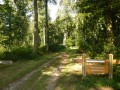
At the T-junction, head down to the left towards the woods. Once you reach the woods, the path branches off to the right; follow it straight on until you reach the RD270 (ignore the other paths until you reach the road).
(6) Turn right onto Rue de la Saâne (D270) to reach the hamlet known as ‘les Mesnils’ (racehorse stud).
Turn left twice (tarmac track, passing the My’Den stables, then a grassy track).
(7) On the grassy track, take the first track on the right, which leads back onto tarmac 150m further on.
(8) Follow the tarmac road, which turns right onto Rue de la Garenne. At the junction, continue straight ahead onto Rue des Monnaies and, at the next T-junction, continue straight ahead along Rue de la Croix Rompue to reach the RD152.
(9) Cross the RD152 and take the grassy path directly opposite; after a few metres, this path descends to join the RD127.
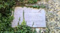
(10) When you reach the road, turn right onto Rue de la Stèle and follow the River Vienne, which is on your left. Enter the village of Lammerville and continue to the church.
(11) At the church, turn left onto Rue du Moulin, then turn right (at the cross). From there, stay on the road until you reach Bacqueville-en-Caux (watch out for traffic). Pass the sign marking the entrance to Bacqueville-en-Caux and continue uphill until you reach the bend that turns left.
(12) At the bend, take the path that goes to the right (Route Neuve) and heads downhill.
When you reach Rue de Verdun, first turn right then left to return to the car park (S/E).

 Visorando Member

 Easy
 Difficult
 Association / Club / Walk leader