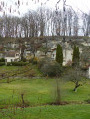
Around Avon-les-Roches

A pleasant walk to explore Avon-les-Roches, a village famous for its nine wash houses lined with streams, which offers a wealth of attractions to discover along the trails. The route takes you through a varied landscape, including paths lined with woodland, cereal fields and a poplar grove.

Details

n°44079387
Creation:
Last update:
Last review:
  • Walking
    Activity: Walking
  • ↔
    Distance: 5.64 mi
  • ◔
    Average duration: 2h 50 
  • ▲
    Difficulty: Easy

  • ⚐
    Back to start: Yes
  • ↗
    Ascent: + 289 ft
  • ↘
    Descent: - 279 ft

  • ▲
    Highest point: 354 ft
  • ▼
    Lowest point: 184 ft
  • ⚐ Country: France
  • ⚐ City: Avon-les-Roches (37220)
  • ⚑
    Start/End: N 47.156481° / E 0.446407°
  • ❏
    IGN map(s): Ref. 1723ET, 1823SB, 1824SB
  • Hour-by-hour weather

Photos

Description of the walk

The car park is located near the stadium and a playground on Rue de la Poste.

(S/E) Leave the car park by heading west along Rue de la Poste. Follow it until you reach Rue de Jautrou on the right.

(1) Turn right onto this street and follow it to the hamlet.

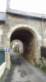
(2) Follow the street to the right as it descends into the valley, cross the valley and take the street on the left to admire the old buildings and see the troglodyte caves. Return to the crossroads.

(2) Turn right onto the farm track leading to La Jouardière. Continue to a T-junction where the road meets the tracks. Turn right onto the farm track heading north. Follow it until it joins the Route du Grand Pas. Turn right and follow this road carefully for about fifty metres.

(3) Turn left onto a track heading broadly eastwards. At the T-junction, turn right onto the track between the fields which descends to the bottom of a small valley where the Bois de la Salle is situated. Cross the stream and continue southwards towards Puy Chauveau. The track becomes a road as you reach the first buildings of the hamlet.

(4) Turn left onto the D138 and follow itcarefully north-eastwards. On leaving the hamlet, take the road on the right leading to La Touche Hulin. Pass through the hamlet and proceed to the T-junction. Turn left onto the track heading north-east. About a hundred metres further on, take the farm track straight ahead, ignoring the signposted path that branches off to the left. Continue to the edge of the plateau overlooking the Étang de la Saulaie and take the path on the right that descends towards the lake.

(5) Where it joins the Route des Hautes Roches, continue straight ahead along this road, taking care as you head eastwards. Cross the embankment of the Étang de la Saulaie, then follow the road that passes beneath the Hautes Roches caves. Continue southwards with care until you reach the crossroads to the west of the hamlet known as Les Roches Tranchelion.

(6) Turn left. As soon as you have passed the buildings, take the farm track on the left and follow it to the junction where the track meets the road to see the ruins of the castle and the Collegiate Church of Roches Tranchelion: access to the immediate vicinity of the ruins is prohibited for safety reasons.

(7) Retrace your steps.

(6) Continue left onto the Route de la Quelle, which runs alongside the stream of the same name on your left, then veers off to the right. 

(8) Turn right onto a path that climbs north-westwards. At the next T-junction, take the left-hand path, which continues along the hillside, passing north of the hamlet of La Guittière, then that of La Vauzelle. When you reach a small road, turn right and walk less than fifty metres. 

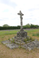
(9) Turn left and carefully follow the road leading to the village cemetery. Turn left to enter the cemetery and walk through it to see the 78 graves of Belgian soldiers who died during the First World War : the memorial to them, designed by Legrain and Bury, stands in front of the left-hand wall, and there is also a calvary with a 16th-century cross. Exit via the south-west gate of the cemetery. At the junction with Route du 8 Mai, turn right onto Rue du Haut Bourg. At the end of the street, take the steps leading down to Route du 8 Mai and, at the bottom, follow this road to the right, passing by the church. Continue to the junction with Rue de Feunet. 

(10) Head south by turning left, walk past the church porch and continue until you reach Rue de la Poste on the right. Turn right onto this street to walk past the wash house and reach the car park (S/E). 

Waypoints

  1. S/E : mi 0 - alt. 187 ft - Car park: Rue de la Poste
  2. 1 : mi 0.25 - alt. 246 ft - Junction of Rue du Stade and Route de Jautrou
  3. 2 : mi 0.49 - alt. 259 ft - Junction of the Route de Jautrou with the path on the left
  4. 3 : mi 1.42 - alt. 338 ft - Junction of the Route du Grand Pas with the track on the left
  5. 4 : mi 2.33 - alt. 266 ft - Junction with the D138 at Puy Chauveau
  6. 5 : mi 3.37 - alt. 249 ft - Junction of the path and the Route des Hautes Roches
  7. 6 : mi 3.97 - alt. 190 ft - T-junction where three roads meet
  8. 7 : mi 4.08 - alt. 217 ft - Castle and Collegiate Church Ruins - Collégiale des Roches Tranchelion
  9. 8 : mi 4.57 - alt. 194 ft - Junction with a path on the right
  10. 9 : mi 5.14 - alt. 256 ft - Crossroads
  11. 10 : mi 5.49 - alt. 213 ft - Junction of Rue du 8 Mai and Rue du Feunet
  12. S/E : mi 5.64 - alt. 187 ft - Car park: Rue de la Poste

Notes

This walk across varied terrain requires suitable footwear.

This route, marked in yellow, presents no real difficulties. It follows marked sections. Consequently, it is advisable to follow the instructions in this description and the map provided by Visorando, whilst also paying attention to the landscapes you pass through. Distance markers from the starting point, or even the GPS coordinates of waypoints (including the start), can also help hikers find their way.

Hike completed by the author on 10 June 2024.

(4) It is possible to take a path on the left at the foot of the caves a few dozen metres earlier. 

Alternative route: 3.91 km with a 45 m elevation gain. Classified as Easy.

(S/E) Leave the car park by taking Rue du Stade towards the village (eastwards). You’ll see theAvon-les-Roches wash houseon the left by the stream.

At the junction of Rue du Stade and Rue du Feunet, turn left and follow Rue du Feunet, which passes in front of the church (see the ‘During the walk’ section). At the junction with Rue du 8 Mai, which joins from the right just after the church, continue straight ahead heading north along Rue du Feunet (D138). Proceed with care along this road until you reach Route de Fontaine Sainte-Marie on the left, just outside the village.

Turn left towards Fontaine Sainte-Marie. Visit the wash house and return to the main road at this point. Continue left towards Puy Chauveau. When you arrive there, at the junction with the road known as the Route du Puy Chauveau, turn left onto it. Walk uphill to the Puy Chauveau wash house on the left-hand side. Retrace your steps and, after about sixty metres, take a path on the left which passes beneath the cliff and the troglodyte caves at the top of the hamlet. Further on, this path leads out onto the D138 to the north-east of the hamlet. About sixty metres further on, take the road to the hamlet of La Touche Hulin, pass through it and continue to a crossroads where roads and paths meet.

Carry on straight ahead along the path heading south. At the next junction of four paths, north of the hamlet of La Guittière, join the long route. Turn right onto the hillside path and complete the route by following the long route. 

Worth a visit

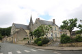
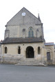
Notre-Dame Church.

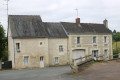
The ‘La Poste’ washhouse.
Situated on the Puy Chauveau stream, this washhouse already existed in 1831. There are nine washhouses in the parish; most have been restored and decorated with the washing women’s tools.

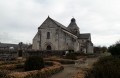
Collegiate Church and Château des Roches Tranchelion.
Only ruins remain of the fortress built in the 15th century by Guillaume de Tranchelion and of the collegiate church built in the 16th century by Lancelot de la Touche. It is one of the rare examples of Renaissance religious architecture in the Tours region

The cemetery at Avon-les-Roches.

 The Landes du Ruchard.
The heather harvested from the moors is used to make brooms, fences, small huts, horse-racing obstacles, and so on.

In the hamlet of Puy Chauveau.
See a pretty washhouse situated below.

At La Jouardière.
Take the time to admire the magnificent panoramic view over the village and the region

Jautrou.
An old wash house… well worth a visit.

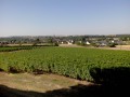
Chinon wine vineyards.
As you leave the village of Avon-les-Roches, take in the sight of the vineyards producing the famous Chinon wine, as Avon-les-Roches lies within the Chinon AOC appellation area.

Reviews and comments

4.2 / 5
Based on 2 reviews

Reliability of the description
4 / 5
Ease of following the route
4 / 5
Route interest
4.5 / 5
Pascal Aspe
Pascal Aspe

Overall rating : 5 / 5

Date of your route : Oct 12, 2026
Reliability of the description : ★★★★★ Very good
Ease of following the route : ★★★★★ Very good
Route interest : ★★★★★ Very good
Very busy route : No

An easy walk. Very enjoyable for its cultural aspects.

Machine-translated

Michnou
Michnou

Overall rating : 3.3 / 5

Date of your route : Sep 10, 2025
Reliability of the description : ★★★☆☆ Average
Ease of following the route : ★★★☆☆ Average
Route interest : ★★★★☆ Good
Very busy route : No

The description of the circuit is not very clear or precise and often leads to confusion.
However, the cave dwellings and cellars, the wash houses, and the ruins of the collegiate church of Les Roches Tranchelion make the route undeniably interesting.

Machine-translated

Other walks in the area

For more walks, use our search engine .

The GPS track and description are the property of this route's author. Please do not copy them without permission.