Amidst the fields of the Artesian Plateau, starting from Tilloy-lès-Hermaville

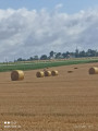
A walk mostly along good paths, through fields of cereals, potatoes and peas, best enjoyed when the flax is in bloom or has been cut in the fields.

Details

n°2263735
Creation:
Last update:
Last review:
  • Walking
    Activity: Walking
  • ↔
    Distance: 5.67 mi
  • ◔
    Average duration: 2h 40 
  • ▲
    Difficulty: Easy

  • ⚐
    Back to start: Yes
  • ↗
    Ascent: + 85 ft
  • ↘
    Descent: - 79 ft

  • ▲
    Highest point: 449 ft
  • ▼
    Lowest point: 341 ft

Description of the walk

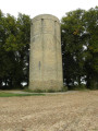
Park near the church at Tilloy-lès-Hermaville, of which only the tower dates from before the French Revolution.

(S/E) Join the D75 and turn right towards Aubigny, following it for about 150 metres.

(1) Turn left onto the well-surfaced Chemin des Blatiers. The ‘blatiers’ were small market traders who would travel by horse or donkey to collect wheat from the countryside and bring it to the markets in the big towns. After a 45° bend, you’ll reach the D78.

(2) Cross the road and head straight ahead. You’ll come to a four-way crossroads; continue along the path that slopes to the right for a few dozen metres.

(3) Ignore the path on the left – you’ll take that on the way back – walk for about fifty metres, then turn onto the path that branches off at a right angle to the right. Then turn left to join a path whose hedge you can see a little further down the slope: the Chemin des Briolets.

(4) Turn left and join the D75E, which you follow to the left. This is the only section of the route with a fair amount of traffic, at least during the week. Follow the road straight on until you reach the entrance to Izel-lès-Hameau.

(5) Turn left immediately, passing a few farms. At the end of the street known as the Faubourg du Nord, carry on straight ahead along the track until you reach the four-way crossroads you passed on the way out.

(3) Turn right, then keep to the right at the Fork in the road just ahead to head back down towards Tilloy.

(6) At the junction with Rue d’Izel, turn left. Cross the D75 at the pedestrian crossing and head towards the church (S/E).

Waypoints

  1. S/E : mi 0 - alt. 384 ft - Church at Tilloy-lès-Hermaville
  2. 1 : mi 0.16 - alt. 394 ft - Chemin des Blatiers
  3. 2 : mi 1.06 - alt. 443 ft - D78
  4. 3 : mi 1.66 - alt. 397 ft - Junction of the circular loop
  5. 4 : mi 2.54 - alt. 354 ft - Chemin des Briolets
  6. 5 : mi 4 - alt. 384 ft - Izel-lès-Hameau
  7. 6 : mi 5.34 - alt. 394 ft - Rue d’Izel
  8. S/E : mi 5.67 - alt. 384 ft - Church at Tilloy-lès-Hermaville

Notes

Take a water bottle if it’s hot, as there are no cafés along the route that offer shelter from the sun, with no trees.

Worth a visit

Fortified churches in the surrounding villages.
The Scarpe Valley from Berles-Monchel.

Reviews and comments

4.7 / 5
Based on 1 review

Reliability of the description
5 / 5
Ease of following the route
5 / 5
Route interest
4 / 5
Fredcath
Fredcath

Thank you for your feedback, Immercurien!
Catherine

Machine-translated

immercurien
immercurien

Overall rating : 4.7 / 5

Date of your route : Jan 30, 2022
Reliability of the description : ★★★★★ Very good
Ease of following the route : ★★★★★ Very good
Route interest : ★★★★☆ Good
Very busy route : No

A route entirely on tarmac but through the fields.
A lovely setting, very quiet and with no difficulties
Thanks for sharing this

Machine-translated

Other walks in the area

For more walks, use our search engine .

The GPS track and description are the property of this route's author. Please do not copy them without permission.