Thur biotope, starting from Cernay

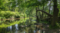
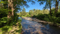
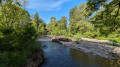
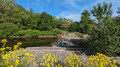
A 5 km route (or 7 km with optional extensions), very easy, which takes you along the River Thur and allows you to enjoy its wildlife in a wild stretch of the river. This route, which is very shaded, can be done at a walking or jogging pace. You’ll come across storks, herons and wild ducks.

Details

49920634
Creation:
Last update:
Last review:
  • Walking
    Activity: Walking
  • ↔
    Distance: 4.38 mi
  • ◔
    Average duration: 2h 05 
  • ▲
    Difficulty: Easy

  • ⚐
    Back to start: Yes
  • ↗
    Ascent: + 62 ft
  • ↘
    Descent: - 69 ft

  • ▲
    Highest point: 1,040 ft
  • ▼
    Lowest point: 971 ft
  • ⚐ Country: France
  • ⚐ City: Cernay (Haut-Rhin) (68700)
  • ⚑
    Start/End: N 47.804973° / E 7.174959°
  • Accessible from the train station Gare de Cernay (Haut-Rhin).
  • ❏
    IGN map(s): Ref. 3620ET
  • Hour-by-hour weather

Photos

Description of the walk

Rue René Guibert car park.

(S/E) From the car park, join the cycle path at the statue of Nepomuk (guardian of bridges), near the Colonel Basset Bridge. Continue straight on along the cycle path, past the stork park and alongside the campsite.

(2) At the footbridge over the Thur, leave the cycle path and go straight on along a path that goes round the Skate Park.

(3) Carry on straight ahead to enter the Thur nature reserve and arrive at a riding centre.

(4) Option 1: you can turn right as soon as you see the riding centre to reach the banks of the Thur. Allow an extra 10 minutes for the round trip.
Otherwise, carry straight on.

(5) Option 2: you can turn right onto the “discovery trail” (signposted) to reach the banks of the Thur at several points. Allow an extra 30 minutes for the round trip. Return via the same route to the junction.

(5) Turn right and head towards the railway line.

(6) Turn left onto a wide path running alongside the railway line.

(7) At the level crossing, turn left and go all the way round the riding centre.

(8) Walk under the canopy of trees, past the horse jumping obstacles, and carry on straight ahead. Complete the circular path by taking the wide path that goes round the football pitches.

(3) Turn right and, following the route back in the opposite direction to the outward journey, return to the car park (S/E).


Waypoints

  1. S/E : mi 0 - alt. 978 ft - Car park on Rue René Guibert
  2. 1 : mi 0.12 - alt. 981 ft - Footbridge over the River Thur - Parc à cigognes (Cernay)
  3. 2 : mi 0.41 - alt. 994 ft - Skate Park -
  4. 3 : mi 0.53 - alt. 994 ft - Entrance to the Thur biotope
  5. 4 : mi 0.98 - alt. 1,007 ft - Equestrian centre
  6. 5 : mi 1.57 - alt. 1,017 ft - Nature trail
  7. 6 : mi 3 - alt. 1,024 ft - Railway line
  8. 7 : mi 3.1 - alt. 1,020 ft - Level crossing
  9. 8 : mi 3.35 - alt. 1,007 ft - Equestrian centre
  10. S/E : mi 4.38 - alt. 971 ft - Car park on Rue René Guibert

Notes

(S/E) You can park in the small car park at the start of Rue René Guibert.

Worth a visit

(1) The stork park. Herons are nesting a little higher up in the neighbouring trees.

Reviews and comments

4.7 / 5
Based on 2 reviews

Reliability of the description
5 / 5
Ease of following the route
5 / 5
Route interest
4 / 5
Ulysse68
Ulysse68

Overall rating : 4.7 / 5

Date of your route : Aug 26, 2024
Reliability of the description : ★★★★★ Very good
Ease of following the route : ★★★★★ Very good
Route interest : ★★★★☆ Good
Very busy route : Yes

A lovely, easy walk

Machine-translated

Mickanside
Mickanside

Overall rating : 4.7 / 5

Date of your route : Jul 08, 2024
Reliability of the description : ★★★★★ Very good
Ease of following the route : ★★★★★ Very good
Route interest : ★★★★☆ Good
Very busy route : No

Discover a lovely, unspoilt corner of the countryside, with beautiful flora to explore this July! Both options are equally enjoyable.
The route was a little less shaded than expected, so best avoided in very hot weather and/or make sure you protect yourself from the sun anyway.
The section (8) → horse paddock is less passable after rainy weather, but it’s probably possible to avoid this tricky stretch by taking the path through the woods that runs to the right of the track.
One downside, especially if you do both options, is that this makes up a large part of the route.
There were plenty of people out on the greenway this Sunday ((S) → (2) and (2) → (E)), but hardly anyone on the rest of the route
All in all, a lovely little Sunday walk – thank you

Machine-translated

Other walks in the area

For more walks, use our search engine .

The GPS track and description are the property of this route's author. Please do not copy them without permission.