


 Country:

 City:


From the French-Spanish border at Béhobie, take the N121-A road towards Pamplona (south); then, after 32 km, take the exit on the right towards Arantza (NA4020) and continue for 15 km to Arantza. There is a large car park for cars and coaches at the entrance to the village.
(S/E) Drive 150 m into the village, then take a small, steep street that climbs to the left up to a tiny square. Continue straight ahead along a small street that climbs up to the cemetery, where the Ermita de San Salvador is located.
(1) Take the track as it bends to the left, then leave it almost immediately to follow the small path on the right heading south-east: marked with yellow and white signs. Continue for about 800 metres, then take the path on the left and you’ll soon reach a junction.
(2) Follow the small path along the hillside which heads off to the right, southwards, then makes a circular route to the left to go round Gurutzeko. On this path, you’ll notice a memorial stone on your right in honour of the parish priest of Arantza, who died in 1969. A little further on, join a track and follow it uphill to Urkidi.
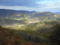
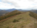
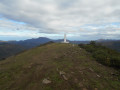
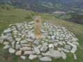
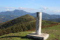
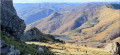
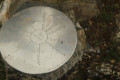
(3) Turn left and follow the north-north-east-facing ridge to reach the summit of Kurutzeko (728 m), the highest point of the walk. Its stone cross served as a landmark for shepherds moving through the fog with their flocks, as well as marking the boundary of the territory allocated to each shepherd during transhumance. You’ll be treated to a remarkable panorama, including the Mendaur, the Rhune and the Trois Couronnes. Nearby, a recent stone circle featuring a carving brings to mind the many prehistoric megalithic burial monuments. According to archaeological research, the ashes and personal effects of the deceased were deposited there.
(4) Then descend to the Col de Bulatsegi.
(5) Follow the ridge north-eastwards to reach thesummit of Bulatsegi.
(6) Continue eastwards to reachthe Urkidi.
(7) Descend via the northern ridge, then head right to climb up to Mount Apaola (682 m):magnificent panoramic views, triangulation point.
(8) Descend back to the Bulatsegi Pass, taking a short detour from the route you took on the way up.
(5) Descend about 40 metres to the right (north) onto the small road, then take the path on the left and follow it to the junction with a track about 100 metres from the (2).
(9) Cross the track and set off almost directly opposite onto the path running alongside a fence. Join a small road and continue to the left until the first junction.
(10) Take the path on the left and follow it to the cemetery.
(1) Continue down towards Arantza. You can walk straight down the same way you came up, or, at the small square, turn left and take a short detour to visit the little town: you’ll find a restaurant and a bistro along this short route. All that remains then is to return to the car park where you started (S/E).
 Visorando Member

 Difficult
 Association / Club / Walk leader

