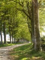
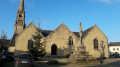
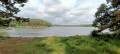
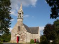
Covered walkways and the Roman road

Discover the covered walkways of Coat Luzuen and the Roman road in the commune of Pont-Aven, starting from the Kérampaou car-sharing area in Melgven.

Details

n°397729
Creation:
Last update:
Last review:
  • Walking
    Activity: Walking
  • ↔
    Distance: 7.49 mi
  • ◔
    Average duration: 3h 35 
  • ▲
    Difficulty: Moderate

  • ⚐
    Back to start: Yes
  • ↗
    Ascent: + 187 ft
  • ↘
    Descent: - 200 ft

  • ▲
    Highest point: 322 ft
  • ▼
    Lowest point: 128 ft
  • ⚐ Country: France
  • ⚐ City: Melgven (29140)
  • ⚑
    Start/End: N 47.889207° / W 3.800739°
  • ❏
    IGN map(s): Ref. 0620ET
  • Hour-by-hour weather

Photos

Description of the walk

(S/E) Leave the car-sharing area and head left to join the D24. Cross the D24, taking care of the traffic (danger). Follow the D24 to the left and enter the Industrial Estate by taking the first road on the right. Turn onto the small grassy path on the left near the security company.

(1) At Kernévez Roussica, cross the road and take the path opposite, slightly to the left, leaving the farm on your left.

(2) At the end of the track, near a house, take the track on the right, pass under a power line and arrive at the River Aven.

(3) Turn right onto the small path located about ten metres before the river. If the path is too muddy, you can walk alongside it through the meadow on the left (with the landowner’s permission).

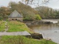
(4) Enter the field on the right to discover the first covered walkway. Then continue along the path, passing under the power line once more. Pass a path on the left, then another on the right immediately afterwards.

(5) Opposite the gable end of a house, there is a small opening in the embankment leading to a second covered passageway. Continue along the road to reach Coat Luzuen.

(6) Turn left and then take the first road on the right. Follow this road and cross the motorway. Pass Kerangoaï on your right and look for a path that branches off to the left at a bend.

(7) Take this track to reach La Villeneuve and admire its beautiful thatched cottages. Follow the road to the right to reach L’Enfer before the D24.

(8) Cross it, as well as the hamlet of Cleu Nizon, to find a path opposite. Carry on straight ahead until you reach a crossroads.

(9) Take the Kergueral road on your right.

(10) Take the track on the right.

(11) Follow the D24 on your left and, at the crossroads, turn left to reach the car-sharing area (S/E).

Waypoints

  1. S/E : mi 0 - alt. 308 ft - Carpooling area
  2. 1 : mi 0.86 - alt. 289 ft - Roussica
  3. 2 : mi 1.39 - alt. 276 ft - Path on the right
  4. 3 : mi 2.19 - alt. 131 ft - Take the hairpin bend to the right - Aven (fleuve)
  5. 4 : mi 2.32 - alt. 131 ft - Covered passageway 1
  6. 5 : mi 2.79 - alt. 308 ft - Covered passageway 2
  7. 6 : mi 3.23 - alt. 312 ft - At Coat Luzuen, turn left
  8. 7 : mi 4 - alt. 276 ft - Path on the left
  9. 8 : mi 4.75 - alt. 276 ft - L’Enfer
  10. 9 : mi 5.35 - alt. 269 ft - Junction with the Kergueral road
  11. 10 : mi 6.1 - alt. 279 ft - Take the path on the right
  12. 11 : mi 7.05 - alt. 312 ft - D24, turn left
  13. S/E : mi 7.48 - alt. 308 ft - Carpooling area

Worth a visit

At points (4), see the covered walkways at Coat Luzuen.
At the hamlet of La Villeneuve, admire the thatched cottages.
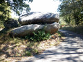
From to (11), you are on the Roman road.

Reviews and comments

2.8 / 5
Based on 4 reviews

Reliability of the description
3.3 / 5
Ease of following the route
3.3 / 5
Route interest
2 / 5
Solo56
Solo56

Overall rating : 1.7 / 5

Date of your route : May 13, 2024
Reliability of the description : ★★☆☆☆ Disappointing
Ease of following the route : ★★☆☆☆ Disappointing
Route interest : ★☆☆☆☆ Very disappointing
Very busy route : No

If you enjoy cycling on a route that’s 75 per cent tarmac. If you’ve got a good sat-nav. If you like cycling through industrial estates, along expressways and on busy roads. This cycle ride is for you!
Even for enthusiasts of megalithic sites, it’s not worth the effort.
In a nutshell: utterly uninteresting.

Machine-translated

laurentlepage29
laurentlepage29

Overall rating : 3.3 / 5

Date of your route : Jul 11, 2022
Reliability of the description : ★★★★☆ Good
Ease of following the route : ★★★☆☆ Average
Route interest : ★★★☆☆ Average
Very busy route : No

‘Open’ covered walkways – that’s the main attraction. Otherwise, there’s a lot of tarmac and it’s tricky on both sides of the junction.

Machine-translated

NiniJeff
NiniJeff

Overall rating : 3.3 / 5

Date of your route : Aug 19, 2021
Reliability of the description : ★★★☆☆ Average
Ease of following the route : ★★★★☆ Good
Route interest : ★★★☆☆ Average
Very busy route : No

The first part of the walk is pleasant: the river, the first covered walkway – I didn’t see the second one (point 5) – and the thatched cottages. However, the route from point 8 onwards is no longer of any interest. The path at point 10 is difficult to find; it should be noted that it is opposite the gable end of a house and a sign for Route de Kerguéral, 150 metres before the pony club. This path is passable for only 700 metres; after that, it’s nothing but mud, probably caused by cows trampling it. We turned off to the right at Kerfur Farm, which took us back onto the D24.

Machine-translated

henri57
henri57 ★

Hello,

Following comments made by a Visorandonneur, a message has been sent via private message to the author of the walk.

Kind regards

Machine-translated

eric&mariepierre
eric&mariepierre

Overall rating : 3 / 5

Date of your route : Dec 03, 2017
Reliability of the description : ★★★★☆ Good
Ease of following the route : ★★★★☆ Good
Route interest : ★☆☆☆☆ Very disappointing

Nothing of particular interest + lots of driving
and tracks ploughed up by tractors

Machine-translated

Other walks in the area

For more walks, use our search engine .

The GPS track and description are the property of this route's author. Please do not copy them without permission.