The ancient road from Sartène to the Col de Suara

Hike from Sartène to the Col de Suara along the old path linking Porti Vechiu to Sarté. Beautiful sections of this ancient route are still visible along the way. Return via the small D50.

Details

16373926
Creation:
Last update:
Last review:
  • Walking
    Activity: Walking
  • ↔
    Distance: 3.69 mi
  • ◔
    Average duration: 2h 20 
  • ▲
    Difficulty: Easy

  • ⚐
    Back to start: Yes
  • ↗
    Ascent: + 761 ft
  • ↘
    Descent: - 745 ft

  • ▲
    Highest point: 1,673 ft
  • ▼
    Lowest point: 974 ft
  • ⚐ Country: France
  • ⚐ City: Sartène (20100)
  • ⚑
    Start/End: N 41.616947° / E 8.975022°
  • ❏
    IGN map(s): Ref. 4254OT
  • Hour-by-hour weather

Photos

Description of the walk

The route starts from the Bassacciu car park in Sartène, located past the Casino supermarket as you continue along the D65.

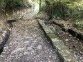
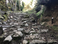
(S/E) From the car park, look for a path to the left of the entrance, running above it. At the start of this path is a sign indicating the ‘Strada Antica’. Take this path and follow it to an imposing gate.

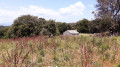
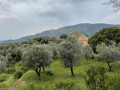
(1) Turn slightly left to go round it. A few metres further on, pass the wash house with its two half-full basins and continue uphill, passing beneath beautiful, perfectly maintained olive groves. There may be some livestock along the route, but they will usually run off when you approach. It is not advisable to startle them, as their reactions may be unpredictable. The path climbs until it joins the D50 after passing through a gate, which you must close behind you.

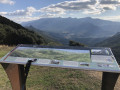
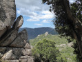
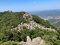
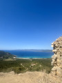
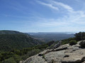
(2) Superb panoramic view of Sartène and the Aiguilles de Bavella. Take the D50 to the right to reach the Col de Suara. Continue a little way down the descent to reach the viewpoint over the Ortolu Valley (orientation table). Opposite lies the summit of the Uomo di Cagna, recognisable by its rocky outcrops

(3) Turn back.

(2) Continue along the D 50 to Sartène, enjoying some fine views of the Valincu.

(4) At the entrance to Sartène, take the D 65 to the left at the hairpin bend and negotiate another bend to return to the starting point (S/E).


Waypoints

  1. S/E : mi 0 - alt. 974 ft - Bassaciu car park
  2. 1 : mi 0.15 - alt. 1,010 ft - Gate, fork to the left
  3. 2 : mi 0.99 - alt. 1,667 ft - Col de Suara
  4. 3 : mi 1.29 - alt. 1,575 ft - Panoramic views, orientation table
  5. 4 : mi 3.49 - alt. 1,040 ft - D65 to the left
  6. S/E : mi 3.69 - alt. 974 ft - Bassaciu car park

Notes

The route is mostly shaded. Suitable all year round, weather permitting. No drinking water along the way.

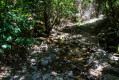
Sturdy footwear is required. The path may be muddy in places.

Reviews and comments

3.7 / 5
Based on 5 reviews

Reliability of the description
3.8 / 5
Ease of following the route
4.8 / 5
Route interest
2.4 / 5
Frederico
Frederico

Overall rating : 3.7 / 5

Date of your route : Jun 02, 2026
Reliability of the description : ★★★★★ Very good
Ease of following the route : ★★★★★ Very good
Route interest : ★☆☆☆☆ Very disappointing
Very busy route : No

Elevation gain from the car park (which charges a fee) from point 2 to point 3, then from point 2 to point 4 on the way back; the route is entirely on tarmac, with a view of an illegal tip along one section; ultimately not very interesting apart from the duration

Machine-translated

User 14511396

Overall rating : 3.7 / 5

Date of your route : Aug 19, 2025
Reliability of the description : ★★☆☆☆ Disappointing
Ease of following the route : ★★★★★ Very good
Route interest : ★★★★☆ Good
Very busy route : No

Hike with a beautiful finish and an orientation table overlooking a lovely viewpoint. That said, the description is misleading; it was sold to me as a "flat" hike, but expect a fairly intense 200-metre climb.
And the descent was so beautiful! A 25-minute descent on the road overlooking a landfill 🥰 The view is beautiful, but the end is disappointing

Machine-translated

Pchretien
Pchretien

Overall rating : 4.3 / 5

Date of your route : Aug 04, 2023
Reliability of the description : ★★★★★ Very good
Ease of following the route : ★★★★★ Very good
Route interest : ★★★☆☆ Average
Very busy route : No

A short walk with just two points of interest and one major drawback:
more than half of it is on roads.

Machine-translated

BAMX
BAMX

Overall rating : 4.3 / 5

Date of your route : Jun 07, 2023
Reliability of the description : ★★★★★ Very good
Ease of following the route : ★★★★★ Very good
Route interest : ★★★☆☆ Average
Very busy route : No

A pleasant walk – short but uninteresting

Machine-translated

AMIS14
AMIS14

Overall rating : 2.3 / 5

Date of your route : Oct 02, 2022
Reliability of the description : ★★☆☆☆ Disappointing
Ease of following the route : ★★★★☆ Good
Route interest : ★☆☆☆☆ Very disappointing
Very busy route : No

We chose this route because of its length and because it was marked as ‘easy’ – which is far from true, given the 2 km climb up a very steep path. It should really be marked as ‘moderate’ – and even that might be an overestimation.

Machine-translated

Other walks in the area

For more walks, use our search engine .

The GPS track and description are the property of this route's author. Please do not copy them without permission.