Circular Omu di Cagna–Bocca di u Monacu–Gianucciu loop

This circular route takes you along the classic route to Omu di Cagna but extends the route as far as Bocca di u Monacu and returns via the other side.
If you follow the track carefully, you’ll be able to see the exact spot where you need to go through (and come out) to find yourself right at the foot of the rock, on the edge of the precipice!
A few technical sections – see Practical Information
Use of a GPS or the Visorando app is strongly recommended

Details

n°52730383
Creation:
Last update:
Last review:
  • Walking
    Activity: Walking
  • ↔
    Distance: 6.99 mi
  • ◔
    Average duration: 5h 35 
  • ▲
    Difficulty: Difficult

  • ⚐
    Back to start: Yes
  • ↗
    Ascent: + 2,690 ft
  • ↘
    Descent: - 2,690 ft

  • ▲
    Highest point: 3,940 ft
  • ▼
    Lowest point: 1,558 ft

Photos

Description of the walk

Park in the car park in front of the church, at the entrance to the village.

(S/E) Walk up to the ‘official’ starting point of the route, following the signposts towards the south of the village.

(1) Start straight away with a climb and join a tarmac track. Head up to the right along this track, which leads to an EDF substation.

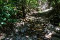
(2) Turn left to join the actual path, which climbs steeply straight away, with very short breaks, through the forest (pleasant in summer). After about 1 hour 20 minutes of continuous climbing, you’ll reach a spot offering the first view of the Omu di Cagna.

(3) Immediately afterwards, a small clearing provides a well-deserved break. Continue to follow the yellow-marked path, which heads off to the left. The route changes completely. Go round the mountain, climbing over the rocks – where you’ll need to use your hands – and squeezing through gaps. Stunning and a little technical. You’ll reach a signpost.

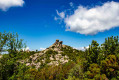
(4) For the round trip to the summit, turn right to reach the plateau; opposite you stands today’s destination.
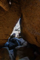
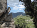
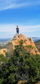
Follow the yellow markings, then the cairns, and proceed by sight. You’ll need to climb over some boulders. You’ll arrive opposite a gap. You’ll need to pass through this gap (the eastern route), which is narrow (but even with my rucksack on, I managed to get through), to reach the foot of the rock, facing the precipice – be careful – and a breathtaking view over the entire southern tip of Corsica and Sardinia.

(5) The return route is via another gap, immediately to the left (western route), where you must first descend 1 metre, then squeeze through and turn right to emerge ‘into the open’. From there, there are no further markings; you must follow your instincts, continuing to climb over the boulders, towards the path taken on the way there.

(4) At the signpost, take the path which climbs slightly to the right – it’s hard to spot!
NB: this path is not shown on the sign (why?), nor is it marked; you must follow the cairns and look carefully as it is, at times, very inconspicuous.
The path, still unmarked but with cairns, continues for 1 hour through low scrub and a small pine forest, before reaching a plateau at the foot of Punta di u Monacu, at a place known as “a bocca di u Monacu”.

(6) Take the path that branches off to the left. At first, it isn’t very visible, but it becomes clearer further on.

(7) Once you reach the Omu d’Ovacce and the ruined sheepfolds of Presarella (half an hour from the pass), with views over the Gulf of Valincu, the path begins its long, steep descent. At the very bottom, you’ll come to a much wider path; follow it to the left.

(8) Cross a small ford. The path turns into a track, which you should follow to the village (S/E).

Waypoints

  1. S/E : mi 0 - alt. 1,558 ft - Church, at the entrance to the village
  2. 1 : mi 0.15 - alt. 1,608 ft - Start of the “official” route
  3. 2 : mi 0.37 - alt. 1,759 ft - To the left
  4. 3 : mi 1.91 - alt. 3,350 ft - Viewpoint over the - Uomo di Cagna
  5. 4 : mi 2.45 - alt. 3,678 ft - Return journey to the - Uomo di Cagna
  6. 5 : mi 2.82 - alt. 3,934 ft - Foot of the rock - Uomo di Cagna
  7. 6 : mi 4 - alt. 3,612 ft - A bocca di u Monacu - Col du Monaco (1101m)
  8. 7 : mi 4.55 - alt. 3,619 ft - Ruined sheepfolds at Presarella
  9. 8 : mi 6.26 - alt. 1,722 ft - Ford
  10. S/E : mi 6.99 - alt. 1,558 ft - Church, at the entrance to the village

Notes

There’s no water along the way (except at the ford at the end).
Some sections towards the end require climbing over boulders, which may be difficult for some people and children (I would advise against bringing children).
Crossing the gaps is fairly straightforward, but may be nerve-wracking for some people.
Once you reach the foot of the rock, you’ll find a large precipice ahead of you… take great care here, especially on windy days!
Follow the track carefully and look at the photos to identify the eastern gap. The start of the western passage is just to the left (west) of the exit from the eastern passage.
The climb is quite a challenge (almost 900 m in 3 hours), but the rest is flat and downhill.

Worth a visit

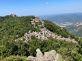
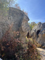
Admire all these piles of granite boulders, as numerous as they are varied, characteristic of the whole of the Cagna mountain range.
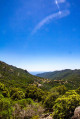
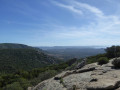
Once you reach the plateau, there are beautiful views of Corsica’s south-west coast (beaches, the Lion of Roccapina, the Gulf of Valincu, etc.).
At the foot of the rock, there’s an exceptional view across the far south, Bonifacio, Sardinia and a bird’s-eye view of Figari Airport. Below (be careful not to lean out too far!), there are slabs of granite split by frost.
From the plateau, on the way to the pass, you pass through areas dotted with martagon lilies, foxgloves, daisies, sweet peas and everlasting flowers… magnificent when in bloom.
Once past the pass, you can see the Omu di Cagna on your left, and the whole plateau.
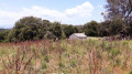
The path runs just north of the Presarella sheepfolds: these are ruins completely overgrown with vegetation, but you can go and have a look around.
On your right (north), you’ll notice the Pointe de l’omu d’Ovacce, which, like its neighbour at Cagna, features a large boulder perched on a rocky outcrop; you might want to try climbing it.
On the way down, there are lovely views over the Ortolu Valley (north) and its vineyards, as well as the small dam.
The descent is long, along a path churned up by wild boars; there are numerous stones in the middle, as well as trees felled by storms, with, to top it all off, a carpet of leaves, making the descent slippery.

Reviews and comments

4.2 / 5
Based on 2 reviews

Reliability of the description
4.5 / 5
Ease of following the route
4 / 5
Route interest
4 / 5
Chlo_msy
Chlo_msy

Overall rating : 4.7 / 5

Date of your route : Apr 19, 2026
Reliability of the description : ★★★★★ Very good
Ease of following the route : ★★★★☆ Good
Route interest : ★★★★★ Very good
Very busy route : No

The start of the walk is very busy, but most walkers only do the return leg. It’s a very strenuous walk, as we covered an elevation gain of 900 m instead of the 820 m stated, but the view is definitely worth it 😁
For the end of the circular walk, I recommend following the cairns built by hikers, which mark the end of the walk.
(If you’re doing this hike with a dog, you’ll need patience 😂)

Machine-translated

Sandysan
Sandysan

Overall rating : 3.7 / 5

Date of your route : Oct 22, 2024
Reliability of the description : ★★★★☆ Good
Ease of following the route : ★★★★☆ Good
Route interest : ★★★☆☆ Average
Very busy route : No

An easy walk, but not particularly interesting....
Not much in the way of views, especially on the second half... You spend far too long in the forest, over and over again, and it’s really difficult to find the path leading up to the highest point

Machine-translated

Other walks in the area

For more walks, use our search engine .

The GPS track and description are the property of this route's author. Please do not copy them without permission.