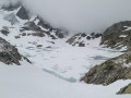
Exploring the lakes between Chamrousse and the Refuge de la Pra

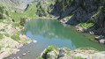
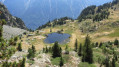
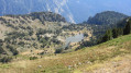
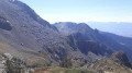
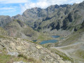
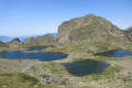
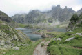
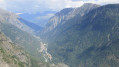
An original route, starting from Roche Béranger towards the Refuge de la Pra, to explore numerous natural lakes. A varied route combining wide tracks, rugged paths, scree crossings, steep rocky gullies where you’ll often need to use your hands, and pleasant, shaded paths amongst Swiss stone pines. With a feel reminiscent of Scandinavia and the Canadian Rockies, the landscape is spectacular, offering a 360° panorama. (Please read the ‘Practical Information’ section carefully.)

Details

25473468
Creation:
Last update:
Last review:
  • Walking
    Activity: Walking
  • ↔
    Distance: 12.74 mi
  • ◔
    Average duration: 9h 25 
  • ▲
    Difficulty: Difficult

  • ⚐
    Back to start: Yes
  • ↗
    Ascent: + 4,121 ft
  • ↘
    Descent: - 4,111 ft

  • ▲
    Highest point: 7,454 ft
  • ▼
    Lowest point: 5,833 ft

Photos

Description of the walk

At Roche Béranger, park on the Route de la Croisette, near the residential complex of the same name. The start of the walks is marked by signposts next to the Croisette chairlift.

(S/E) Head east along the track that passes by a bar-restaurant and leads to an artificial lake recently built in 2020: Lac de la Lauze (or Lac de Roche).

(1) Turn left onto the stony track that climbs northwards towards the Croix de Chamrousse, signposted by a sign. Keep to the right at the Fork in the road.

(2) At a left-hand bend (near the 2072 mark), admire Lac Achard below and the Arselle plateau. Continue on to the Croix de Chamrousse.

(3) Then head east towards the Lacs Robert. You’ll reach the Col des Trois Fontaines.

(4) Turn left and head down the steep, stony path which joins the Lacs Robert chairlift further down. You’ll reach a crossroads near a hut and a signpost (elevation 2005).

(5) Head towards Brèche Nord and walk alongside the lakes on either side until you reach a Y-junction and a signpost. This is Brèche Nord (2,008 m).

(6) Keep to the right and head towards the Refuge de la Pra, following theGR® 738. The path descends and becomes more rugged. You’ll reach a Fork in the road and a signpost.

(7) Keep to the right and head towards the Refuge de la Pra (leave the path to the Waterfall de l’Oursière on your left). About 100 m further on, you’ll reach a Y-junction and a cairn.

(8) Keep to the left, heading due north. The path winds its way through woods and meadows. On the left, you’ll catch a glimpse of the Waterfall de l’Oursière. After a short but steep climb and crossing a stream (via a footbridge), you’ll reach Lac Léama. Walk along the left-hand side of the lake, then head up the Combe de Jasse Bralard.

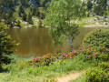
(9) In the middle of the valley, turn left at the signpost, then emerge into a mountain pasture leading to Lac Longet. Walk along the left side of the lake. To the left of the path lies Lac Bernard, which is much smaller and often dry in the height of summer.

(10) Carry on to reach Lac Claret and, at the far end of the mountain pasture, you’ll see the Refuge de la Pra.

(11) Cross the meadow. Take the opportunity to have a break or carry on towards Lac David.

(12) Before reaching the refuge, turn right to follow a path heading south-east, which is barely visible at first. This path becomes clearer as it crosses a scree slope on the mountainside. You’ll arrive at Lac David.

(13) Walk past the lake. What follows is a series of very steep ascents and descents and narrow gullies to cross, where you’ll need to use your hands to help you along. This is the most gruelling part of the route. You’ll eventually reach the junction you passed on the way out.

(8) Follow the path back along the same route as on the way out until you reach the signpost (elevation 2005).

(5) Head south-west towards the Col des Lessines (2,100 m), signposted by a signpost. This ascent involves a significant elevation gain and ends with a climb over a large boulder to reach the pass. This is the final challenge of this route.

(14) At the pass, turn right, heading north-east. Take in the view of the Lacs Robert. Follow the deserted path along the mountainside to reach the Col de la Botte (2,166 m).

(15) Descend westwards and then northwards towards Lac Achard, signposted by a signpost. Along the way, there are numerous small, unnamed lakes. The largest is on the left at the Col de l’Infernet, before descending towards Lac Achard.

(16) At the 994-metre mark, turn right and follow the path that takes you round the west side of Lac Achard. At its southern end, follow the signposted path heading south-west to reach a Y-junction (1,914 metres).

(17) Keep to the right, heading west, and follow the signposted path which winds its way through the Swiss stone pines.
Take care not to stray off course: there are exposed rocks and tree roots. You’ll reach the Ours ski run and then come close to the junction you passed at the start of the hike.

(1) Walk past Lac de la Lauze (de Roche) and join the Route de la Croisette (S/E).

Waypoints

  1. S/E : mi 0 - alt. 5,833 ft - La Croisette
  2. 1 : mi 0.25 - alt. 6,017 ft - Lower circular junction
  3. 2 : mi 1.25 - alt. 6,759 ft - Left-hand bend – View of the - Lac Achard (Belledonne)
  4. 3 : mi 2.2 - alt. 7,365 ft - Chamrousse Cross
  5. 4 : mi 2.55 - alt. 7,126 ft - Col des Trois Fontaines
  6. 5 : mi 3.09 - alt. 6,572 ft - South Bank - Lacs Robert
  7. 6 : mi 3.27 - alt. 6,568 ft - North Bank - Lacs Robert
  8. 7 : mi 3.73 - alt. 6,322 ft - Towards the Refuge de la Pra
  9. 8 : mi 3.78 - alt. 6,302 ft - Junction of the upper circular loop
  10. 9 : mi 4.75 - alt. 6,339 ft - Junction
  11. 10 : mi 5.17 - alt. 6,670 ft - Lac Longet
  12. 11 : mi 5.65 - alt. 6,726 ft - Lac Claret
  13. 12 : mi 5.95 - alt. 6,844 ft - Junction
  14. 13 : mi 6.76 - alt. 7,277 ft - Lac David
  15. 14 : mi 9.68 - alt. 6,883 ft - Col des Lessines (2100m)
  16. 15 : mi 10.15 - alt. 7,096 ft - Col de la Botte
  17. 16 : mi 11.02 - alt. 6,542 ft - Junction
  18. 17 : mi 11.65 - alt. 6,283 ft - Junction
  19. S/E : mi 12.74 - alt. 5,833 ft - La Croisette

Notes

For reference: the author’s time for this route was 8 hours 15 minutes (excluding lunch break).
Please note: Take the length and difficulty of this route fully into account.

Option 1: To save energy for the rest of the route, you can replace the walk up to the Croix de Chamrousse with a cable car ride (€10 in 2024) from Le Recoin, which is easily accessible from Roche Béranger via the Sentier du Renard.

Alternative 2: Avoid the Croix de Chamrousse by passing via the artificial lake at Les Vallons, the Col de la Balme and the southern pass of the Robert Lakes to reach the waypoint (5).

Alternative route 3: Avoid the Croix de Chamrousse by going via the artificial lake at Les Vallons, the Aiguille, theGR®738, Lac des Pourette and the northern pass of the Robert Lakes to reach the point (6).

List of lakes encountered: Robert Lakes (number 4), Lake Léama, Lake Longet, Lake Bernard, Lake Claret, Lake David, Lake de l’Infernet (named arbitrarily as it is unmarked on maps), Lake Achard, Lake de la Lauze or de Roche (artificial lake created in 2020), the artificial Lake des Vallons (if taking route 2), Lake des Pourette (if taking route 3).

This route passes through a protected area, which may be subject to special regulations:

Worth a visit

Lake Achard
Camping prohibited: Municipal Order No. 23-069 of the municipality of Chamrousse
Open fires prohibited: Prefectural Order No. 38-2017-04-28-007 of the Isère department
Swimming prohibited: Municipal Order No. 23-069 of the municipality of Chamrousse
Fishing prohibited: Municipal Order No. 23-069 of the municipality of Chamrousse
The collection and cutting of wood, even dead wood, the picking of plants, and the extraction of sand, topsoil or fossils are strictly prohibited unless expressly authorised.
Dogs must be kept on a lead.

Roberts Lakes
Camping permitted: from 7.00 pm to 9.00 am
Fires prohibited: Prefectural Order No. 38-2017-04-28-007 of the Isère department
Swimming is harmful: please do not swim here to protect the lake from human pollution
Fishing permitted with a fishing licence.

Lakes Léama – Longet – Bernard – David
Camping permitted: from 7.00 pm to 9.00 am
No open fires: Prefectural Order No. 38-2017-04-28-007 of the Isère department
Swimming prohibited: Municipal Order No. 2024-92 of the commune of Revel
Fishing permitted with a fishing licence.

Lake Claret
Camping prohibited: within a 50-metre radius of the lake to protect fragile wetlands.
Municipal Order No. 53-2020 of the municipality of Revel
Open fires prohibited: Prefectural Order No. 38-2017-04-28-007 of the Isère department
Swimming prohibited: Municipal Order No. 2024-92 of the municipality of Revel
Fishing permitted with a fishing licence.

Lake L’Infernet
Camping prohibited: Municipal Order No. 23-069 of the municipality of Revel
Fires prohibited: Prefectural Order No. 38-2017-04-28-007 of the Isère department
Swimming is harmful
Fishing permitted with a fishing licence.

Always be cautious and plan ahead when you're outdoors. Visorando and the author of this route cannot be held responsible for any accidents occurring on this route.

The GR® and PR® markings are the intellectual property of the Fédération Française de Randonnée Pédestre.

Reviews and comments

4.8 / 5
Based on 2 reviews

Reliability of the description
4.5 / 5
Ease of following the route
5 / 5
Route interest
5 / 5
User 25874471

Overall rating : 5 / 5

Date of your route : Aug 14, 2025
Reliability of the description : ★★★★★ Very good
Ease of following the route : ★★★★★ Very good
Route interest : ★★★★★ Very good
Very busy route : No

A magnificent, very comprehensive hike that takes you around the Pra lakes (combines very well with the "Pra Lakes" itinerary, which allows you to see Merlat and the Oursière waterfall, but this itinerary allows you to see even more lakes)

You can climb up to the Domenon lakes, but this adds about an hour to the round trip, so it can start to get quite long (a total of 27 km and 1,700 metres of elevation gain)

Don't underestimate the return journey, as the section after Lake David is the most challenging (13), with the climb back up almost as steep as the descent

If you want to save your energy, you can "shorten" the beginning (1-3) - which offers a few views of Lake Achard and the Arselle plateau but is relatively uninteresting compared to the rest of the hike - by going straight up (via the marked trails and signs) to the Robert lakes. The gain is not huge, but if you are a little short on energy or in a hurry to see the lakes, it's always something.

Machine-translated

Vusky
Vusky

Hello, there are no dangerous sections. You must have taken the wrong trail.
Best regards.

Machine-translated

User 9477019

Overall rating : 4.7 / 5

Date of your route : Jul 01, 2025
Reliability of the description : ★★★★☆ Good
Ease of following the route : ★★★★★ Very good
Route interest : ★★★★★ Very good
Very busy route : No

After camping at La Pra, the return route along the mountainside has two very short but dangerous sections: you obviously have to hold on with your hands, there is little room for your feet with a bit of a drop below, there is a large rock to climb over (not easy if you are short) with an overhanging wall just above where your backpack will scrape, or you will have to lean over if you are tall.
The "corridor" indicated is much longer and more physically demanding but easier than these two passages.

Machine-translated

Vusky
Vusky

All the lakes were really very low this summer. I’ve never seen anything like it.
Kind regards

Machine-translated

camillou38
camillou38

My mistake – the photo of Lake Bernard doesn’t appear when I open Visorando on my PC, but it does on my phone. It’s impressive, and Lake Longet was even lower down.
Regards

Machine-translated

Vusky
Vusky
• Edited:

Hello,
And yet, if you look at the photo, it’s dated 13 August 2022. But there were thunderstorms at the end of August
Kind regards

Machine-translated

camillou38
camillou38

Hello, was Lake Bernard dry last August? That’s odd – we were there on 1 September and, although the water level wasn’t at its highest, there was definitely water in it...

Machine-translated

Other walks in the area

For more walks, use our search engine .

The GPS track and description are the property of this route's author. Please do not copy them without permission.