


vivreenvillage

 Visorando Member
Sign up:
Published route(s)
 Hills and valleys in the Borderies
 4.53 mi
 +315 ft
 -312 ft
 2h 20
2h 20
 Easy
Easy
 Departure from Saint-Laurent-de-Cognac (Charente)
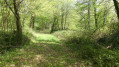
This route includes a tour of the Vallée de La Croix, part of the natural and historical heritage of the Borderies region, via the Chemin du Panteneau in the canton of Saint-Martin, whose right-of-way has marked one of the boundaries between the two municipalities of Saint-Laurent-de-Cognac and Louzac-Saint-André since 1824.
Route des Borderies in Louzac-Saint-André
9.12 mi
+541 ft
-564 ft
4h 40
 Moderate
Departure from Louzac-Saint-André (Charente)
Moderate
Departure from Louzac-Saint-André (Charente)
At the westernmost tip of Charente, Louzac-Saint-André, with its two villages and numerous hamlets, is a typical commune of the Borderies region in Saintonge.
These rural paths wind through alternating wooded areas and vineyards.
From valleys to hills, in addition to beautiful views of the Romanesque churches of Saint-Martin de Louzac and Saint-André, walkers will discover two remarkable natural landscapes, the Ri Bellot Valley and the Vallée de La Croix.