


No description
Discovery Path (Sentier Découverte), Esparron-de-Verdon
For more info visit https://gillianswalks.com/2016/05/04/sentier-decouverte-esparron-france/
Details
Creation:
Last update:
-
 Activity: Walking
-
 Distance: 3.09 mi
-
 Average duration: 1h 55
-
 Difficulty: Moderate
-
-
 Back to start: Yes
-
 Ascent: + 610 ft
-
 Descent: - 614 ft
-
-
 Highest point: 1,709 ft
-
 Lowest point: 1,178 ft
-
 Country:
France
-
 Area: Basses Gorges du Verdon
-
 City:
Esparron-de-Verdon (04550|04800)
-
 Start/End: N 43.739262° / E 5.976036°
-
 IGN map(s): Ref. 3342ET, 3343OT
-


 Hour-by-hour weather
Description of the walk
Waypoints
- S/E : mi 0 - alt. 1,250 ft
- S/E : mi 3.09 - alt. 1,230 ft
Other walks in the area
La Colle loop (Autour de la Colle), Esparron-de-Verdon
 Tourism professional
 3.11 mi
+397 ft
-397 ft
1h 45
 Easy
 Departure from Esparron-de-Verdon (Alpes-de-Haute-Provence)
On this hike you will be rewarded with beautiful views into the village of Esparron-de-Verdon and across to the hills of the Verdon Canyon. Enjoy the flowers, butterflies and olive trees as well as an optional visit to see the village chateau and church.
Esparron-de-Verdon
 Visorando Member
 3.80 mi
+663 ft
-643 ft
2h 20
Moderate
Departure from Esparron-de-Verdon (Alpes-de-Haute-Provence)
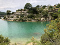
Above the lake of Esparron-de-Verdon.
Lac d'Esparron and the "Salle à Manger" site
 9.70 mi
+1,532 ft
-1,529 ft
5h 50
Moderate
Departure from Esparron-de-Verdon (Alpes-de-Haute-Provence)
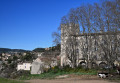
A circular eight-shaped loop starting from the village of Esparron-de-Verdon. A round trip takes you to the pretty site of the "Salle à Manger" in the lower Gorges du Verdon (access to water possible).
After starting on a small road, the route alternates between rocky paths and wide tracks.
There are some lovely views of the lake and glimpses of the plateaus of Provence and its lavender fields.
At the edge and on the heights of Lake Esparron
 7.01 mi
+1,027 ft
-997 ft
4h 05
Moderate
Departure from Saint-Julien (Var) (Var)
A family hike partly along the edge of Lake Esparron with many opportunities for swimming and picnicking. The second part of the hike is mostly in the woods with views of Lake Esparron. This hike is generally very shaded.
Balcon du Lac d'Esparron
 5.19 mi
+863 ft
-827 ft
3h 10
Easy
Departure from Saint-Julien (Var) (Var)
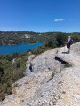
This is a very pleasant walk, with no real difficulty, offering views of Lake Esparron for most of the route. You can enjoy superb scenery as you climb up onto the plateau. There is a chance to swim if you follow the lake shore.
Between Les Cades and Esparron-de-Verdon
 9.27 mi
+1,243 ft
-1,253 ft
5h 20
Moderate
Departure from Esparron-de-Verdon (Alpes-de-Haute-Provence)
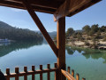
A circular walk starting from the road between Gréoux-les-Bains and Esparron-de-Verdon, a stretch through the heath, a visit to the village of Esparron-de-Verdon and a return route through the mountains.
Between Saint-Martin-de-Brômes and Allemagne-en-Provence
 10.10 mi
+866 ft
-869 ft
5h 25
Moderate
Departure from Saint-Martin-de-Brômes (Alpes-de-Haute-Provence)
A circular route between Saint-Martin-de-Brômes, passing by the Clock Tower and the church, then along the Chemin de la Crête de Saint-Pierre, with views of the mountains behind Moustiers, a descent along a lovely path towards Allemagne-en-Provence, passing by the Château de Castellane, and back down to the plain via the cycle path.
Circuit along the Colostre
 4.79 mi
+535 ft
-522 ft
2h 40
Moderate
Departure from Saint-Martin-de-Brômes (Alpes-de-Haute-Provence)
This walk near Gréoux-les-Bains takes you to discover a tributary of the Verdon, the Colostre, a charming little river that flows all year round through a small, fairly steep-sided valley. Also on the itinerary are an oppidum and the magnificent village of Saint-Martin-de-Brômes.
This route is not signposted, so it is advisable to use your mobile phone to follow the GPS track.
There is a ladder to climb (about 2 metres high), so this route is not recommended for those who are very prone to vertigo (though it’s no worse than climbing a stepladder), or for those with very young children (children aged 3–4 and over will really enjoy it!) or with large dogs.
There are a few sections along the Colostre that may prove tricky for those who aren’t very agile, especially if it has just rained.
For more walks, use our search engine .
The GPS track and description are the property of this route's author. Please do not copy them without permission.

