


tonioc

 Visorando Member
 Premium user
 - Location: Haute-Goulaine (44115)
- Gender: man
Sign up:
Published route(s)
 Bon Garand to La Haymionière loop
 8.20 mi
 +66 ft
 -69 ft
 3h 50
3h 50
 Moderate
 Departure from Sautron (Loire-Atlantique)
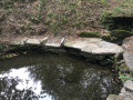
This hike starts and ends at the Bon Garand Chapel in the commune of Sautron but mainly takes place in the commune of Vigneux. It alternates between farm tracks in the countryside and wooded passages, and passes through several typical hamlets with some very beautiful buildings.
Circular route between Sillon and Marais in Saint-Etienne-de-Montluc
 8.23 mi
+331 ft
-348 ft
4h 05
Moderate
Departure from Saint-Étienne-de-Montluc (Loire-Atlantique)
8.23 mi
+331 ft
-348 ft
4h 05
Moderate
Departure from Saint-Étienne-de-Montluc (Loire-Atlantique)
This hike takes place mainly on roads, but these are fairly quiet to very quiet. It follows sections ofthe GR®3and a few farm tracks. The hike offers some clear views from the heights of the Sillon de Bretagne (you can even see the Loire). There are also some interesting buildings to see along the way...
Audubon Marsh Circular: Arche du Dareau - Etang-Bernard
 6.12 mi
+30 ft
-30 ft
2h 50
6.12 mi
+30 ft
-30 ft
2h 50
 Easy
Departure from Couëron (Loire-Atlantique)
Easy
Departure from Couëron (Loire-Atlantique)
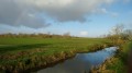
This hike covers part of the Marais Audubon, a wetland that is part of the estuarine marshes. This area is a sanctuary for many species of birds, including storks, herons, egrets, ducks, harriers... An area of extensive cattle farming, it is also home to other less desirable species, such as nutria.
This circular route of about 10km runs almost exclusively along roads – some of which are flood-prone – but with very little traffic.
From the village of Couëron to Lake Beaulieu and then to the Loire
 5.90 mi
+161 ft
-167 ft
2h 50
Easy
Departure from Couëron (Loire-Atlantique)
5.90 mi
+161 ft
-167 ft
2h 50
Easy
Departure from Couëron (Loire-Atlantique)
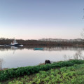
Starting at the town hall square in Couëron, this circuit quickly leaves the village to reach Lake Beaulieu, offering some beautiful views of the town. After circling the lake and perhaps observing a few birds, it ends along the Loire, which you reach via footpaths. Here you will find Jean-Luc Courcoult's "La maison dans la Loire" (The House in the Loire) and the "Tour à Plomb" (Plumb Tower).
Suitable for all seasons, this route is particularly pleasant in the low winter light.
Couëron West: between town and countryside
 5.67 mi
+85 ft
-82 ft
2h 40
Easy
Departure from Couëron (Loire-Atlantique)
5.67 mi
+85 ft
-82 ft
2h 40
Easy
Departure from Couëron (Loire-Atlantique)
Starting from the Couëron velodrome, this route begins in the old quarter of Bourg d’Aval and then follows the green corridor through the new neighbourhoods in the west-central part of the town. After an optional circular route through the countryside, it returns towards the Port-Launay neighbourhood near the Couëron–Le Pellerin ferry and then rejoins its starting point.
It is possible to shorten the route to a 6 km route.
From Maresclé beach to Haut-Pénestin along the coast and other paths
 8.06 mi
+98 ft
-108 ft
3h 45
Moderate
Departure from Pénestin (Morbihan)
8.06 mi
+98 ft
-108 ft
3h 45
Moderate
Departure from Pénestin (Morbihan)
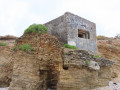
This hike starts at the car park of the Mine d’Or beach, along the coast north to Haut-Pénestin, to return by internal paths to reach the sea at Maresclé beach and then the starting point.
Between Saint-Fiacre and Château-Thébaud
 7.25 mi
+430 ft
-456 ft
3h 40
Moderate
Departure from Saint-Fiacre-sur-Maine (Loire-Atlantique)
7.25 mi
+430 ft
-456 ft
3h 40
Moderate
Departure from Saint-Fiacre-sur-Maine (Loire-Atlantique)
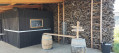
This loop mainly takes place in the vineyards between Saint-Fiacre-sur-Maine and Château-Thébaud, south of Nantes. It offers some lovely views, particularly at the Belvédère de Château-Thébaud, which overlooks the Maine. The circuit follows farm tracks through the vineyards (some of which may be private). The landscape changes with the seasons and the different colours of the vineyards.
Le Loroux-Bottereau between Pont de Louen and the village
 10.11 mi
+427 ft
-407 ft
5h 00
Moderate
Departure from Haute-Goulaine (Loire-Atlantique)
10.11 mi
+427 ft
-407 ft
5h 00
Moderate
Departure from Haute-Goulaine (Loire-Atlantique)
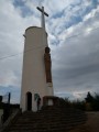
Starting at Pont de Louen on the banks of the Goulaine (and its marsh in winter), this route immediately climbs to the Butte de la Roche to overlook the area, with a panoramic view as far as Nantes. It then winds its way between vineyards and charming hamlets, with other panoramic views such as at the Moulin du Pé. Crossing the village of Loroux-Bottereau, it then makes a circular route back to the hill and the starting point.
Between Sèvre Nantaise, vineyards and mills
 5.76 mi
+151 ft
-171 ft
2h 45
Easy
Departure from Le Pallet (Loire-Atlantique)
5.76 mi
+151 ft
-171 ft
2h 45
Easy
Departure from Le Pallet (Loire-Atlantique)
This hike starts on the north bank of the Sèvre Nantaise but mainly takes place on the south bank. It offers both beautiful views along the river and panoramic views over the vineyards. It is accessible all year round in principle, but in wet weather, some sections may be muddy.
A ‘Vines and Villages’ route in La Haie-Fouassière
 7.21 mi
+164 ft
-151 ft
3h 25
Moderate
Departure from La Haie-Fouassière (Loire-Atlantique)
7.21 mi
+164 ft
-151 ft
3h 25
Moderate
Departure from La Haie-Fouassière (Loire-Atlantique)
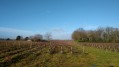
This route, which runs mainly through the vineyards, offers some unobstructed, elevated views over the vineyards (where Muscadet is the main wine produced). It shares some sections with the yellow-marked ‘Vignobles en Villages’ route; do not rely on this signage but follow the directions below.
The route alternates between sections on low-traffic roads and paths or farm tracks through the vineyards.
The Sèvre, its hillsides and mills between Vertou and La Haye-Fouassière
 7.67 mi
+233 ft
-220 ft
3h 45
Moderate
Departure from Vertou (Loire-Atlantique)
7.67 mi
+233 ft
-220 ft
3h 45
Moderate
Departure from Vertou (Loire-Atlantique)
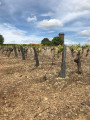
This hike takes place mainly on paths. Going from village to village, it offers a beautiful variety of landscapes: there are both wide-open views of the vineyards and the Sèvre Nantaise valley, and wooded passages, particularly along the banks of the Sèvre.
It can be enjoyed in any season, with the colours and light offering ever-changing pleasures!
Route from La Berrière to Barbechat
 7.81 mi
+381 ft
-364 ft
3h 55
Moderate
Departure from Barbechat (Loire-Atlantique)
7.81 mi
+381 ft
-364 ft
3h 55
Moderate
Departure from Barbechat (Loire-Atlantique)
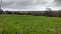
This fully signposted route runs between the banks of the Divatte, vineyards and hedgerows in the commune of Barbechat. It mainly follows unpaved paths and offers wide-open views of the landscape.
In terms of built heritage, the main point of interest is the Château de la Berrière.
The route starts from the car park at the Perthuis Churin leisure centre, which can be reached by following the signs for Landemont on the D207 from the village.
Circular between La Haye-Fouassière and Le Pallet
 10.21 mi
+486 ft
-486 ft
5h 05
Moderate
Departure from La Haie-Fouassière (Loire-Atlantique)
10.21 mi
+486 ft
-486 ft
5h 05
Moderate
Departure from La Haie-Fouassière (Loire-Atlantique)
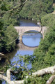
This hike starts at the port of La Haye-Fouassière and follows a circular route along the south bank of the Sèvre Nantaise to Monnières (on the Way of St James), with an optional detour to the reservoir on the Sèvre at Le Pallet (approximately 15 km without this option).
It offers commanding views over the Sèvre and its surroundings and often winds its way through vineyards.