


lenny77

 Visorando Member
 Premium user
 - Location: Combs-la-Ville (77380)
- Gender: man
Sign up:
Published route(s)
 Château-Landon, the Loing Canal and the Étangs de Dordives
 10.77 mi
 +292 ft
 -279 ft
 5h 10
5h 10
 Average
 Departure from Château-Landon (Seine-et-Marne)
This walk follows the city's monument trail and adds the canal, ponds and promenade along the Fusain to combine a cultural approach with the discovery of bucolic landscapes.
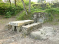
Mont Ussy, Rocher Cassepot and Tour Denecourt
 9.33 mi
+463 ft
-446 ft
4h 40
Average
Departure from Fontainebleau (Seine-et-Marne)
9.33 mi
+463 ft
-446 ft
4h 40
Average
Departure from Fontainebleau (Seine-et-Marne)
The best of the Denecourt-Colinet trails nos. 1, 2 and 3 in a day's hike! The Croix d'Augas, the rocks of Mont Ussy, the Solle racecourse, the Rocher Cassepot, the Denecourt Tower, the Circuit des Fontaines, and return via the beautiful viewpoint of the Croix du Calvaire.
N.B. As is often the case with the Denecourt-Colinet trails, the automatic calculation underestimates the twists and turns in the rocks: allow for 17 km and 250 m of elevation gain, or 5 hours.
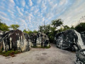
The Cuvier-Chatillon Rocks
 9.41 mi
+735 ft
-735 ft
5h 00
Average
Departure from Fontainebleau (Seine-et-Marne)
9.41 mi
+735 ft
-735 ft
5h 00
Average
Departure from Fontainebleau (Seine-et-Marne)
The most beautiful and rocky part of the Denecourt-Colinet trail No. 5 is completed by a circular loop around the massif with views of Camp de Chailly and Rocher Canon.
Please note! The automatic calculation underestimates the twists and turns of the rocky Denecourt-Colinet trails. Allow for 19 km and 400 m of elevation gain.
The Rocher Saint-Germain and the Rocher Canon via the Butte Saint-Louis
10.11 mi
+640 ft
-640 ft
5h 10
Average
Departure from Fontainebleau (Seine-et-Marne)
From the beautiful Rocher Saint-Germain and its Crystal Cave to the surprising Rocher Canon, via the Table du Grand Maître, the Longues Vallées and the Butte Saint-Louis.
Please note: the automatic calculation underestimates the twists and turns of the Blue trails. Allow for 18 km and 300 m of elevation gain. Allow 6 hours of walking time.
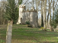
Double circular route starting from Chaumes-en-Brie
 13.42 mi
+436 ft
-459 ft
6h 35
13.42 mi
+436 ft
-459 ft
6h 35
 Difficult
Departure from Chaumes-en-Brie (Seine-et-Marne)
Difficult
Departure from Chaumes-en-Brie (Seine-et-Marne)
Around Chaumes-en-Brie through the villages of Maurevert, Forest, Arcy and Argentières, with the Yerres, Bréon and Vivier and Arcy castles.
Note: in the description below, the (*) refers to the section: During the hike or nearby.
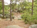
Autour de Beauvais et Mondeville par le Rocher du Duc
 12.33 mi
+705 ft
-689 ft
6h 15
Difficult
Departure from Champcueil (Essonne)
12.33 mi
+705 ft
-689 ft
6h 15
Difficult
Departure from Champcueil (Essonne)
Une longue randonnée avec le joli village de Beauvais, des sous-bois comme la forêt des Grands Avaux, les très beaux Rocher du Duc et Roches aux Dames avec leurs points de vue, qui rappellent Fontainebleau, la Tour du Buisson et les 100 marches de l'aqueduc de la Vanne et du Loing à Champcueil.
Les (*) dans le descriptif renvoient à la rubrique "Pendant la randonnée ou à proximité"
The Orge Valley between the source and Dourdan
 13.73 mi
+381 ft
-374 ft
6h 40
Difficult
Departure from Dourdan (Essonne)
13.73 mi
+381 ft
-374 ft
6h 40
Difficult
Departure from Dourdan (Essonne)
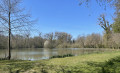
A long walk through forests, ponds and the banks of the Orge river, passing through the beautiful villages of Sainte-Mesme and Saint-Martin de Bréthancourt. Includes a visit to Dourdan, which you cross via parks and walking trails along the Orge river or the old fortifications, avoiding the suburbs and their buildings.
The Virgin Tower and other viewpoints from Arbonne-la-Forêt
7.30 mi
+653 ft
-643 ft
3h 55
Average
Departure from Arbonne-la-Forêt (Seine-et-Marne)
A half-day walk offering access to the Tour de La Vierge, the Vanne and Loing aqueducts, and the viewpoints at Hurlevent and the Hautes Plaines. All this whilst following part ofthe GR®®11through beautiful rocky terrain and peaceful connecting paths where you can relax.
Please note: the route covers 13 km with 300 metres of elevation gain. It’s quite a challenging hike for such a relatively short distance.
Le Grand Morin de Tigeaux at the Moulin de Prémol
 9.32 mi
+374 ft
-384 ft
4h 35
Average
Departure from Mortcerf (Seine-et-Marne)
9.32 mi
+374 ft
-384 ft
4h 35
Average
Departure from Mortcerf (Seine-et-Marne)
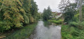
A country walk in the Grand Morin valley, with the mills of Coude and Prémol.
Note: actual elevation gain: approximately double the calculation, i.e. 260 m.
Avoid in wet weather.
Caution! The route has been modified at the Moulin de Prémol due to the removal of the footbridge over the railway line.
Along the Seine between Fontaine-le-Port and Chartrettes
6.01 mi
+167 ft
-164 ft
2h 55
 Easy
Departure from Fontaine-le-Port (Seine-et-Marne)
Easy
Departure from Fontaine-le-Port (Seine-et-Marne)
A walk along the Seine, with the village of Fontaine-le-Port, a section ofthe GR®2 trailoverlooking the Seine towards Chartrettes, then the Bois-le-Roi leisure centre on the other side of the river.
The École Valley towards Saint-Sauveur-sur-École and Brinville
 11.07 mi
+449 ft
-449 ft
5h 30
Average
Departure from Pringy (Seine-et-Marne) (Seine-et-Marne)
11.07 mi
+449 ft
-449 ft
5h 30
Average
Departure from Pringy (Seine-et-Marne) (Seine-et-Marne)
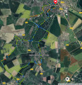
Enjoy a country walk in the valley and on the slopes of L'École, with its mills, wash houses, castles and the town park. Be careful of muddy conditions during rainy periods.
Old villages of Auvers-Saint-Georges and Saint-Fiacre and the Butte du Puits
 9.59 mi
+574 ft
-564 ft
4h 55
Average
Departure from Auvers-Saint-Georges (Essonne)
9.59 mi
+574 ft
-564 ft
4h 55
Average
Departure from Auvers-Saint-Georges (Essonne)
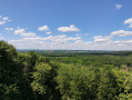
This loop allows you to discover the old villages of Saint-Fiacre and Auvers-Saint-Georges (in the same commune), the hillsides and the magnificent and little-known site of the Butte du Puits.
Allow 16 km and 5 hours, including time spent at the site
Banks of the Seine and Sénart Forest
 7.81 mi
+135 ft
-151 ft
3h 40
Average
Departure from Draveil (Essonne)
7.81 mi
+135 ft
-151 ft
3h 40
Average
Departure from Draveil (Essonne)
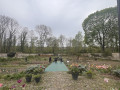
An easy hike that alternates between the Forest of Sénart, the banks of the Seine and some beautiful estates such as the Ermitage de Sénart, where Nadar lived, and the Parc du Grand Veneur in Soisy-sur-Seine.Please note the opening hours of the public garden. In addition, the park is closed during storms.
Du plateau du Coquibus à celui des Belvédères par le Rocher aux Voleurs
6.66 mi
+495 ft
-499 ft
3h 30
Average
Departure from Noisy-sur-École (Seine-et-Marne)
Une randonnée qui passe du plateau du Coquibus à celui des Belvédères afin de varier les paysages et les points de vue. Cette randonnée se fait à la demi-journée.
Le détour par le "Chapeau de Napoléon" est supprimé: passage trop délicat pour un intérêt limité.
Rocher de Samoreau, Fours du Roy and banks of the Seine
 7.75 mi
+541 ft
-551 ft
4h 00
Average
Departure from Samoreau (Seine-et-Marne)
7.75 mi
+541 ft
-551 ft
4h 00
Average
Departure from Samoreau (Seine-et-Marne)
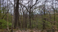
A rural hike that alternates between old villages, former quarries, forest and the banks of the Seine. The road that was previously used for the return journey has changed from a private road to a public road and is no longer suitable for walking, hence a significant change to the route.
From Pointe de Brezellec to Pointe de Penharn
 6.88 mi
+469 ft
-476 ft
3h 35
Average
Departure from Cléden-Cap-Sizun (Finistère)
6.88 mi
+469 ft
-476 ft
3h 35
Average
Departure from Cléden-Cap-Sizun (Finistère)
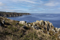
A short coastal hike between the Brezellec and Penharn headlands, with the opportunity to visit the charming little local ports. Return via the inland route and old villages.
The Port aux Cerises and the Château de Draveil
 6.04 mi
+105 ft
-105 ft
2h 50
Easy
Departure from Draveil (Essonne)
6.04 mi
+105 ft
-105 ft
2h 50
Easy
Departure from Draveil (Essonne)
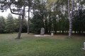
Draveil, the Port aux Cerises, the Château de Draveil (Paris Jardins) and the Château de Villiers (Town Hall) and the footbridges along the Seine with views of the marinas.Reminder: Paris Jardins is private property. Passage is tolerated, but please be discreet and respectful so that the estate remains open to visitors.
Dannemois via Tertre Blanc from Soisy-sur-École
 10.95 mi
+486 ft
-479 ft
5h 25
Average
Departure from Soisy-sur-École (Essonne)
10.95 mi
+486 ft
-479 ft
5h 25
Average
Departure from Soisy-sur-École (Essonne)
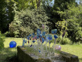
A varied country walk, passing by the Moulin de Dannemois and the Verrerie d'Art de Soisy-sur-École.
Duration: Allow extra time if you want to see the master glassmakers at work (free of charge).
Avoid during hunting season.
Moret-sur-Loing par Loing et Seine au départ de Saint-Mammès
6.98 mi
+184 ft
-180 ft
3h 20
Average
Departure from Veneux-les-Sablons (Seine-et-Marne)
Visit the medieval town of Moret-sur-Loing coming from Saint-Mammès along the banks of the Loing. Return along the banks of the Seine. Check the opening hours of the Pont Loup museum.
Please note: on Sunday mornings, there is a market in the car park.
The route has been significantly modified to take into account various passages that have become unusable by pedestrians and to avoid walking along the railway line on the way back, without walking too much on tarmac.
From Les Saints to Paradis via the Mauvais Passage
 11.42 mi
+548 ft
-564 ft
5h 45
Average
Departure from Mauperthuis (Seine-et-Marne)
11.42 mi
+548 ft
-564 ft
5h 45
Average
Departure from Mauperthuis (Seine-et-Marne)
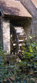
A country walk in the Aubetin valley, via Mauperthuis, Esse, the hamlet of Paradis and Saints, with mills and the river. Lots of quiet, pleasant little roads for when the paths are too muddy.Note: The annotations (*) refer to the chapter "During the hike or nearby".
The Rocher Canon and the Affolantes de Bois-le-Roi
 8.00 mi
+272 ft
-246 ft
3h 55
Average
Departure from Fontainebleau (Seine-et-Marne)
8.00 mi
+272 ft
-246 ft
3h 55
Average
Departure from Fontainebleau (Seine-et-Marne)
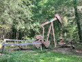
This hike alternates between the rocks of Fontainebleau, the undergrowth, the banks of the Seine with the "Affolantes" of Bois-le-Roi (the beautiful villas), and a return via the Mare aux Évées.
Please note: the Rocher Canon becomes very crowded at weekends when the weather is good.
The Javot Valley starting from Machault
 8.40 mi
+381 ft
-377 ft
4h 10
Average
Departure from Machault (Seine-et-Marne) (Seine-et-Marne)
8.40 mi
+381 ft
-377 ft
4h 10
Average
Departure from Machault (Seine-et-Marne) (Seine-et-Marne)
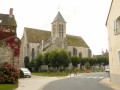
Variation of the "From vineyards to orchards in the Javot valley" hike available on the FFRP Seine-et-Marne hiking website.
Courquetaine - Ozouer le Voulgis via Retal
 10.56 mi
+312 ft
-315 ft
5h 10
Average
Departure from Courquetaine (Seine-et-Marne)
10.56 mi
+312 ft
-315 ft
5h 10
Average
Departure from Courquetaine (Seine-et-Marne)
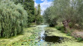
A countryside walk that takes you from the Marsange valley to the Yerres valley, taking in Retal Manor, Ozouer-le-Voulgis and Courquetaine Castle.Not recommended during wet weather.
The Bois de La Rochette and the Parc de l'Abbaye du Lys
5.85 mi
+98 ft
-98 ft
2h 45
Easy
Departure from La Rochette (Seine-et-Marne) (Seine-et-Marne)
This hike alternates between forest, the Parc de l'Abbaye du Lys and the animal park at Château Soubiran in Dammarie.
From the Salamander Rocks to the Demoiselles Rocks
 6.67 mi
+564 ft
-564 ft
3h 35
Average
Departure from Fontainebleau (Seine-et-Marne)
6.67 mi
+564 ft
-564 ft
3h 35
Average
Departure from Fontainebleau (Seine-et-Marne)
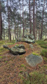
A very "mineral" hike, from Salamandre Rock to Mont Morillon Rock, passing by the rocks of La Combe (former sandstone quarries), Mauvais Passage and Les Demoiselles. This hike uses unmarked trails, some of which are not shown on the IGN map. The use of the Visorando app on your smartphone is therefore strongly recommended.