Country:

 City:
City:


Car park on Place de Villance, opposite the care home.
(S/E) Opposite the care home, take the road on the right towards Transinne.
(1) At the next junction, turn left towards Wezelvaux. Continue along the road, keeping to the left, and pass a small place of worship dedicated to Notre-Dame de Taillevent or Tahivan. Turn left at thefirst street you come to.
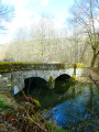
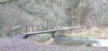
(2) Turn right at the farm before reaching the football pitch. Follow the road downhill, ignore the forest track branching off ahead of you and continue along the road. It becomes a forest track after the property. Further down, ignore the track branching off to the right and pass the Pont de la Justice bridge, which spans the River Lesse, on your left.
(3) Head up the track, which becomes a road at the Maissin cemetery. At the junction with the N808, turn left. Follow the road downhill and leave the built-up area. Walk past the property with the ponds on your right and take thefirstforesttrackon your right. Head uphill. The track turns left. Ignore the grassy path ahead of you and continue to the right.
(4) At the crossroads, carry on straight ahead. At the next wide junction, turn right and then immediately left. Follow the main track, ignoring the tracks on your left.
(5) Leave the woods at the hamlet of Trois Fontaines and cross the road. Continue along the path opposite. Walk alongside the plot of young fir trees and enter the forest. Ignore the path on your left. Follow the main forest track for 600 m until you reach a road. At the road, cross over and continue straight on until you reach the next road.
(6) At the road, turn right, head downhill and walk past the Anloy military cemetery. Turn left at the place known as Cimetière Militaire Bruyère, which is just after the cemetery. Walk through a clearing. At the Fork in the road, turn left.
(7) At the junction, turn right. Walk to the road. Cross the road and carry on straight ahead. At the next road, cross again and continue straight ahead for 550 m.
(8) At the T-junction, turn left. You are now walking along the boundary between Libin on your left and Paliseul on your right. Ignore any paths or tracks on your right for about 400 m. You’ll rejoin theGR® signposting at a junction.
(9) At the next junction, turn left and follow the forest track to the road. Turn right and walk along the road for 350 m.
(10) Turn left. Head uphill and back down a path (not shown on the map) and continue to the left.
(11) At the T-junction, turn left. Leave theGR® markings and follow the forest track until you reach the road. Cross the road and continue straight ahead. At the next road, at a place called Franc Bois, carry on straight ahead for about 600 m and, at the crossroads, continue straight ahead again.
(12) At the Fork in the road, turn left. Ignore the path on your right and, at the open clearing, turn right. At the road, in the hamlet of Haie du Wez, cross it and continue straight ahead. Stay on the main path for 600 m. The path turns left.
(13) As you emerge from under the trees, take the path on your right. When you rejoin another path, carry on straight ahead. Head downhill and cross the Frô Fays stream. Head back up the path and, at the junction, carry on straight ahead.
(14) At the next junction (not shown on the map), carry on straight ahead. When you reach the road, turn left.
(15) At the junction, at a place called Vieille Rochette, take the hairpin bend to the right. Walk past the pond in the nature reserve. At the large turning area, carry straight on along the path opposite.
(16) At the T-junction, turn left. Walk alongside the meadows and, when you reach the road, turn left. At the place known as Route de Jehonville, turn right. The path turns right.
(17) At the fork in the road, continue to the left.
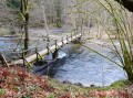
(18) At the crossroads (not shown on the map), carry on straight ahead. Follow the most clearly marked path, which turns left. Pass through the ferns and enter the forest. Cross the Omois stream via the footbridge.
(19) At the forest track, turn right. The track turns left and passes a clear-cut area. At the junction (not shown on the map), keep left. When you return to a stony track, carry on straight ahead. Leave the path on your right (not shown on the map) and carry on straight ahead. At the road, turn left and go under the motorway. Enter the town of Ochamps. On the left, at a place called Colonel Detrie, you’ll find the monument dedicated to the20th Infantry Regiment as well as the memorial steles.
(20) Then turn right onto the path running some distance alongside the football pitch. Walk past the commemorative steles dotted along the path. At the junction, carry on straight ahead and, when you reach the road, continue straight ahead. Do the same at the next junction and stay on the main path.
(21) At the Fork in the road, turn left. Keep to your right and, when you reach the dirt track, turn left. Cross over the River Lesse and pass between the farm buildings. At the crossroads, carry on straight ahead along the road, pass the hamlet of La Goutelle and head uphill.
(22) At the farm track, with a copse of oak and conifer trees, turn right. Walk alongside the meadows. At the crossroads (not shown on the map), carry on straight ahead and enter the forest. When you return to a forest track, turn left. At the junction, turn right, then turn left and cross the footbridge. Then keep to your right. Go round the fallen tree and keep to the right.
(23) At the junction with a wide forest track and a pond on your right, head straight ahead onto the path. Follow the Source de la Lesse. Ignore the path on your right and carry on straight ahead. At the road, at a place called Source de la Lesse, cross over and continue straight ahead along the forest track.
(24) The track turns left. Ignore the grassy path on your right and stay on the main track.
(25) A track (not shown on the map) joins from your right; carry on straight ahead for 500 m, ignoring the other tracks.
(26) At the junction, turn right.
(27) At the Fork in the road, keep to the left. After 540 m, look out for the campsite on your right. The entrance is at the junction (E).
 Visorando Member
 Easy
Easy 
 Moderate