Country:

 City:
City:



You can reach Rougiers either from Saint-Maximin-La-Sainte-Baume via the D83, or from Nans-les-Pins, or from Tourves via the D1. In all three cases, the car park at the start of the walk is situated at the junction of these roads, at the northern entrance to the village.
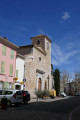
(S/E) Leave the car park and head back towards the main road (D1). Turn right onto it and follow it for about 200 metres until you reach the footpath leading to the village, with a view of the church on your right. Cross a main road (which passes in front of the town hall) and take the street opposite (Chemin du Pays Haut), which climbs southwards, with the castrum in sight. At the end of this street, turn right onto Rue de l’Ancienne Fontaine.
(1) At the junction, turn left onto Rue Sainte-Anne.
(2) At the top of this street, ignore the road on the right and turn left towards Les Glacières (CD 9). This quiet road climbs gently southwards.
(3) Just after passing the entrance to a house (on the right), turn left onto the path that leads downhill, initially running almost parallel to the road, then veering away from it. Continue along the main path (ignoring the few footpaths you come across on the left).
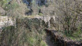
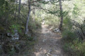
Carry on downhill until you cross the bed of a stream (which is usually dry), then gradually climb back up to the road, which you have been following more or less parallel to all along. The track is very rocky here and still bears the wheel ruts of the carts that once travelled along it.
Reach the road and follow it slightly to the left until you reach a lay-by on the right-hand side of the road, where several tracks converge.
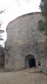
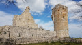
(4) This is a car park for the start of walks. To the east, a stony track, closed off by a gate, climbs towards the Défend hills. Ignore another forest track to the west, which is also closed off by a gate. Turn right (north) onto the path – at times stony, at times earthy – which leads to the ruins of Castrum Saint-Jean.
(5) You’ll come to a track; turn right onto it to reach the castrum, and make the most of this superb site to explore the ruins and admire the panoramic views. After your visit, return to this same track and follow it to the right for about 200 metres towards the west.
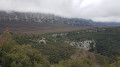
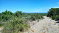
(6) On your right, you’ll find the entrance to a path which first leads into a forest of holm oaks and pines, and continues along the beautiful ‘balcony path’ that heads west, running directly below the cliffs, with the Oppidum du Piégu in your line of sight and, above all, the sweeping panorama over Rougiers, Saint-Maximin and beyond.
(7) You’ll emerge onto a lovely rocky path, the GRP® “Circular Tour of Sainte-Baume”. If you head slightly south along it, you’ll first come across a path on the right leading to the Oppidum du Piégu, followed by a stone-built water catchment.
Instead, turn sharp right, heading north, and follow this GRP® downwards; it is mostly very rocky and rugged, but with a few pleasant earthen sections. When you reach a road, turn left, going round a house. Continue down to a junction you passed on the way out.
(2 ) Head back along Rue Sainte Anne, in the opposite direction to the outward journey, until you reach the original junction.
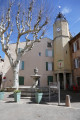
(1) Carry on straight ahead to the village centre. At a pretty little square with a large plane tree and a fountain, walk past the 20th-century café-tobacconist’s and take the alleyway on the right, which leads to the car park (S/E).

 Visorando Member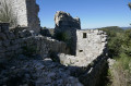

 Easy
Easy