Country:

 City:
City:


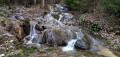
Start from the church in Neuvecelle, at a place called Ausnières. There are large car parks on either side of Avenue du Léman (D124); see the practical information section.
Signposts are provided at all major junctions.
No signposting
(S/E) Head towards the recycling bins and turn left onto Avenue d’Évian. Cross Avenue des Châtaigniers on the right-hand side and, at the next junction, turn left onto Avenue du Flon. Continue straight ahead, ignoring all side roads, and head slightly downhill.
Red + yellow markings + signposts with yellow arrows
The markings are one-way: red in the direction of travel, yellow in the opposite direction. The yellow arrows are two-way.
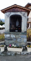
At the Stop sign (with the oratory opposite), carry on straight ahead along Avenue du Flon. Pass the cul-de-sac of the same name on your right and continue along the small road. Cross the Forchex (which you can hear more than you can see) and then head uphill.
Yellow signposting (one-way) + signposts with yellow arrows (two-way)
(1) At the T-junction, by the signpost marked ‘Au-dessus-du Chêne’, turn right towards Verlagny. Cross Avenue de Milly at the pedestrian crossing on the right and head up Avenue de Verlagny towards the town hall. Pass the Neuvecelle town hall and, at the junction just after it (signpost ‘Verlagny’), turn left onto Avenue de Montigny towards Neuvecelle Park.
(2) At the Stop sign (large wooden cross), turn right onto Chemin des Houches (ignore the arrow indicating to go straight on) and head uphill. At the Fork in the road, turn right onto Chemin du Châtelard. Pass between No. 72 (on the right) and No. 79 (on the left), go past the “Chez Laurent” sign and continue uphill along a grassy track. At the next junction, carry on straight ahead and uphill along a shaded track. You’ll come out onto a small road; follow it to the left and uphill.
Red and yellow markings on posts with yellow arrows + MTB signpost 19
(3) When the road bends to the left (signpost marked ‘Bois Ramé’), there are two options:
- Follow the additional route described in the practical information section.
- As shown on the map, turn right onto a path heading towards Bois du Feu and Évian. A little further on, cross the road with care and continue straight ahead along the path which climbs steeply alongside a stream. The path turns right, moves away from the stream and climbs more gently. Ignore a path and a chalet on the right. Then ignore a track on the left and descend slightly. Ignore a track on the right (old route) and climb back up a sunken path. Descend again, reach a fence and follow it on your right-hand side.
(4) Cross a torrent via a footbridge without a railing, turn right and head uphill. Continue on level ground. At a Fork in the road not marked on the map, keep to the right and head downhill (beautiful views over Lake Geneva).
(5) At the junction, first turn left then right as you head uphill and continue on roughly level ground along the signposted path. At the ‘Bois du Feu’ signpost, go straight on towards Évian. Descend gently and walk alongside a large lawn on your right. Cross a stream at the ford and walk alongside the fence of a residential property on your right.
Red and yellow markings on posts with yellow arrows
At the “Chez le Maure” signpost, turn right towards Évian and head down a gentle slope. Join the tarmac road and continue straight down. At the Stop sign, follow a busy road (D21) to the right, keeping to the right-hand pavement. Just after the sign marking the entrance to Neuvecelle, cross the D21 at the pedestrian crossing with care. On the other side, turn left to reach the sign marking the exit from Neuvecelle.
(6) Then head down a flight of steps on the right, followed by a path running alongside a channelled stream.
No signposting
Pass a chicane and continue straight on along the Chemin du Bois du Feu. Cross the Avenue des Tours and continue downhill to the Avenue de la Dent d’Oche.
Red and yellow markings on posts with yellow arrows
Then first turn right then left to enter the Verger du Funiculaire. Descend along a winding, gravelly path. Leave the garden and first turn left then right to go round the funicular’s upper station. Pass a chicane, follow the Chemin du Stream d’Enfer towards Évian and walk alongside the funicular track on your right.
No signposting
Pass another chicane and turn right onto the Avenue des Mélèzes (cross over the funicular track). At the ‘give way’ sign, cross the avenue coming from the left at the pedestrian crossing and follow it to the right on the proper left-hand pavement. Pass under a wooden footbridge. At the Stop sign, turn left. At the next junction, go straight on, leaving the church on your left, and you’ll reach the car park (S/E).

 Visorando Member
 Moderate