The Chemin de la Reyne starting from Curemonte

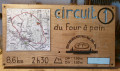
The ‘Les Clefs de Curemonte’ association voluntarily restores and maintains rural footpaths in the commune. This Walk No. 1 will take you along three of them: the Chemin de la Reyne, the Chemin des Crouzets and, finally, the Chemin de la Fontenelle, offering you both views of the village and a stroll through the village centre.

Details

18316309
Creation:
Last update:
Last review:
  • Walking
    Activity: Walking
  • ↔
    Distance: 1.68 mi
  • ◔
    Average duration: 1h 00 
  • ▲
    Difficulty: Easy

  • ⚐
    Back to start: Yes
  • ↗
    Ascent: + 285 ft
  • ↘
    Descent: - 299 ft

  • ▲
    Highest point: 751 ft
  • ▼
    Lowest point: 512 ft

Photos

Description of the walk

Park in the Esturgie visitors’ car park on Route de Branceilles.

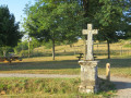
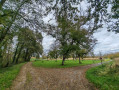
(S/E) Opposite, take the Chemin de la Reyne at the stone cross – this is the Croix de Clavel. Walk alongside the picnic area. Enjoy the view of the village to your left, then the 360° panorama, before reaching a road.

(1) Cross the road and turn right onto theGRP® Midi Corrézien, signposted in red and yellow. Continue until you reach the junction with Rue Curemonte.

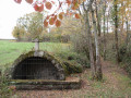
(2) Leave theGRP® and turn right onto this street for about a hundred metres. At the corner by a cowshed, head up to the left and cross a narrow road, taking the Chemin de la Fontenelle opposite to reach the Fontaine de Fontenelle.

(3) Walk past the fountain, rejoin the narrow road and head uphill to the right. Turn right again onto Place du Barry, then onto Rue Joséphine Perrier. Turn right once more and walk alongside the high walls of a private property. On your left, you’ll see the old farrier’s workshop and, opposite, the Château de la Johannie.
You’ll arrive at the grain market and Saint-Barthélémy Church, which is open to visitors.
Continue your tour by taking the cobbled street to the right of the church, Rue Colette de Jouvenel, named after the garlic grower opposite the well. Walk along the ramparts of the Châteaux de Plas and Saint-Hilaire until you reach Place de la Barbacane, where the war memorial stands. Carry on past the restaurant and you’ll arrive at the small square at the top of the village.
Here, as an optional detour from the main route, you can take a short round trip by following the sign for ‘Fontaine du Chassang’ to the left. Turn right, then left onto Rue de la Grotte. Walk up to the orientation board and enjoy the view over the village.
Head down the road to the Esturgie car park (S/E).

Waypoints

  1. S/E : mi 0 - alt. 715 ft - Esturgie car park
  2. 1 : mi 0.46 - alt. 633 ft - GRP
  3. 2 : mi 0.77 - alt. 571 ft - Rue de Curemonte
  4. 3 : mi 1.09 - alt. 627 ft - Fontaine de la Fontenelle
  5. S/E : mi 1.68 - alt. 715 ft - Esturgie car park

Reviews and comments

5 / 5
Based on 2 reviews

Reliability of the description
5 / 5
Ease of following the route
5 / 5
Route interest
5 / 5
User 28317948

Overall rating : 5 / 5

Date of your route : Jan 05, 2026
Reliability of the description : ★★★★★ Very good
Ease of following the route : ★★★★★ Very good
Route interest : ★★★★★ Very good
Very busy route : No

Great...
Lovely paths that we would never have thought of taking without your suggestions.
Thank you.

Machine-translated

sylvie bretagne
sylvie bretagne

Overall rating : 5 / 5

Date of your route : Aug 26, 2024
Reliability of the description : ★★★★★ Very good
Ease of following the route : ★★★★★ Very good
Route interest : ★★★★★ Very good
Very busy route : No

There’s a lovely view of Curemonte at the start of the walk; you wind your way through the countryside and then along the narrow streets. It was very easy with our little girls, aged 3 and 5, although there were a few descents to watch out for as they can be a bit slippery in the woodland… followed by a picnic overlooking the village. We then went on to visit Collonges-la-Rouge, which was very busy.

Machine-translated

Other walks in the area

For more walks, use our search engine .

The GPS track and description are the property of this route's author. Please do not copy them without permission.