


 Country:

 City:
City:


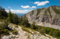

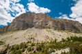
Park at the Col du Fa (or Col du Fam, depending on which you use). There are likely to be several possible access routes, but I personally arrived via Castellet-Lès-Sausses. As soon as you enter the village, the pass is signposted, and after a few kilometres, the road gives way to a track for a few hundred metres. There is plenty of space at the pass to park several vehicles.
(S/E) Look out for the cross in the middle of the pass and start climbing just behind it, leaving the track that branches off to the left. The path isn’t very visible but it’s definitely there. Climb gently until you cross the track again, which you left below you.
(1) Cross the track and continue climbing towards the forest. Paradoxically, the path marked on the IGN map isn’t actually very clear on the ground, and it’s from the next point (where the map no longer shows anything) that it finally reappears.
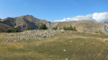
(2) A warning sign about grazing livestock marks the start of the path that will take you to the summit of Mourre Frey. Be warned: the gradient is quite steep – the most challenging part of the entire hike – but the climb up these grassy slopes is rather pleasant. Numerous cairns make it easy to find your way to the summit.
(3) Head back down the other side towards the ridge line, with the Tête de Travers as your destination. As you begin the ascent, you’ll see fence posts on your left; follow them at a leisurely pace until you reach the Tête de Travers.
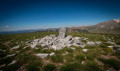
(4) Head due north towards La Mélina. Although the path is still unmarked, it remains easy to follow. You’ll reach the summit of La Mélina, marked by a stone marker.
(5) Continue northwards to reach the Col de Mélina, where you’ll find the first signpost for route no. 57, though it does not indicate which path to take.
(6) Continue north, leaving two paths on your right. You’ll reach the Vallon du Fer.
(7) Cross this valley, then head diagonally left to reach the Pierre Grosse hut.
(8) From here, follow the cairns. They point in a general south-south-westerly direction until you reach a clearly visible path. Take this path and, via a few hairpin bends, cross first the Ravins de la Pierre du Boui and then the Ravin du Son Aubert. Make a wide turn heading south to reach the first ravine.
Take care on this section as the path starts on marl before quickly entering a dense forest. It becomes a little chaotic here: many trees have fallen and often obscure the path, so be extremely careful and go round the fallen branches to stay on the path (it remains clearly visible amongst the pine needles).
(9) Here, the path becomes much more pleasant once you reach the bottom of the valley, dominated by the impressive Beaussebérard mountain. Walk gently downhill until you reach the magnificent hamlet of Aurent.
(10) Walk through Aurent, a timeless village with its own unique charm, and when you’re ready to set off again, head to the church at the end of the village to continue your journey. The circular route to Argenton is still a bit long and the path isn’t necessarily easy going, so you always have the option here:
- to cross the valley via the Aurent footbridge and head straight back to the Col du Fa via the Aurent path.
- carry on to the right, cross the Coulomp via the small bridge, following the route described below.
Set off across the marl to begin the journey towards Argenton. The path is sometimes very narrow, and a rockfall near the next landmark may make the return journey difficult for less experienced walkers.
(11) Here, a rockfall has damaged the path. Whilst it may look daunting at first glance, it is perfectly stable, fairly easy to climb and does not require the use of your hands. Continue towards Argenton until you reach a crossroads before the hamlet of Villard, where you’ll find a new signpost.
(12) Carry on towards Argenton and pass the two wayside shrines before reaching the hamlet.
(13) Turn left towards the south and follow the yellow markings. Reach the bottom of the Coulomp valley at the hamlet of Tardoun. Take care to follow the markings closely to stay on the path, which may be hidden by fallen leaves.
(14) Cross the bridge and, immediately after the signpost, head towards the Col du Fa. These final kilometres may be challenging after such a long walk, but the climb through this shady forest is very pleasant and leads you back to the Col du Fa car park (S/E).

 Visorando Member

 Extremely difficult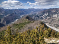
 Difficult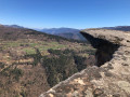
 Moderate
 Easy
Easy 
