Atxuria or Arxuria Peña Plata and Col des Trois Bornes

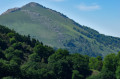
Ascent to the summit of Atchuria and a wide circular route to reach the border at the Col des Trois Bornes: you can shorten the route by passing closer to the southern cliffs of the summit.

Details

20992209
Creation:
Last update:
Last review:
  • Walking
    Activity: Walking
  • ↔
    Distance: 5.16 mi
  • ◔
    Average duration: 4h 10 
  • ▲
    Difficulty: Moderate

  • ⚐
    Back to start: Yes
  • ↗
    Ascent: + 2,087 ft
  • ↘
    Descent: - 2,070 ft

  • ▲
    Highest point: 2,470 ft
  • ▼
    Lowest point: 702 ft

Description of the walk

Park at the uppermost car park at the Grottes de Sare, above the quarry.

(S/E) Take the yellow-marked route at the cattle grid, to the west. Continue to follow the yellow route along a wide path that winds upwards to a junction.

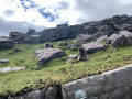
(1) Turn left onto the yellow-marked route. After about 300 m, turn right towards the ridge, following the markings to the summit, or walk further to the right across the slabs towards the ridge.

(2) From the summit, follow the ridge eastwards (yellow markings) to a pass that is clearly visible.

(3) Turn south and continue straight on towards a solitary oak tree, where you’ll join a lovely path.

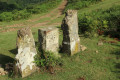
(4) Turn right and follow this path, which becomes a track, to the Col des Trois Bornes. This path and track are very scenic and there are numerous springs.

(5) Once at the pass, take the track heading north, which descends slightly to a sheep shelter.

(6) Head up to the right across the meadow after the fence and reach a flat area where the shortcut joins (see Practical Information).

(7) Turn left.

(8) Cross the sheepfold and continue to the junction by the Loretxoa restaurant (closed at Easter when I was there).

(9) Take a detour to the right if you wish to visit it, then turn back. A sign reads: ‘Car park: 0h 55’. Do not take this path but continue to the right and rejoin the junction with the climb.

(1) Carry on straight ahead and follow the route back down to reach the car park at the Sare Caves (S/E).
Waypoints

  1. S/E : mi 0 - alt. 705 ft - Sare Caves car park
  2. 1 : mi 0.69 - alt. 1,345 ft - Junction on the circular loop
  3. 2 : mi 1.56 - alt. 2,464 ft - Atxuria
  4. 3 : mi 1.84 - alt. 2,208 ft - Pass
  5. 4 : mi 2.23 - alt. 1,762 ft - Crossroads, turn right
  6. 5 : mi 3.05 - alt. 1,709 ft - Col des Trois Bornes
  7. 6 : mi 3.46 - alt. 1,716 ft - Sheep shelter, on the right in the meadow
  8. 7 : mi 3.69 - alt. 2,021 ft - Flat section, turn left
  9. 8 : mi 3.97 - alt. 1,677 ft - Bergerie
  10. 9 : mi 4.17 - alt. 1,480 ft - Carrefour restaurant
  11. S/E : mi 5.16 - alt. 702 ft - Sare Caves car park

Notes

Good, grippy footwear is essential, particularly if you take the flagstone path.

To reach the summit, allow 1 hour 30 minutes to 2 hours, with a 550-metre elevation gain over 2.5 km. It’s quite steep from the car park.
You can do the route in the opposite direction; the climb will be gentler.

(3) You can take the path on the right, which also leads to the Col des Trois Bornes or directly back to the car park.

Reviews and comments

5 / 5
Based on 2 reviews

Reliability of the description
5 / 5
Ease of following the route
5 / 5
Route interest
5 / 5
eric bourdon
eric bourdon

Overall rating : 5 / 5

Date of your route : Feb 11, 2025
Reliability of the description : ★★★★★ Very good
Ease of following the route : ★★★★★ Very good
Route interest : ★★★★★ Very good
Very busy route : No

A lovely walk with a superb view from the summit of Axturia. The path to the Col des Trois Bornes is pleasant, but after a spell of rain, when the route description mentions ‘numerous springs’, you should understand this to mean ‘mud everywhere’.
At the summit, you need to be careful not to walk on the rock slabs, which are very slippery when wet.

Machine-translated

Testeur59
Testeur59

Overall rating : 5 / 5

Date of your route : Nov 04, 2024
Reliability of the description : ★★★★★ Very good
Ease of following the route : ★★★★★ Very good
Route interest : ★★★★★ Very good
Very busy route : No

A steep climb at the start, but a superb view. It’s absolutely lovely at the top of the ridges. Return via the Spanish side. I’d recommend it.
Be careful if it’s raining, as some sections are slippery (rock).
A very beautiful, well-signposted route

Machine-translated

CHILLA Louise
CHILLA Louise

Hike cancelled due to bad weather: rain and strong winds

Machine-translated

Other walks in the area

For more walks, use our search engine .

The GPS track and description are the property of this route's author. Please do not copy them without permission.