Country:

 City:
City:


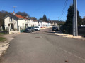
Head to Champagney. At the entrance to the village on the Ronchamp side, at the roundabout leading towards the fire station, take the exit for Rue Aimé Césaire, which continues as Rue Léopold-Sédar Senghor (RD312). After the junction with Rue Sous Theurey (speed bump + roundabout), park on the right-hand side of the road between numbers 42bis and 44, near the bus shelter.
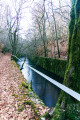
(S/E) Return to Rue Senghor and head towards Champagney. On the right, you’ll notice a low-rise house typical of miners’ and farmers’ dwellings, with no upper storey, a small stable at one end and a hayloft above it. The road slopes down slightly; on the right is a stately home that once belonged to one of the coal mine directors. At the bend after the bridge over a stream, turn left to follow a white-pebbled path that runs alongside the stream at the edge of pastureland for 200 metres.
(1) Turn left into the forest, crossing a small footbridge.
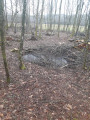
After fifty metres, on the right, small embankments and ditches catch the eye. A large funnel, 8 m in diameter and constantly filled with water, marks the site of Shaft No. 5, dug in 1830 to a depth of 74 m. Nearby, slightly elevated, is a circular platform which is thought to have been a turning circle used by horses to operate the winches needed to haul up the excavated material (Baritel). About ten metres to the north-north-west, there are still traces of coal.
Return to the path and continue straight on. At the end of the path, follow the track that cuts through a fir forest. Cross a well-trodden path and continue along the track that winds its way southwards. Its entrance is marked by two dry, fallen tree trunks lying on either side of the path. Cross a small stream, leave the Douglas fir woodland and arrive at a three-way junction.
(2) Take the right-hand branch and continue straight on towards the west. The path crosses the deciduous forest and reaches a trench at the edge of a felling area. Turn left at a right angle, with plot no. 24 on your right, and continue straight on. Pass under the power line. The path curves sharply to the left and, after 250 m, at a small junction, turn right. Cross a stream and then a damp patch to reach a good, fairly wide path at a junction.
(3) Turn right again and continue north-west. At the first junction, join the fitness route. Continue straight on in the opposite direction to the stations, from station 5 to station 1. (Near this station, on the edge of the forest, stood the Sainte-Barbe well, dug in 1854 – 324 m).
(4) Just after station 1, turn left onto a lovely straight avenue, which is in fact the bed of the old railway line that linked the various mine shafts in the area (Notre Dame d’Eboulet, Thonnet) to the Ronchamp coal station. Continue straight on until you reach the edge of the woods. Walk about ten metres to the tarmac road (Rue Jean Moulin), and note on your left the row of old mining housing estates at La Piotnaz and, on your right, the Sainte-Pauline Chapel.
(5) Retrace your steps and immediately turn right onto the fitness trail, following it to station 14. Then turn right onto the lovely path, which also runs along the route of a railway line that served the Sainte-Pauline shaft. When you reach a crossroads in the form of a small square, turn left onto the path that climbs up the spoil tip and walk round it on the left, along the crest of the embankment, ignoring the first access points to the platform.
At the far end, turn right heading due south and cross the platform, taking a moment to look for some fossils in the areas disturbed by earth-moving machinery. Initially consisting of coal-bearing spoil, the platform is covered by a layer of sand. At the southern corner of the embankment, descend the slope between the broom bushes to rejoin the path. Facing you, slightly to the right, climb to the top of the embankment strewn with household waste. Near some fir trees, a depression marks the site of the Sainte-Pauline mine shaft (dug in 1854 – depth 546 m – closed in 1884). From here, on the other side of the main road, you can see the Fressais barracks with its large balcony. As its name suggests, this building was intended to house miners from the Fresse valley who were unable to return home every evening. Retrace your steps, heading south-east.
(6) Continue along the path which veers to the left. Pass a path junction on the right and follow the almost straight trench between cuts 27 and 26. After a small Fork in the road to the right, you’ll come back to the junction you passed earlier.
(3) Then turn right and head towards the tarmac road
(7) Turn left. Note the recently renovated wash house on the left, then, on the right, the three adjoining miners’ housing estates of the Saint-Jean shaft, which was situated on the small hillock behind the central building (dug in 1854 – depth 51 m). Continue along the road for a few hundred metres to return to the car park (S/E).


 Association / Club / Walk leader
 Visorando Member
 Moderate