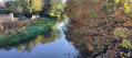
Woodman circular via Bluebell Bridge and Orton Lock, Peterborough, Cambs

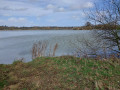
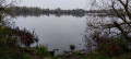
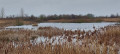
Great walk on hard-surface paths and footpaths, crossing the River Nene and following it downstream to Orton Locks, crossing over and returning along the River Nene and alongside the golf course. Depending upon the time of year, a good opportunity for birdlife.

Details

n°110358689
Creation:
Last update:
Last review:
–
  • Walking
    Activity: Walking
  • ↔
    Distance: 3.29 mi
  • ◔
    Average duration: 1h 35 
  • ▲
    Difficulty: Easy

  • ⚐
    Back to start: Yes
  • ↗
    Ascent: + 72 ft
  • ↘
    Descent: - 75 ft

  • ▲
    Highest point: 82 ft
  • ▼
    Lowest point: 13 ft

Description of the walk

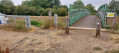
(S/E) Park in the car park for the Golf Club and Woodman pub (see Notes for free parking). From the pub, proceed along the pavement with the car park on your right; after about 300 metres, turn left off the road onto a hard footpath. Follow the footpath for about 500 metres, descending to waymark 1 (The Bluebell Bridge, where you return towards the end of the walk).

(1) Cross the bridge and River Nene and continue straight on. Reaching a fork in the path, go left and cross the bridge over the outlet water from Overton Lake to waymark 2 (fork).

(2) Turn left to follow the outlet and then the River Nene; there are two bird observation hides along this stretch. Follow this hard path for about 1.2 kilometres, crossing the railway line to reach waymark 3 (junction with Water Lane).

(3) Turn left to follow the tarmacked path with poplars on the right. Follow this path for about 1 kilometre to reach waymark 4 (junction towards Orton Lock).

(4) Turn left and cross over Orton Lock and Sluices; there is fast water on the right and a slalom gate for canoeists. After crossing the lock, turn immediately left to follow the River Nene on your left and the golf course on your right. There are usually several boats and barges moored along this stretch. Follow this path – be aware of possible mud and exposed roots along this stretch – for nearly 1.5 kilometres to reach waymark 1.

(1) At this point, turn right, climb the short hill to reach the road and turn right back to finish. (S/E)

Waypoints

  1. S/E : mi 0 - alt. 49 ft - Car park for Golf club and Woodman
  2. 1 : mi 0.44 - alt. 39 ft - Fork right to cross Bluebell Bridge and River Nene
  3. 2 : mi 0.65 - alt. 23 ft - After crossing bridge fork left
  4. 3 : mi 1.33 - alt. 26 ft - After crossing railway turn left to tarmacked path
  5. 4 : mi 1.91 - alt. 30 ft - Turn left to cross over Orton Lock
  6. S/E : mi 3.29 - alt. 49 ft - Car park for Golf club and Woodman

Notes

Parking Postcode: PE3 6SQ

There are no facilities on this route.

The car park is free to those who use the Woodman; inside, there is a machine to record your car registration. Depending on when you arrive, the Woodman may not be open, so go to the Golf Club registration office and record your car there.

Good food is available at the Woodman.

When we walked (October), we saw Greylag Geese, a variety of Ducks, Crested Grebes, Cormorants and Small Ibis.

Other walks in the area

For more walks, use our search engine .

The GPS track and description are the property of this route's author. Please do not copy them without permission.