Country:
 City:
City:


By train: line 8C – Tigeaux – Crécy-la-Chapelle; then trains to Paris.
By RER: line 38 – Faremoutiers – Chessy.
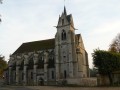
By car, park in the car park opposite the church at 22/28 Rue du Grand Morin.
(S/E) Leave the car park and head south along Rue du Grand Morin until you reach Chemin de Saint-Fiacre.
Yellow signposts
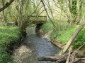
(1) Turn right onto the path and ignore the branches to the right and left. Pass the path leading to the Plessis Sainte-Avoye farm, cross the small bridge over the Ru de la Forêt and continue until you can no longer go straight on, at the junction with theGR®®.
Red and white markings
(2) Turn left onto the path leading down towards Plessis-Sainte-Avoye, take the small road on the right and head back up to the left onto theGR®® de la Brie Verte. You’ll reach the road.
(3) Turn left twice to stay on the GR® until you reach the level crossing.
End of red and white markings
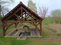
(4) Turn left at the level crossing, walk down the road and veer to the right. Pass the wash house at the hamlet of La Fontaine and continue along Rue de la Fontaine until you reach the junction with the D20.
(5) Cross straight ahead with care, follow the Grande Rue and, at the junction, turn right onto Rue Saint-Gobert, following it along the castle walls until you reach Chemin de Moulans.
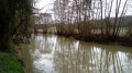
(6) Carry on straight along the track until you reach the Moulin de Prémol. Turn left to cross the Grand Morin via the footbridge and arrive at a Fork in the road.
(7) Turn left onto theGR®®1, then turn right to head up towards Les Grands Champs.
Yellow markings
(8) Turn left onto a path that climbs towards the hamlet of Monthérand and ends at Rue du Clos Galle; follow this by first turning left then right. You’ll reach the “petite ruelle”.
(9) Take this on the right, then, at the end, turn left into Rue de Crécy. It is tarmac-surfaced at the start but then becomes a farm track. Ignore all the streets on either side. You’ll reach a junction of farm tracks.
(10) Turn left to head back down towards the hamlet of Serbonne. Cross the bridge over the Ru de Biche and continue along Rue de la Ferme until you reach Rue du Champs de l’Eau.
Red and white markings
(11) Turn left and follow the track to the junction with a road. Follow the road down and round the bend until you reach a Fork in the road.
Yellow markings
(12) Let theGR®® branch off onto a farm track to the left, and continue along the road until you reach the junction with the D20; cross this with care, then carry on to Rue des Meuniers and on to the junction with Chemin de Fort à Faire.
(13) Follow the Chemin de Fort à Faire and take a path on the left between two houses: the Chemin du Grimpel. This leads to the Church of Saint-Leu de Tigeaux. Walk down to the foot of the little church, cross the road (watch out for traffic!) to reach the car park and the bus stop opposite (S/E).

 Visorando Member
 Difficult